
The Borough of Fylde consists of the seaside resort towns of Lytham and St Annes, the towns and villages of Kirkham, Wesham, Freckleton and Warton, along with the rural countryside and smaller picturesque villages. A rich heritage has helped to make Fylde a destination in its own right.
Fylde is also an important part of the Lancashire economy – containing regionally significant business sectors including BAE Systems at Warton and its associated Enterprise Zone, the Westinghouse Springfields nuclear reprocessing plant and Blackpool Airport Enterprise Zone. It is vital that we manage, guide and encourage development within Fylde to meet the aspirations of our local communities.
This Publication Version represents the culmination of the work undertaken in preparation of the new Fylde Local Plan to 2042. The Council previously consulted on the Options, Issues, Vision and Scope of the new plan between September-October 2025, and the Publication Version of the plan reflects the Council’s consideration of the comments made.
The new Fylde Local Plan to 2042 sets out the Council’s proposals for how the area of Fylde will develop over the period between now and 2042, to provide the necessary homes, business and commercial premises, retail, leisure uses, and supporting infrastructure; but also identifying areas that should be protected from development, such as important green spaces, areas important for nature, and areas where development should be restricted to retain the distinctive character of Fylde.
This Local Plan will eventually replace the existing adopted Fylde Local Plan to 2032 (incorporating Partial Review).
The consultation is for the benefit of all residents within Fylde and those with an interest in the area. Therefore, it is important that we hear from the community to obtain their views on what is being proposed.
We look forward to hearing your views on the new Fylde Local Plan.

Fylde Council is publishing the Fylde Local Plan to 2042 for representations under Regulation 19 of the Town and Country (Local Planning) (England) Regulations 2012. The consultation will be conducted for six weeks from Friday 18th September to 5pm on Friday 30th October 2026.
The Proposed Submission (Regulation 19) consultation is a key stage in the preparation of the Local Plan. It is the final opportunity to comment on the proposed Plan before it is submitted to the Secretary of State for examination by an independent Inspector. The consultation provides an opportunity for members of the public and other interested parties to comment on the Plan. All representations received will be submitted to the Secretary of State alongside the Plan for consideration as part of the independent examination process.
Comments should be made in accordance with the Statement of Representations Procedure which is available to view at: www.fylde.gov.uk/2042, at the Town Hall, St Annes Road West, Lytham St Annes, FY8 1LW and at libraries throughout the Borough. Please visit www.lancashire.gov.uk/libraries/ for library locations and opening times. Comments should be made in writing, either by using the online form which is available at: www.fylde.gov.uk/2042, email to planningpolicy@fylde.gov.uk, or by post to Planning Policy, Planning Department, Fylde Council, Town Hall, St Annes Road West, Lytham St Annes, FY8 1LW, to be received by the deadline of 5.00 pm on Friday 30th October 2026. All comments will be published, but apart from the name of the sender, no other personal information will be publicly available. Anonymous comments will not be accepted.
All comments will be published. The name of the respondent and that of the organisation they represent (if applicable) will be published; apart from the name, no other personal information will be publicly available. Name and contact address, either email or postal address (dependent on the respondent’s preference), will be retained by the Council on its Planning Policy Register of Consultees, for providing statutory notifications about the Local Plan and to provide information on further planning policy matters including any future consultations. All respondents’ names and contact addresses (email or postal) will be shared with the Planning Inspectorate in order for the Programme Officer to provide information regarding the Examination in Public of the Local Plan. All comments received by whatever means will be deemed to be in agreement with the terms of this Privacy Notice. Anonymous comments will not be accepted.
- Introduction
1.1 Future development within Fylde will be guided by the plans and policies within this new Local Plan for Fylde, which runs from 1 April 2026 to 31 March 2042, to ensure a 15 year plan period from the date of adoption in 2027.
1.2 The Local Plan provides a framework to guide development in a co-ordinated and sustainable way, whilst protecting other areas from the effects of development. It also sets out policies to ensure that development is of high quality, is deliverable and provides necessary infrastructure.
1.3 The Fylde Local Plan to 2042, once adopted, will supersede the current policies of the Fylde Local Plan to 2032 (incorporating Partial Review). Appendix 1 sets out the policies of the Fylde Local Plan to 2032 (incorporating Partial Review) and shows
- Policies that are replaced by new policies in this new Fylde Local Plan to 2042
- Policies which have been superseded or replaced by policies in the National Planning Policy Framework (the Framework)
- Policies which are no longer required.
1.4 The Borough of Fylde comprises the major coastal resort towns of Lytham and St Annes, the market town of Kirkham and its adjoining settlement Wesham, developed areas forming the outskirts of the adjoining Borough of Blackpool, the settlements of Freckleton and Warton, and an extensive sparsely-populated rural area.
1.5 The current Local Plan for Fylde is the Fylde Local Plan to 2032 (incorporating Partial Review), which was adopted in December 2021. This sets out through allocations and allowances to provide for a minimum of 7,275 homes and 60.6 ha of employment land over the plan period 2011-2032. It sets out a development strategy to deliver around 90% of homes and 59.6 ha of employment land at four strategic locations: Lytham and St Annes; the Fylde-Blackpool Periphery; Warton; and Kirkham and Wesham. It sets out policies to allocate sites for homes and employment uses. It provides policies to guide development of retail and leisure/tourism uses, policies to ensure provision of infrastructure including open space, to ensure protection from flood risk, and to ensure that valued sites are protected.
1.6 The National Planning Policy Framework (December 2024) (henceforth referred to as “the Framework”) requires policies to be reviewed at least every five years. The Local Plan was prepared under a previous version of the Framework, and some of the policies in the Framework have changed. Under the arrangements set out in paragraph 232, policies in the Local Plan are not rendered out-of-date by changes to the standard calculation method for housing need, providing that housing supply and delivery is maintained, for a period of five years from the adoption of the Local Plan. Accordingly, policies for the supply of housing will be out-of-date after December 2026. Therefore, there is a need for Fylde Council to fully review its Local Plan, or produce a new plan, by December 2026.
1.7 The Council published its Local Development Scheme January 2025, setting out its timetable for the production of the new Local Plan. The Local Development Scheme proposed submission of the new plan to the Secretary of State in August 2026.
1.8 The Local Plan is required to cover a period of 15 years from adoption, in accordance with the Framework. Therefore, this plan has been named the Fylde Local Plan to 2042, extending ten years further than the existing Local Plan.
1.9 The last Government introduced a new legislative framework for plan-making, through the Levelling Up and Regeneration Act 2023. This present Government is bringing this forward, to have effect for plans submitted for examination from 1st January 2027. This new plan will be submitted for examination ahead of this date, and will therefore be produced and examined under the current primary legislation, the Planning and Compulsory Purchase Act 2004 (as amended), and the current regulations, the Town and Country Planning (Local Planning) (England) Regulations 2012 (as amended).
1.10 The Local Plan should be read as a whole and every policy together with its supporting text should be considered, in order that a balanced judgement be made when determining applications.
Options Issues, Vision and Scope
1.11 The Council published its Options, Issues, Vision and Scope for the new Fylde Local Plan to 2042 for consultation under Regulation 18 of the Town and Country Planning (Local Planning) (England) Regulations 2012 (as amended) between 18th September 2025 and 30th October 2025.
1.12 The document presented the vision for Fylde and three alternative spatial options for the distribution of future development. The three spatial options were
- Option 1: Retain the Existing Development Strategy with Updates
- Option 2: Variant on the Existing Development Strategy
- Option 3: Entirely New Development Strategy
1.13 A series of questions (62 in total) were posed of respondents, who were free to select which to respond to, covering the broad areas of the spatial portrait, vision, development strategy, housing, economic development, protected environments and assets, infrastructure, design and amenity and climate change/ renewable energy /flood risk.
1.14 Representations and responses are set out in a separate document that accompanies this consultation.
National Planning Policy
1.15 The current version of the Framework was published in August 2026. However, Annex A of the 2026 Framework provides that local plans not being prepared under the new plan-making system introduced by the Levelling-Up and Regeneration Act 2023 should be examined against the provisions of the December 2024 version of the Framework. The Fylde Local Plan to 2042 therefore will be examined against the December 2024 Framework, but must also have regard to the fact that planning decisions on applications will be made with regard to the August 2026 Framework. National planning policy is guidance that represents a material consideration in the determination of planning applications. Local Plans are required to be consistent with national policy (see “Examination” below). The Framework sets out national policy for all main planning policy themes. As such it is of great importance in the production of this Local Plan.
1.16 The Framework sets out requirements for local plan-making. The Local Plan should seek to achieve sustainable development, be prepared positively, involve engagement with stakeholders, contain clear policies, be accessible and avoid duplication of other policies. It must include strategic policies to address the Council’s priorities for the development and use of land in its area. Policies should make provision for development needs to be met, including homes, employment land, retail, leisure, other commercial development, infrastructure and community facilities. It should provide policies to conserve and enhance the natural, built and historic environment.
Spatial Development Strategies
1.17 The Planning and Infrastructure Act 2025 introduced the requirement for strategic planning authorities to produce Spatial Development Strategies (SDSs). The SDS will provide the strategic plan within which individual local plans are made, setting requirements for development types and identifying strategic priorities. The strategic planning authority covering the area of Fylde is the Lancashire County Combined Authority
Neighbouring Authorities
1.18 The area of Fylde adjoins the council areas of Blackpool, Wyre, West Lancashire, Preston (Central Lancashire Authority) and South Ribble (Central Lancashire Authority). In the case of South Ribble and West Lancashire the border is within the Ribble Estuary and there is no land connection. Fylde, Wyre, Blackpool and Lancashire County Council have regular meetings under a Memorandum of Understanding to discuss key strategic matters as they apply to plan-making. Similarly, Fylde has regular meetings with Preston to discuss similar matters. Statements of Common Ground with the neighbouring authorities are being prepared to accompany the Fylde Local Plan to 2042, setting out matters of agreement between the authorities.
Neighbourhood Plans
1.19 Fylde has two existing neighbourhood plans that are made:
- Bryning-with-Warton Neighbourhood Development Plan
- Saint Anne’s on the Sea Neighbourhood Development Plan
1.20 Both existing Neighbourhood Plans were made in 2017. The Fylde Local Plan to 2042 supersedes any policies within the neighbourhood plans where there is conflict. It will be for the relevant Neighbourhood Planning Bodies (Parish Councils) to decide on how to take the Neighbourhood Plans forward in response to the Fylde Local Plan to 2042. Fylde Council will be providing assistance where requested in line with statutory requirements.
Integrated Assessment
1.21 The Integrated Assessment incorporates a number of related studies which assess the Local Plan’s policies and allocations. Included are Sustainability Appraisal (which itself fulfils the requirement for Strategic Environmental Assessment); Equalities Assessment; and Health Impact Assessment.
1.22 The headline conclusion of the assessment is that:
The plan is predicted to lead to broadly minor to significant positive effects, particularly with regard to social and economic environmental considerations. Whilst a degree of uncertainty / potential minor negative effects is anticipated under the historic environment and landscape IA topics, it is recognised that this is difficult to avoid given the sensitivity of heritage assets / landscape character to development. In addition, the policy framework sufficiently addresses these constraints and outlines how development could protect or enhance these assets.
1.23 The Integrated Assessment takes the two mixed use sites at Whitehills and St Annes as fixed components of any reasonable development strategy. It then assesses the potential balance of development for the remainder of the housing requirement, testing the Local Plan strategy and reasonable alternative options against a range of broad and high-level criteria. The outcome of the exercise is that the Integrated Assessment scores options that concentrate development most strongly in Kirkham and Wesham most highly under its sustainability criteria. However, the Council has chosen a more balanced strategy of developing at four strategic locations, including Kirkham and Wesham with only 10% of housing overall at the non-strategic locations, as it considers it the most appropriate for the Local Plan. Higher growth at Kirkham would require sites that, considered individually on their merits, are much less sustainable than those elsewhere included in their place. The Framework requires plans to bring forward “an appropriate strategy, taking into account the reasonable alternatives, based on proportionate evidence”. The Council has taken account of the alternatives in bringing forward the development strategy in this Local Plan.
1.24 The Integrated Assessment made a number of recommendations regarding the policies of the plan to improve its sustainability which have been taken up in the policies of the plan:
- Reference to the Local Nature Recovery Strategy to ensure opportunities for Biodiversity Net Gain to meet priorities are taken up.
- Masterplanning across adjoining sites to improve opportunities for biodiversity enhancement
- Site-specific policies to direct development away from flood risk areas and provide for biodiversity in these
1.25 The Integrated Assessment makes the following policy suggestions not taken up by the Local Plan:
- A strategic all-embracing climate change policy is recommended. It is considered that much of the material covered would duplicate existing policies, particularly the specific elements of design policy, water management and landscape policies that contribute to climate change mitigation. It suggests including requirements for consideration of whole-life carbon impacts. Whilst this was considered by the Council, it is unlikely to be of regular significance to Fylde, compared to large urban centres, as it relates principally to considerations around the redevelopment of existing buildings, which is only occasionally a significant issue for development proposals in Fylde. It also requires a degree of technical understanding from applicants and agents that would involve difficulty in effective implementation.
- Requirement for Equalities Assessments for large development sites. This could be appropriate if the plan included very large sites that included a full range of new facilities to serve it; however for this plan it is considered to have no practical applicability.
- A requirement for developers to prepare employment and skills plans or to target training towards certain groups. It is not considered that the Council has evidence to justify the introduction of specific requirements on individual companies, nor that it is necessarily desirable.
Habitats Regulations Assessment
1.26 The Borough includes wildlife sites with International designations. There is a legal requirement that the Council demonstrates that the Local Plan will result in no likely significant effects of the designated sites. Where likely significant effects are identified, an Appropriate Assessment is required to demonstrate that the integrity of the site would not be compromised.
1.27 The HRA considered whether Likely Significant Effects are possible across a number of possible pathways. The following pathways were screened in for Appropriate Assessment:
- Loss of functionally-linked habitat
- Recreational pressure
- Water quality
- Water quantity, level and flow
1.28 The Appropriate Assessment considered whether the impacts of the plan in relation to each of the above would affect the integrity of the designated sites. It made a recommendation to strengthen plan policy to more clearly demonstrate this, which has been taken up in Policy ENT6. The document concludes that under each pathway considered, the Local Plan will not affect the integrity of the International sites, either alone or in combination with other plans and programmes.
Evidence Base
1.29 The Local Plan relies on various pieces of evidence, ranging from work to identify the Borough’s development needs for different forms of development, to information about environmental constraints to particular areas of land.
1.30 Evidence used to inform the Fylde Local Plan to 2042 Publication Version is available on the Council’s website.
Viability Appraisal
1.31 The Council needs to demonstrate that the Local Plan will be capable of being delivered, and a key part of this is showing that developers will be able to viably bring the sites in the plan forward. Therefore the Council undertakes a Viability Assessment of the plan, through specialist consultants. The results of the Viability Assessment will be included when available.
Public Consultation
1.32 The Fylde Local Plan to 2042 Publication Version will be subject to a statutory public consultation for six weeks. Representations made will be considered and set out in a consultation report.
Examination in Public
1.33 Before a Council adopts a Local Plan, it must be submitted to the Secretary of State, and undergo Examination in Public. The submission to the Secretary of State must include the Local Plan, the Integrated Assessment, Habitats Regulations Assessment, all supporting evidence that has been used in the preparation of the Local Plan, earlier stages of plan preparation and a report on how representations to that stage have informed the plan, and all of the representations made on the consultation of the Fylde Local Plan to 2042 Publication Version, as complete representations and as a summary.
1.34 The Local Plan is examined by an independent Inspector whose role is to assess whether the plan has been prepared in accordance with legal requirements and whether it is sound. The Examination includes a series of public hearings the agenda and contents of which are determined by the Inspector. Only those people who have made representations to the Fylde Local Plan to 2042 Publication Version statutory consultation, and representatives of the Council, may appear at the hearing sessions.
1.35 The tests of soundness against which the Inspector must test the Local Plan are as follows:
- a) Positively prepared – providing a strategy which, as a minimum, seeks to meet the area’s objectively assessed needs; and is informed by agreements with other authorities, so that unmet need from neighbouring areas is accommodated where it is practical to do so and is consistent with achieving sustainable development;
- b) Justified – an appropriate strategy, taking into account the reasonable alternatives, and based on proportionate evidence;
- c) Effective – deliverable over the plan period, and based on effective joint working on cross-boundary strategic matters that have been dealt with rather than deferred, as evidenced by the statement of common ground; and
- d) Consistent with national policy – enabling the delivery of sustainable development in accordance with the policies in this Framework and other statements of national planning policy, where relevant.
Adoption
1.36 Following the Examination hearings the Inspector will inform the Council of any modifications needed to make the plan sound. Any modifications would then be subject to a six-week public consultation. The Inspector would then make the report to the Council. The Council then takes the decision (at full Council) as to whether to adopt the modified version of the Local Plan. Once adopted, the new plan has full status as the principal statutory development plan document for the Borough.
- Spatial Portrait of Fylde, Key Issues, Vision and Objectives
2.1 This section presents a description of the Borough in the form of the Spatial Portrait, which highlights the important issues in the Borough going forward to 2042 that the Local Plan seeks to address.
A Spatial Portrait of Fylde in 2026
The Borough of Fylde
2.2 Fylde is a predominantly rural Borough, covering 166km2, which is situated on the west coast of Lancashire. It is bounded to the north by Wyre Council and the estuary of the River Wyre, to the north-west by the densely populated urban area of Blackpool, to the east by Preston and to the south by the Ribble Estuary. It sits within the Fylde Coast sub-region, made up of the Boroughs of Fylde, Wyre and Blackpool.
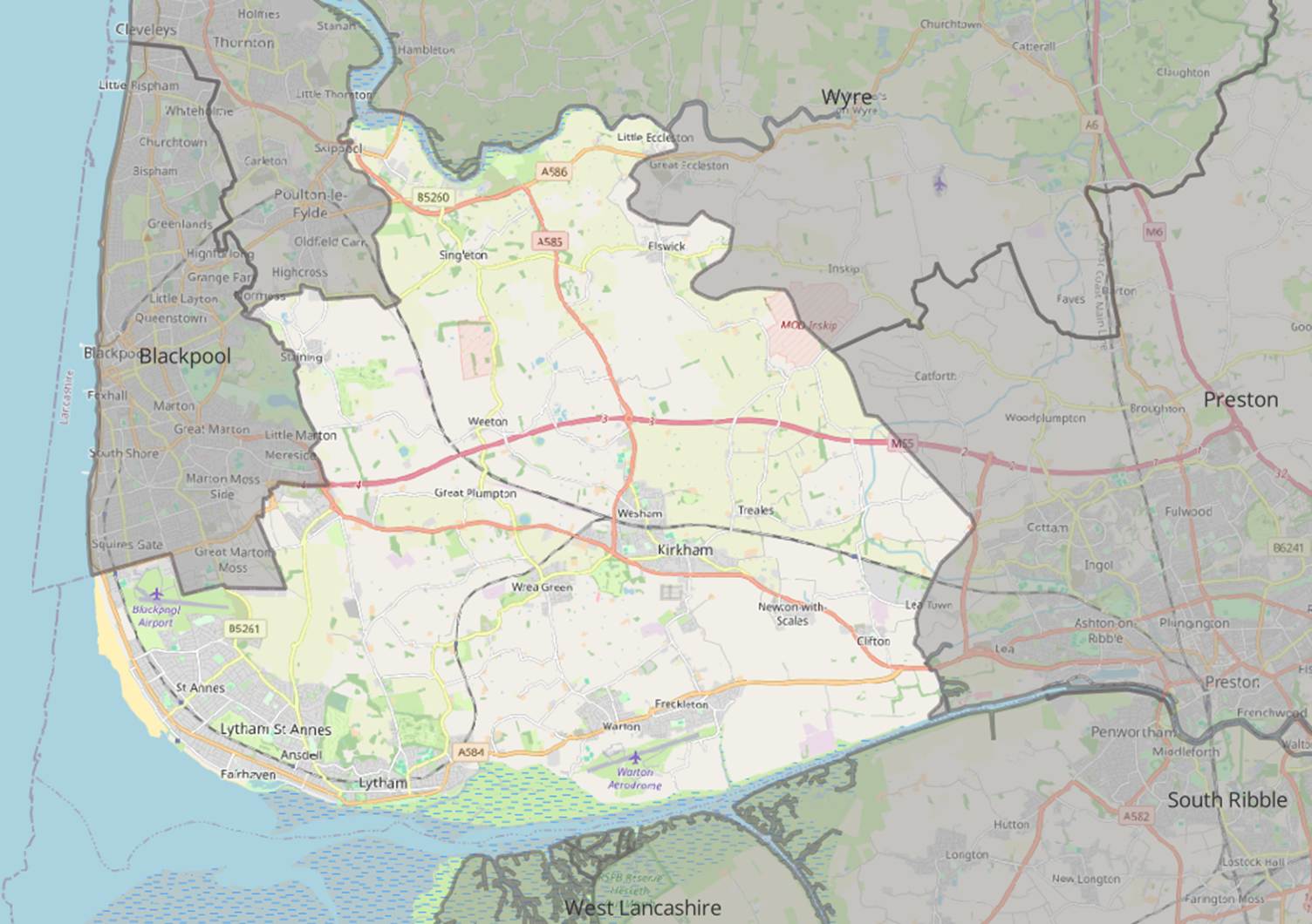
The Borough of Fylde and surroundings
Map data from Open Street Map Open Database Licence https://www.openstreetmap.org/copyright
2.3 The main land use in Fylde, in terms of area, is agriculture. This is due to the significant areas of Grade 2 and Grade 3a agricultural land (classed as the best and most versatile agricultural land). Fylde has no areas of Grade 1 agricultural land, but around 47% of the Borough is classified as Grade 2, and a further 33% as Grade 3.
2.4 The coastline is one of the dominant features of the Borough and is the setting for the majority of its urban areas. The largest towns, Lytham and St Annes, together have a reputation as a high-quality resort with their significant visitor attractions along with their distinctive seafronts and internationally famous championship golf course. The other significant settlements are Warton and Freckleton, lying further east, and Kirkham and Wesham, which together form the only sizeable inland settlements.
2.5 With a total of 3.2 million tourism visits worth more than £345 million in 2023, the Borough of Fylde has a strong and consistent visitor offer that includes a variety of major events. Part of this offer are the natural assets such as the expansive beach, Lytham Green and surrounding rural areas which appeal to walkers and cyclists.
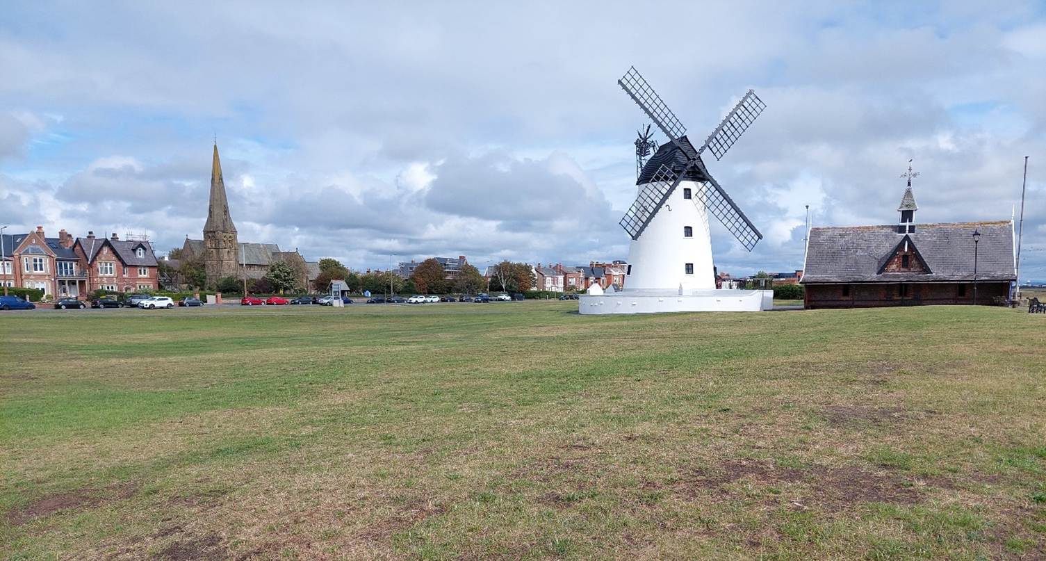
Lytham Green and Windmill
Heritage Assets
2.6 Fylde boasts a rich and varied built environment including sites and buildings of historic and architectural interest. Heritage assets make a valuable contribution to economic and social wellbeing, as well as providing a focus for heritage led regeneration and tourism development.
2.7 The historic development of the Borough has resulted in a variety of built heritage, reflecting the varied character and function of different parts of the Borough. The Victorian and Edwardian seaside resort towns of Lytham and St Annes on the Sea contrast with the historic market town of Kirkham, and these contrast with the extensive rural area containing many individually listed houses and villages with distinct heritage interest.
2.8 Historic attractions such as Lytham Hall, the Victorian Pier and Promenade Gardens at St Annes and the iconic Lytham Windmill and Green provide a strong identity and character for Fylde, complementing the thriving town centres which include a variety of quality independent dining and shopping opportunities. However the range of heritage assets across the Borough is much more extensive reflecting the different history of the areas of the Borough: the historic development of the coastal resort towns, with St. Annes the Edwardian planned town distinct from Lytham which grew from a historic fishing village; the market town of Kirkham with its attractive townscape reflects its development as a market town with a later mill town stage; whilst the rural areas reflect the agricultural history of those areas.
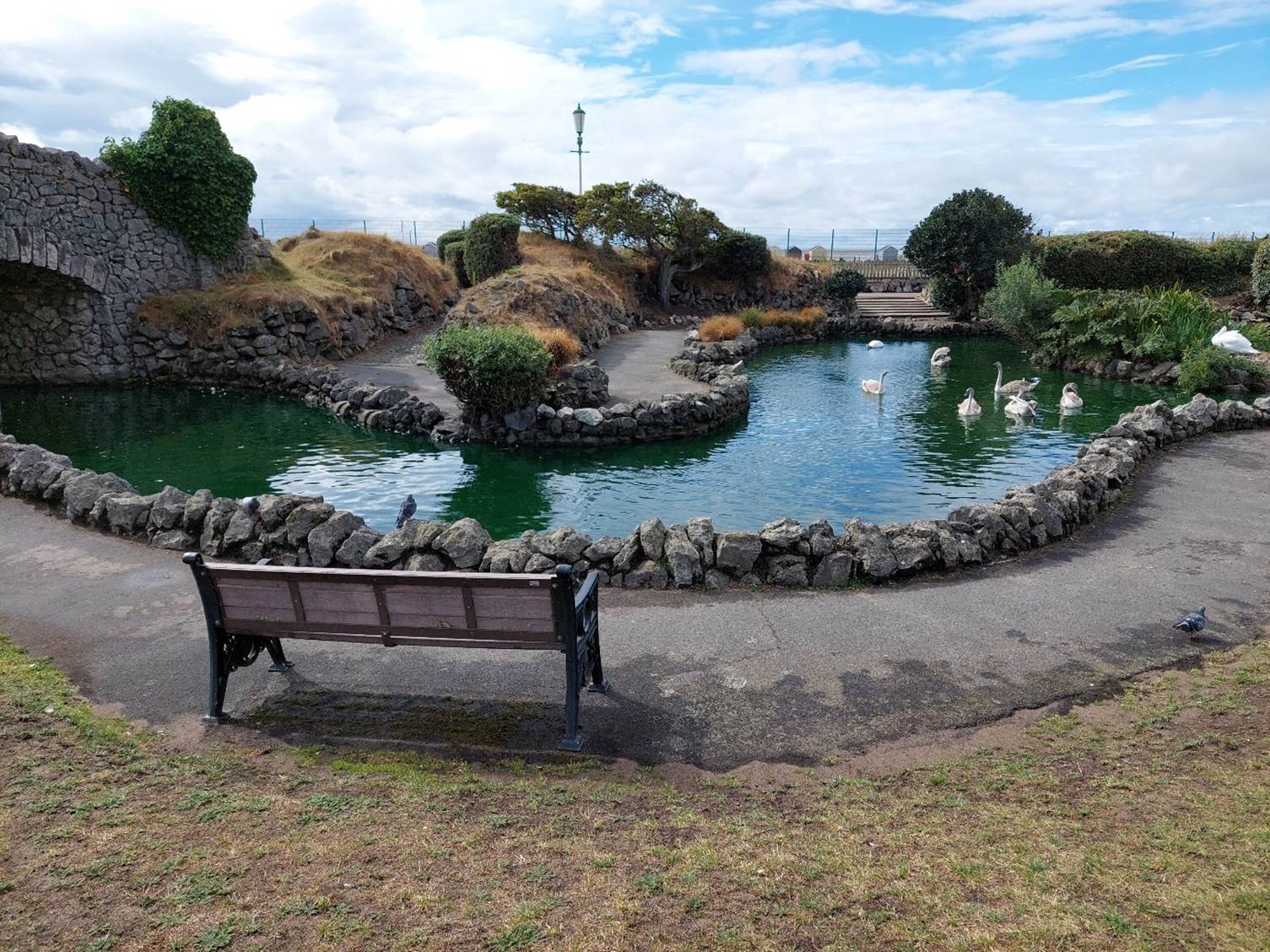
Promenade Gardens, St Annes
2.9 Fylde contains a large number of heritage assets which require protection, including over 200 Listed Buildings, ten Conservation Areas, three Registered Parks and Gardens included within the national register, which are Lytham Hall Park, Ashton Gardens and Promenade Gardens, all within Lytham and St Annes. Lytham Hall is a Grade I listed building, which is of exceptional interest. There are no scheduled ancient monuments in Fylde, but there is the potential for undesignated archaeological sites. In addition, through the Local Listing Project, the Council and partners have identified heritage assets of local interest that may not necessarily meet the criteria for statutory designation but merit local protection.
Implications for the Local Plan
- The success of the Borough as a visitor destination and as an attractive place to live and work depends significantly on the protection of the valued heritage assets, which should be an important element of the Local Plan.
Population, Income and Employment
2.10 The Borough of Fylde has a population of 85,447[1]. The population of Fylde has increased significantly over recent years. This latest figure represents a 12.3% increase over the beginning of the previous Local Plan period in 2011, greater than the 10.4% increase for England as a whole, and also greater than the 9.7% increase for North West England.
2.11 The population of the Borough has an age profile that is strongly slanted towards older age groups. There are 24,817 people aged 65 and over, representing 29% of the population, much greater than the proportion across England (18.7%.). Inward migration from outside of the Borough maintains the Borough’s population, as natural increase (births minus deaths) is always negative.
2.12 The Borough of Fylde has a strong economy, estimated at £3.07bn in 2023[2]. Significant levels of net in-commuting and the presence of high value industries such as engineering and nuclear, mean that GDP per head of resident population is the second highest in Lancashire[3]. However, income levels are also high: gross disposable household income per head (2022) was £24,259, 22.8% higher than the North West average and 27.4% higher than the Lancashire[4]. This is despite the higher proportion of older people leading to higher dependency ratio.
2.13 Fylde has a significant tourism economy, with direct expenditure by visitors of £260m and overall economic impact of £345m in 2023. The impact of this contributes to the vitality of the town centres and resorts, but also brings spending to the rural areas.
2.14 The economy of Fylde is driven to a significant degree by micro businesses (less than 10 employees), with 3,235 such businesses in 2021, 84.5% of the total number of businesses of all sizes. The total number of businesses in Fylde grew by 13.1% in the ten years to 2021. Fylde is unusual in having a larger manufacturing sector than typical for Lancashire, the NW region and England.
Implications for the Local Plan
- The need to plan for housing for older people
- Housing affordability
- The need for small employment units for micro firms
The Coast
2.15 The Ribble Estuary in the south of the Borough is designated for its importance as habitat as a Special Protection Area, Ramsar wetland site and a Site of Special Scientific Interest. The area consists of intertidal mud flats and salt marsh environments. The small area of the Wyre Estuary in the north of the Borough has the same degree of protection. The Ribble Estuary is of great importance for bird life. Both are also designated as SSSIs.
2.16 Most of the length of the coast between Starr Gate and Lytham, except where hard coastal defences have been introduced, is formed of sand dunes. The dunes are important for biodiversity, for their landscape value and for coastal defence. The areas of dunes to stretching south from Starr Gate are designated an SSSI; part of this dunes area extends inland to the Local Nature Reserve at Starr Hills. Forward of the dunes is an extensive sandy beach with significant areas above the mean high watermark, making it popular as a resort beach.
2.17 The coastal resorts of St Annes, Fairhaven and Lytham are located adjacent to the coast. Permanent sea walls enclose much of the main resort areas, some of which will require renewal during the medium term. Strategically important recreational and tourism assets are found adjacent to the coast: in particular the Island site, the promenades and Promenade Gardens, St Annes Pier, Fairhaven Lake and strategically important Lytham Green.
2.18 In the eastern part of the estuary the coast is dominated by an extensive salt marsh landscape, adjoining low lying land beyond. The salt marsh is part of the internationally designated SPA and Ramsar site.
Implications for the Local Plan
- Screening of the development brought forward through the Local Plan is required to assess for likely significant effects on the internationally designated sites.
- Key assets of strategic importance require protection.
- There is a need to provide in the plan for necessary coastal defence works.
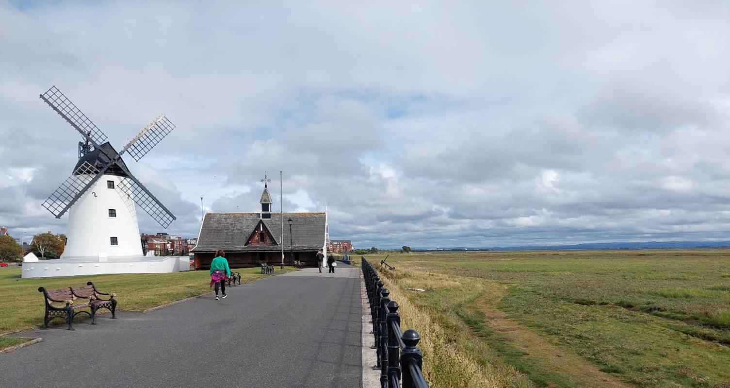
Lytham Windmill and adjacent Salt Marsh
The Towns and Villages
St Annes on the Sea
2.19 St Annes is the largest settlement in the Borough with a population of 27,630[5]. It is situated on the south-western coast of Fylde. Its detached northernmost section of Squires Gate adjoins Blackpool to the north. To the south-east it adjoins Ansdell with Lytham beyond, the three forming a continuous built-up area.
2.20 St Annes is a Victorian/Edwardian planned town that developed as a popular classic seaside tourist resort following the building of the South Fylde Railway Line. Reflecting this, the town has two Registered Historic Parks and Gardens: Promenade Gardens and Ashton Gardens. It also has three Conservation Areas: St Annes Town Centre, Porritt Houses/Ashton Gardens, and St Annes Road East, and a Listed pier. Away from the centre, the Royal Lytham St Annes international championship golf course acts as a further major attraction. St Annes has a number of hotels, some of which have had significant recent investment, providing for a buoyant visitor economy.
2.21 The town centre of St Annes is, with those of Lytham and Kirkham, the highest order centre within the Borough, providing a range of independent shops and services for residents and visitors alike. The Council has produced the St Annes Town Centre Masterplan and is delivering a programme of significant improvements to the town centre which in turn is matched by private sector investment. The centre is accessible via various local bus routes; from further afield, the railway station is centrally located and provides direct connections from the rest of the country via Preston, but needs an increase in frequency to provide an appropriate level of service for the town. Road connections to St Annes, Ansdell and Lytham have been improved by the construction of the Lytham St Annes Way from the M55, opened in June 2024.
2.22 At St. Annes the coastline faces the outermost section of the Ribble Estuary across an expansive all-day beach. Around the resort area permanent sea walls are constructed within which is the Registered Promenade Gardens and the Island area containing a number of built resort attractions. The sea walls will require renewal during the plan period in order to raise the sea defences to protect areas vulnerable to coastal flooding. On either side of the area within the sea wall, the coast is formed by sand dunes. Both the dunes and estuary are important protected habitats designated for their importance.
2.23 To the north of the main built area of St Annes is Blackpool Airport. Although no longer used by commercial airlines for public flights, the airport still acts as a base for private aviators and helicopter services to offshore installations. Land and buildings around the airport site, both in Fylde and Blackpool, have been designated as an enterprise zone to further promote economic development in the area. However this area is physically disconnected from the main settlement of St Annes so is less relevant to meeting local employment land needs.
2.24 St Annes has expanded significantly in recent years but is now largely surrounded by areas protected for habitats or green belt and further opportunities for development are very limited. The large major development site at Queensway on the northern fringe, being built out, will provide the T5 Link Road which will connect the Link Road to the Enterprise Zone.
Issues for the Local Plan
- Protection of historic assets and character
- Promote tourism development
- Provide for improvement of the Island and sea wall construction
- Support continued improvement of the town centre and links to the promenade
- Provide for housing but where – limited
- Provide for employment land connected to settlement
Lytham
2.25 Lytham is the second largest settlement in Fylde. Lytham is a newly designated parish in 2025. It is situated to the east of Ansdell and St Annes, forming the eastern part of the continuously built area. To the north the settlement is surrounded by the Lytham Hall Park Registered Park and Garden, a golf course; to the east is an SSSI and flood risk zone, with green belt beyond.
2.26 Although growing with the coming of the railway, as St Annes, Lytham has a longer history as a small fishing village: it has two conservation areas: Lytham Town Centre and Lytham Avenues, and a significant number of Listed Buildings including the Grade 1 Listed Lytham Hall, set within its separately listed Registered Park and Garden. The historic interest in Lytham is distinctively different from that of St. Annes, reflecting its longer history. Important features of the town as an attraction are Lytham Green with its striking windmill, Lowther Gardens and Pavilion (theatre), and its town centre.
2.27 Lytham has a thriving town centre, home to many independent businesses and has established a culture of outdoor cafes and restaurants, but which has needed to be balanced with the overall street scene and protections for historic buildings. The Council has undertaken significant works in the past to improve the public realm including pedestrianisation of the central part of the square.
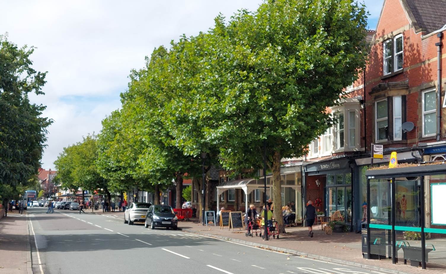
Lytham Town Centre
2.28 The town centre is served by local bus networks from all surrounding areas, including frequent services in the urban area. The railway station is centrally located with services from Preston and connections beyond but requires increased frequency to meet the needs of the town. Road connections have improved through the delivery of Edith Rigby Way to the west of Preston and the Heyhouses M55 Link Road.
2.29 The coast at Lytham faces out southwards onto salt marsh in the Ribble Estuary so does not present the same resort experience as St Annes. The marshes are designated under the Ramsar convention for their important habitat. Much of the eastern part of Lytham is at risk of coastal and fluvial flooding. Coastal defence works have been undertaken to replace an extensive length of sea wall around Lytham.
2.30 Lytham has some small areas of industrial estates on the east side of the town, home to successful manufacturing businesses. However, the supply of new employment land available for take up is very restricted.
2.31 Property values are very high in Lytham compared with the other towns in the Borough, and even more so compared with other parts of the Fylde Coast. Income levels are also higher in Lytham. Available housing sites in Lytham have been built out, so there is a lack of supply. However, the constraints of flood risk, green belt and site designations for heritage and nature mean that there is a lack of options for further development.
Issues for the Local Plan
- Balancing the needs of town centre businesses with the need to maintain the high quality historic environment that attracts people to the town
- Protecting important green spaces particularly Lytham Green, Lowther Gardens
- Keeping any remaining employment land available for take up by employment uses
Ansdell and Fairhaven
2.32 Situated between St Annes and Lytham and forming the central part of the continuously built area, Ansdell and Fairhaven is a parish newly designated in 2025. The area is almost fully built-out, and potential development sites are scarce.
2.33 The area is principally a mature suburban housing area with a coastal frontage. The centre of Ansdell is the area around Woodlands Road, which provides an attractive area of shops and cafes aimed at a local clientele, and includes a number of designated and non-designated heritage assets contributing to the area’s character.
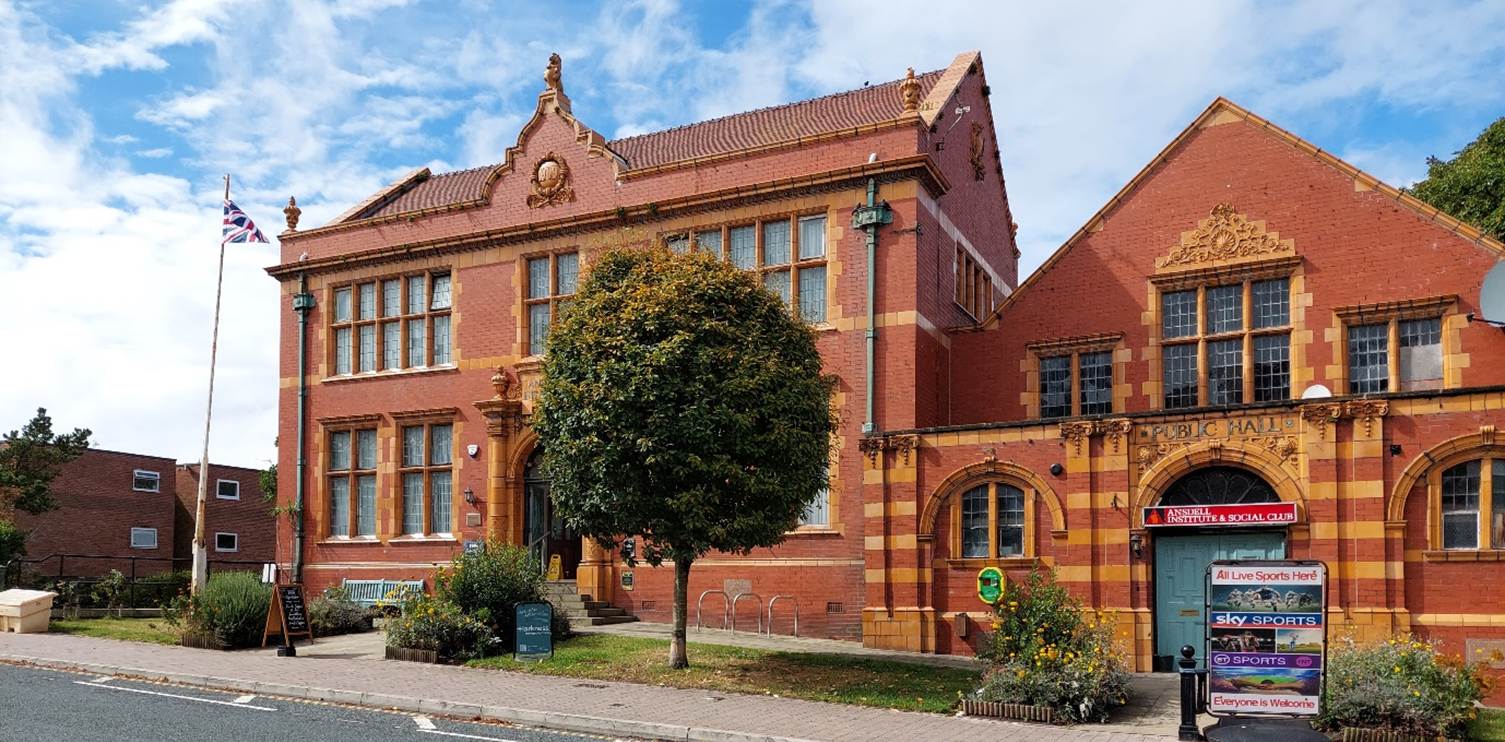
Ansdell Institute
2.34 The area is served by frequent buses to St Annes, Lytham and Blackpool. There is a railway station that provides access to the rest of the country but the service frequency requires improvement. The Heyhouses-M55 Link Road has provided direct road access from Ansdell to the motorway.
2.35 The coastal area is principally a continuation of the sand dunes from St Annes. Coastal defence works have augmented these to provide protection from flood risk. However, Fairhaven Lake is a large marine lake set within an extensive public park operated by the Council, and provides a major resort attraction. Ansdell and Fairhaven do not have any significant tourist accommodation provision however.
Issues for the Local Plan
- Balancing the need for new development with providing protection for local character and existing heritage assets
- Protecting the coastal area including Fairhaven Lake and Gardens
- Maintaining the role of the district centre
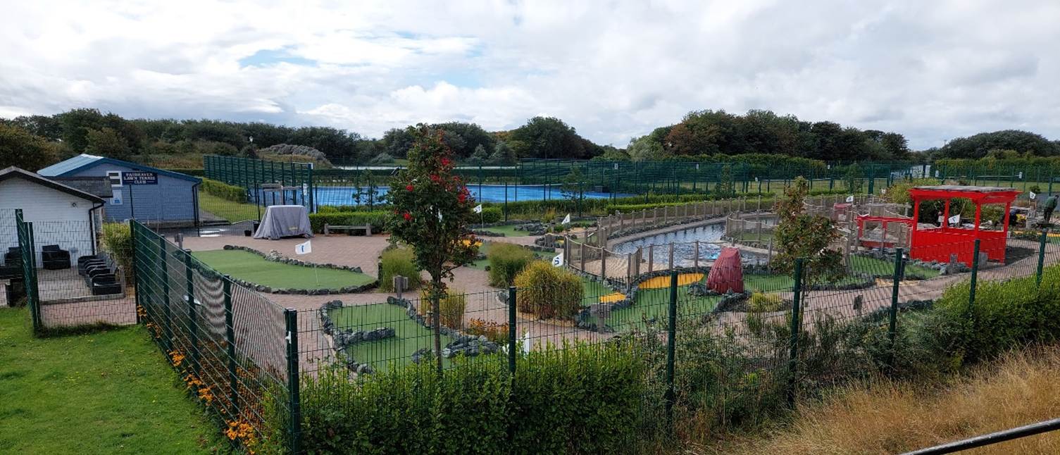
Fairhaven Lake and Gardens
Kirkham and Wesham
2.36 The market town of Kirkham and its adjoining settlement of Wesham, separated by the stream Wrongway Brook, are considered together for the purpose of the Local Plan although they are separate parishes. Kirkham has a population of 7,883[6] and Wesham has 4,474[7]. Kirkham and Wesham are located centrally in the Borough, around mid-way between the Ribble and Wyre estuaries, surrounded by a sparsely-populated agricultural area.
2.37 Kirkham has a long history, with evidence of a Roman fort, and was an Anglo-Saxon settlement that developed into a small medieval market town. Later it grew as a centre for textile production with at most 11 mills. The townscape is reflective of the age of the settlement although few buildings of great age remain. Much of the town centre is designated a Conservation Area. Wesham was an area of dispersed farms until the 19th Century when it grew with the arrival of the railway and the development of cotton mills.
2.38 Kirkham has a town centre with a range of independent shops selling comparison goods and is one of the three town centres in the Borough. Wesham has a wide range of local facilities but there is no clearly defined centre. There are two secondary schools in Kirkham: one in the maintained sector and one private; there are six primary schools across the two settlements; there is also a school for pupils with special needs.
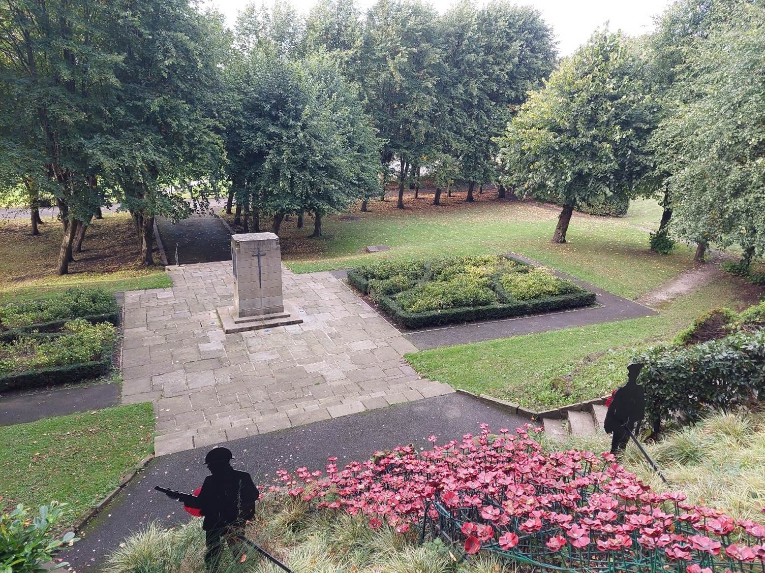
Memorial Park Kirkham
2.39 Kirkham and Wesham railway station provides access to a wider range and more frequent services than the stations on the South Fylde Line; including hourly services to Manchester and Liverpool; there is a need to provide car parking at the station. Bus services to and from Kirkham and Wesham are limited. Junction 3 of the M55 is close to the settlements. Cycling is very difficult in eastern parts of Kirkham due to the topography.
2.40 South of the Kirkham Bypass within the green belt area but adjoining the settlement, HM Prison Kirkham provides accommodation for around 700 prisoners on a site that is low-rise in character.
2.41 Employment areas include significant sites close to the railway line which are home to two large food processing plants, smaller modern and traditional industrial estates within the settlement, and the newly developing Mill Farm mixed use area which includes significant new employment development. Further to north, beyond the boundary of Wesham towards the motorway extending into the rural area, a further large consumer products factory Laleham Health and Beauty is situated.
Issues for the Local Plan
- Maintaining the recovery of Kirkham Town Centre
- Identifying new sites for the next period
- Providing connectivity for pedestrians and cyclists including schoolchildren from development sites to existing facilities including the town centre
- Maintaining sufficient bus services in support of development sites away from the town centre.
Whitehills and Whyndyke
2.42 These are newly developing areas adjoining the edge of Blackpool. Although considered together for strategic purposes, the two areas, although adjoining, are physically separated by the M55 and its onward extension the A5230. Both areas are located within the larger parish of Westby-with-Plumptons; although precise figures are not available, the population of Whitehills represents the large majority of the population of the parish (2,000[8] in total), with the remainder in the rural hamlets.
2.43 Whitehills is the area to the south of the A5230 (which extends westwards from Junction 4 at the end of the M55). Initially an industrial estate, housing areas have been developed to wrap around the southern and western sides. Further developments through the existing Local Plan are still being brought forward.
2.44 Whitehills benefits from being an established area for employment uses, so that housing development can result in short journeys to work for those choosing to live and work in the area. As almost all of the housing in the area has only been developed since the beginning of the existing Local Plan, supporting facilities have taken time to be brought forward. A small children’s play area is complete, and there is the prospect of a local retail centre in the short/ medium term. There is no school or primary care facility in the area. Although geographically close, facilities in Blackpool are difficult to access other than by car. The development of further sites could give the opportunity to support provision of a wider range of facilities.
2.45 Whyndyke is a development area allocated in the existing Local Plan and with planning permission. It lies to the north of the M55 and its Junction 4, and to the north east of Preston New Road which at this point forms much of the boundary with Blackpool. A small portion of the Whyndyke area lies within Blackpool.
2.46 Whyndyke will directly adjoin existing developed areas of Blackpool. Although Preston New Road will provide something of a physical barrier to movement between the areas, this can be overcome through effective provision of crossings and traffic management. Notwithstanding this, it is intended that Whyndyke becomes as self-sufficient as possible, including convenience retail, public open space and primary school.
Issues for the Local Plan
- Ensuring the provision of local facilities to serve the new housing areas.
- Ensuring cohesive and well-designed development
- Working with site promotors to ensure sites such as Whyndyke are brought forward
- Ensuring infrastructure to provide for walking, cycling and public transport to nearby facilities within Blackpool
- Choice of additional sites to be brought forward
- Ensuring a cross-boundary approach to the development of infrastructure to support the areas
Warton
2.47 Warton is a village just over 2 km east of Lytham that has grown significantly in the recent past, with a population of 4,666[9]. It is the site of the BAE Systems manufacturing site and associated aerodrome which is of national strategic importance; as such it is a major strategic employment site attracting commuting from a wide area both within and outside of the Borough. Housing development has sought to redress this issue by increasing the supply of housing close to the employment site.
2.48 In consequence of the amount of growth that is occurring it is necessary to ensure that supporting facilities can be provided. New/ expanded convenience retail units have been provided. Warton has only a very small central area, with retail and other services dispersed along the length of the A584 Lytham Road. The existing Local Plan has sought to bring forward a coordinated local centre; schemes have been prepared for a programme of improvement works. Other improvements have been made to road junctions to assist traffic flow.
2.49 Given this degree of growth, it is critical that existing facilities, including community facilities are protected. Bryning-with-Warton Parish Council produced a Neighbourhood Plan (BWNDP) which was made in May 2017. Warton has a number of important green spaces which were identified by the BWNDP as Local Green Space, providing protection for those areas. There is no conservation area within Warton. Flood risk affects land on the coastal side of the aerodrome which is mainly salt marsh; there is also fluvial flood risk from Pool Stream and its tributaries to the east of the village.
2.50 The BAE site and aerodrome is a secure site. Safeguarding zones to ensure the safety of aviation are applied around the site. Within the BAE site, areas are designated through a Local Development Order as being where further industrial development could occur without express planning permission, for uses appropriate to location within the secure site. These areas are part of the Lancashire Advanced Engineering and Manufacture Enterprise Zone (at Warton and at Samlesbury, east of Preston).
Issues for the Local Plan
- How further development of new commercial uses to support the settlement can be accommodated at sustainable locations
- Protection and improvement of existing facilities
- Location of any new development sites
- Protection and appropriate development of BAE Systems Warton Aerodrome site and the Enterprise Zone
Freckleton
2.51 Freckleton is a large mature village east of but adjoining Warton. The historic village is towards the eastern end of the settlement area as it is now, forming a distinct central area; however further small scale commercial uses are distributed elsewhere in the settlement. The broad extent of the settlement has been unchanged for 30 years or more: this is largely due to the existence of the green belt designation of land to the north of the Freckleton bypass, which runs west-east along the northern edge of most of the settlement. A ribbon of older development extends north into the green belt area along Kirkham Road.
2.52 Freckleton has a good range of facilities including two primary schools, doctors’ surgery, public library, pubs and a range of shops. However there are very limited employment areas, meaning that Freckleton largely has a dormitory function. However, the BAE works at Warton is within easy walking/ cycling distance of the main part of the village.
2.53 Although Freckleton has a bus service connecting with Lytham, St Annes and Preston, it has no railway station and is distant from the nearest one, meaning that access to places outside the local area are much more likely to be made by car than is the case in more sustainable areas. The distances from the village to Lytham and Kirkham are too long for the casual cyclist, meaning that cycling as an active travel option to the local town centres is much less likely to be taken up.
Issues for the Local Plan
- Freckleton has not been taken forward as a strategic location in the previous Local Plan, mainly due to the green belt constraint. The green belt remains a constraint to development.
- Protection of existing services and facilities including heritage assets.
Rural areas
2.54 Outside of the main towns and large villages, the Borough is a sparsely populated agricultural area. Within this area, seven of the villages are identified in the existing Local Plan as being sufficiently sustainable to support a level of growth necessary to maintain the existing facilities. These are: Staining, Newton, Wrea Green, Clifton, Weeton, Elswick and Singleton. Beyond these, there exists a number of small hamlets and small collections of houses, and dispersed farms as typical for Lancashire.
2.55 In the particular case of Staining, a significant proportion of the built-up area of the parish is within the larger area of Normoss, which is partly within Fylde, partly Wyre and partly Blackpool, situated on the edge of the built area of Blackpool. This area is separated from Staining village by Green Belt. Other parts of the rural area of Fylde directly adjoin the settlement edges of Poulton-le-Fylde in Wyre, and newly developing areas of west Preston.
2.56 Within the rural areas there are a small number of major developed sites, not attached to settlements. These are: Westinghouse Springfields nuclear site at Salwick, Weeton Barracks, Ribby Hall Holiday Village, Helical Technologies at Warton, Naze Lane Industrial Estate at Freckleton, as well as the aforementioned Laleham Health and Beauty factory at Greenhalgh. Some of these are major employment centres, which creates difficulty in ensuring there are options for how to travel to work.
2.57 There is development pressure throughout the rural areas for housing in unsustainable locations, and in particular for the development of existing homes into very large units, which in turn reduces the supply of smaller or medium-sized homes within those settlements. Housing in the rural areas is the least affordable in the Borough and properties suitable for newly forming households or those seeking to downsize originating in the rural areas are scarce.
2.58 Much of the rural area is sparsely populated and with community facilities and services largely absent. It is therefore of critical importance to ensure those facilities that exist are protected.
2.59 There is development pressure for the enlargement of rural villages beyond the level of development needed to support existing facilities. This would then put pressure on existing facilities and lead to a need for additional facilities normally found in towns.
2.60 Most rural land is in agricultural use, and a significant proportion is grade 2, with only a very small proportion being grades 4 or 5. The ability of agricultural businesses to diversify whilst maintaining agricultural use of land has been important in recent years. Therefore many farm sites include ancillary businesses, and some have been fully redeveloped for other employment uses where consolidation of farm holdings has occurred.
2.61 There is pressure for alternative use of agricultural land for renewable energy generation, and the development of extensive solar farms has occurred.
2.62 Much of the rural landscape of Fylde is described as within the category Lancashire Coastal Plain, with smaller amounts of low-lying land in South Fylde Mosses. The landscape is lowland, without any significant slopes, and a maximum altitude of 42m above sea level. The only elements of the rural landscape of Fylde protected for landscape value are the Lytham Hall Park Registered Park and Garden, and curtilages of individual listed buildings in the countryside. There are low levels of tree cover in Fylde, with typically isolated small copses. Ponds are found throughout the rural area of the Borough. There is a lack of connectivity between the elements of biodiversity in the rural areas, other than that provided by watercourses.
Issues for the Local Plan
- Protecting the character of villages and heritage assets.
- Ensuring that land lost to development is through the development strategy, at sustainable locations
- Whether development sites adjacent to urban areas lying outside of the Borough would be appropriate
- Minimising the impact of development on high-grade agricultural land
- Provision of affordable housing to meet local needs in the rural areas.
- Improving biodiversity networks through improved connectivity, for instance through new trees and hedgerows between existing vegetated areas
| Vision: Fylde in 2042
In 2042, Fylde will be a place where people choose to live, work and raise a family, retire and feel safe, visit and want to return. Fylde will have continued to develop as a dynamic, prosperous place to live and work through boosting the delivery of sustainable homes and economic growth in accordance with the Local Plan Development Strategy, supported by the necessary facilities, services, infrastructure and access to modern telecommunications. People will have the opportunity to access services and jobs close to where they live. New homes will have been developed to meet housing needs. New housing areas will have been developed at sustainable locations, with safe pedestrian/cycle access to all necessary local facilities. A range of specialist accommodation will have been completed to provide for the needs of an ageing population. Affordability of homes will have improved as a result of the mix of new homes provided. The requirement for high quality design as a key principle in all development will have led to new housing areas that are valued for their appearance, layout and how they contribute to the attractiveness of the wider settlements, but which still function effectively. New developments will have fitted comfortably into the existing content of the surrounding areas. They will include accessible links for pedestrians and cyclists to connect into the wider area without avoidable use of main roads. Landscaping in completed developments will have begun to mature and provide a softening of the appearance of the built development. New commercial developments will have avoided utilitarian design and provided appropriate character. Fylde will have enhanced its unique qualities including its historic and built environment, the classic seaside resort towns of Lytham and St Annes, the historic market town of Kirkham, tranquil coastline, high quality golf courses, tourism offer and picturesque rural settlements. The visitor economy will have been strengthened by the area’s resort appeal, its reputation as a centre for world famous golf championships and its attractive rural areas. The key historic resort assets including Promenade Gardens, Ashton Gardens, St Annes Pier, Fairhaven Lake and Gardens, Lytham Green and Windmill and Lowther Gardens and all of their associated features will have been maintained, and will remain as lynchpins of the resorts’ appeal. High quality attractions and organised events such as the Lytham 1940s Wartime Weekend and the Lytham Festival, staged activities at Lytham Hall (Grade 1 Listed) and the retention of serviced tourism accommodation in the Holiday Areas, will generate an increase in the number of visitors. Projects to improve the Island Sea Front Area and linkages from the sea front to St Annes town centre through the St Annes Masterplan will have provided a high-quality visitor experience. Fylde will have remained flexible in its approach to changing economic and employment patterns, particularly with regard to major local employers. Strategic, nationally-important manufacturing sites at BAE Systems, Warton (and its Enterprise Zone) and Westinghouse Springfields, along with Blackpool Airport Enterprise Zone will have provided for significant economic growth. The needs of businesses, particularly units to assist continuing micro-business formation will have been provided for through the provision of employment sites close to where people live, including further development at Whitehills. Lytham and St Annes will be thriving resorts with quality specialist shops, with Kirkham a vibrant historic market town. Lytham, St Annes and Kirkham will have retained and enhanced their positions at the top of the retail hierarchy. Warton will be a Local Service Centre with a local retail centre serving the needs of the local community. Whitehills and Whyndyke will have been developed as a Local Service Centre, as a sustainable walkable settlement with local retail centres serving the new communities at both Whitehills and Whyndyke. Wesham and Freckleton will retain their functions as Local Service Centres. The rural character and attractiveness of the countryside areas of the Fylde will have been retained and enhanced. Rural settlements in Fylde will have retained their individual identities and heritage assets and their distinctive features will have been protected, enhanced and promoted; all development will have respected and conserved the character of these settlements. The release of land away from the main settlements for development will have been minimised and the highest quality agricultural land will have been protected from development. Rural settlements will have had provision of housing of an appropriate type, tenure, design, density and mix to address local needs and issues of affordability. In rural areas the rural economy will thrive, in particular small and medium sized enterprises. Access to all parts of the Borough from the rest of the region and country will have improved. The T5 Link Road to Queensway will have been completed, providing improved connections to St Annes and to Blackpool Airport Enterprise Zone from the completed Lytham St Annes Way. Rail connections will have improved through improved frequency between the South Fylde Line stations and Preston, and from the provision of parking at Kirkham and Wesham station. Any improvements to motorway junctions needed to mitigate the effects of new development will be completed. Local public transport will have been maintained and enhanced to service newly developed areas. Additional pedestrian and cycle routes provided by new developments will have improved active travel participation through walking and cycling. Open space will have been provided, woodland cover increased and Fylde’s unique offer of Green and Blue Infrastructure will be accessible and contribute to a high quality of life. Biodiversity, including Fylde’s Ecological Network, will have been enhanced and protected from inappropriate development. Sea defences will have been improved. Bathing water quality will have been improved and protected through improvements to infrastructure. Associated tourism, recreational and environmental benefits will have been realised, providing an essential tract of Green Infrastructure network along the coast, running from Starr Gate in the west to Savick Brook in the east. |
Strategic Objectives for the Local Plan
Objective 1: Promoting sustainable development:
- Sustainable pattern through development strategy
- Development directed to sustainable locations
- Restricted development in rural areas
- Good access to jobs and services available locally
- Climate change resilient (flood risk)
Objective 2: Creating safe, caring, sustainable communities
- Meeting housing needs by providing a sufficient quantity in a broad mix of housing sizes and types
- Creating development layouts that allow people to move easily within and between neighbourhoods
- Providing for needs of particular groups especially the ageing population which is a particular issue for the Borough
- Creating mixed, sustainable communities
- Ensuring accessible local facilities are available for new developments and are maintained in existing areas
Objective 3: Promoting a vibrant and healthy economy
- Supporting business growth through maintaining employment land supply
- Supporting the roles of town centres
- Supporting the roles of resorts including protection of assets that contribute to the critical mass of attractions
- Supporting growth at strategically important employment sites
Objective 4: Protect, maintain and enhance the natural and built environment
- Ensure protection for important natural assets
- Protection for open spaces including identification of those of strategic importance
- Management of the impacts on natural environment of development nearby
- Protection for the built environment through provision for design codes
- Protection for heritage assets
[1] Mid-2024 estimate, Office for National Statistics https://www.ons.gov.uk/peoplepopulationandcommunity/populationandmigration/populationestimates/datasets/estimatesofthepopulationforenglandandwales
[2] Regional gross value added (balanced) by industry, Office foe National Statistics https://www.ons.gov.uk/economy/grossdomesticproductgdp/datasets/regionalgrossvalueaddedbalancedbyindustrylocalauthoritiesbyitl1region
[3] Regional gross domestic product: local authorities, Office for National Statistics https://www.ons.gov.uk/economy/grossdomesticproductgdp/datasets/regionalgrossdomesticproductlocalauthorities
[4] Regional Gross Disposable Household Income, Office for National Statistics https://www.ons.gov.uk/economy/regionalaccounts/grossdisposablehouseholdincome/datasets/regionalgrossdisposablehouseholdincomelocalauthoritiesbyit
[5] Census 2021
[6] Census 2021
[7] ibid
[8] Census 2021
[9] Census 2021
- The Development Strategy
3.1 The Borough of Fylde is part of the Fylde Coast sub-region of Lancashire and borders Blackpool, Wyre and Preston, together with South Ribble and West Lancashire across the Ribble Estuary. In particular, the population of Fylde has close links with Blackpool, Wyre and Preston. Through establishing a development strategy and setting out the settlement hierarchy, the role that neighbouring areas play in providing accessible services to the population of Fylde has been taken into account.
3.2 The development strategy provides the overall framework for the pattern of future development in the Borough. National policy requires that all plans should promote a sustainable pattern of development that seeks to: meet the development needs of their area; align growth, delivery and infrastructure; improve the environment; mitigate climate change and adapt to its effects.
3.3 In seeking to achieve a sustainable pattern of development, the Council has prioritised locations where access can be provided for all to local facilities and to local jobs, by walking and cycling (active travel) to promote healthy lifestyles and by public transport.
The Settlement Hierarchy for Fylde
3.4 The role and function of each of the settlements in the Borough is set out in the settlement hierarchy. The settlement hierarchy helps to inform the development strategy but does not directly determine it: the development strategy draws from a wider range of considerations.
3.5 Settlement hierarchies classify settlements into groups to indicate their relative facilities, size or importance based on a series of criteria. In making such a classification to inform the Local Plan development strategy, the overriding aim should be to identify those places which are most sustainable.
3.6 The established settlement hierarchy for Fylde derives from the Fylde Local Plan to 2032 (adopted 2018). It sets out two tiers of urban settlements, Key Service Centres and Local Service Centres, and two tiers of rural settlements, Tier 1 Larger Rural Settlements and Tier 2 Smaller Rural Settlements. The settlements are categorised through an established scoring system recommended in the former Regional Spatial Strategy.
3.7 The settlement hierarchy has been reviewed in the preparation of the Local Plan to reflect an updated position. The outcomes are unchanged, save for the inclusion of Weeton Barracks as a settlement in its own right, and the recognition that Little Singleton should be included in conjunction with Singleton. The Local Service Centres of Warton, Whitehills and Whyndyke are still in development and it may take to the end of the plan period or beyond before the full range of facilities commensurate with the designation is achieved in these locations.
3.8 The settlement hierarchy in Fylde recognises the context of the higher order centres of Blackpool to the west and Preston to the east, which provide a much wider range of services and facilities than the towns in Fylde, including higher-order comparison retail centres and large further education colleges. It also recognises the context of Poulton-le-Fylde, which will be the equivalent of a key service centre, close to the northern boundary of the Borough and within proximity to Singleton and Staining.
Strategic Policy SET1The Settlement Hierarchy Development that is appropriate to the scale and character of settlements at each level of the settlement hierarchy, will be promoted in accordance with the Development Strategy.
Key Service Centres The towns of St Annes, Lytham and Kirkham perform the role of Key Service Centres and serve the wider catchment area. The role of these towns as Key Service Centres will be maintained over the life time of the Local Plan; existing services and facilities will be enhanced to serve the wider catchment area. Local Service Centres The established Local Service Centres of Wesham, Freckleton and Ansdell will provide an appropriate range of facilities to cater for local needs over the plan period. The developing Local Service Centres of Warton and Whitehills will be further enhanced during the plan period to extend the range of facilities provided. Whyndyke will be developed as an entirely new Local Service Centre over the plan period. Tier 1 Larger Rural Settlements The Tier 1 Larger Rural Settlements have a range of basic facilities but are still dependent on sustainable transport connections to the urban settlements for certain essential facilities. Tier 2 Smaller Rural Settlements The Tier 2 Smaller Rural Settlements have some basic facilities but are missing others, and are therefore dependent on sustainable transport connections to urban settlements for most services. |
Deciding on a Development Strategy
3.9 The overall strategy for directing where new development and investment will be located in Fylde is set against the backdrop of underlying development trends. It involves providing for new homes, employment, services, tourism, renewable energy and the infrastructure that supports them. Development must be achieved in the most sustainable way in order to protect and, where possible, enhance Fylde’s historic, environmental, social and economic assets. In particular, choosing the most sustainable locations for development will help mitigate the impacts of climate change. Encouraging a mix of uses on larger development sites and locating homes and businesses in close proximity will reduce the need to travel.
3.10 The size and connectivity of existing places, along with the level of services available, are key considerations in deciding where to locate development. Fylde has many attractive features and distinctive local characteristics which could be lost by allowing inappropriate development to take place in unsustainable locations. The role of the Local Plan is two-fold. Firstly it needs to plan for development and to allocate land accordingly in the Strategic Locations. Secondly, it is to provide policies for the protection of the Borough’s built and natural environment, including nature conservation sites, heritage assets and local characteristics.
3.11 The decision on the strategy for development in Fylde needs to consider the amount of development needed, the sustainability of different development locations, the limits to the development of particular areas (constraints) and the availability of deliverable/ developable sites. A decision is then needed on the balance of development between the different places.
3.12 The issue of constraints is particularly important in Fylde. Freckleton is constrained, effectively on all sides: on the east by Freckleton Marsh, entirely in flood zone 3; on the west by Pool Strem and its flood zone, with Warton beyond; to the south by the strategically important runway that is part of the BAE Systems Warton site; to the north by green belt.
3.13 Lytham is also constrained on all sides. To the east is the estuary including the Ribble Estuary National Nature Reserve, with the remaining area being in a flood risk zone and also green belt. To the north is the Lytham Coastal Changes SSSI, Green Drive Golf Course, and the Lytham Hall Park Registered Park and Garden. To the west, the settlement adjoins Ansdell. To the south is the coastline. No new sites within the urban area have been identified. Therefore, despite being a Key Service Centre, Lytham could not be considered as an option to deliver strategic amounts of growth. Ansdell, between Lytham and St Annes with the coast to the south, adjoins land to the north which is extensive areas of land in flood risk zones, plus the Lytham Hall Registered Park and Garden. Therefore Ansdell is also discounted for strategic growth.
3.14 There are developed areas adjoining the Borough boundary which adjoin the area of Normoss on the edge of Blackpool and the market town of Poulton-le-Fylde located in Wyre. These areas constrained through green belt protection, with some areas further east constrained by flood risk zones. Therefore, areas in Fylde adjoining the settlements outside the Borough in these locations have not been considered for strategic growth.
3.15 The existing Local Plan is based on a strategy of delivering 90% of development at four strategic locations: Lytham and St Annes; the Fylde Blackpool Periphery; Warton; and Kirkham and Wesham. The four strategic locations in the existing Local Plan have resulted in a broad base of housing delivery over the period since the plan was brought forward. The spread of sites across the four locations has meant that there has not been any evidence of over-supply at a single location, which would constrain delivery: instead, the strategy has been effective in ensuring that delivery has been maintained. However, there remain strategic sites still to be delivered fully in each of the four strategic locations. The development strategy set out below therefore takes account of the existing committed/ allocated sites at the four strategic locations in the existing Local Plan.
3.16 The Options, Issues, Vision and Scope consultation invited respondents to provide input into the development strategy for the new plan. The results of the consultation are set out in the Statement of Regulation 18 Consultation. Whilst there was a wide variety of suggestions, including no development and no strategy, there was a significant degree of support for the overall approach of the existing strategy.
3.17 Following refinement in response to the earlier consultation and the Sustainability Appraisal, the Council has decided to take forward a development strategy broadly similar to the existing strategy, with some minor changes:
- The strategic location previously identified as Lytham and St Annes to no longer refer to Lytham, as Lytham no longer presents strategic development opportunities.
- The areas previously identified as Fylde Blackpool Periphery were in practice two discrete areas: Squires Gate Lane and Blackpool Airport being one and the areas of Whitehills and Whyndyke close to M55 Junction 4 being the other. The new strategy includes Squires Gate Lane and Blackpool Airport as within St Annes (which they are), in particular recognising that those who live in the area are citizens of St Annes: the location has been renamed St. Annes (including Squires Gate).
- The second area of the former Fylde Blackpool Periphery has been renamed Whitehills and Whyndyke, to more clearly identify the areas as places (local Service Centres) in their own right, and to recognise that although they form a single contiguous area when mapped, they are physically two separate areas on the ground, divided by the M55 and its junction.
3.18 No distinction is made in the existing development strategy as to the relative importance of the four strategic locations, and no benchmark would be set for the number of units at each; rather, sites would be selected on overall merit, whilst maintaining a reasonable balance to the strategy. The updated development strategy takes a slightly more pragmatic approach, recognising where the most sustainable opportunities are, and how other locations present fewer sustainable sites.
3.19 In relation to non-strategic locations, development is directed on the basis of the most sustainable pattern of development reflecting the opportunities from sites brought forward, rather than applying benchmarks to individual settlements as were applied previously.
Strategic Policy DST1The Development Strategy The Local Plan will provide sites for a minimum of 6,656 new homes and a minimum of 24.49 ha (gross requirement) of additional employment land over the plan period to 31 March 2042. Strategic Locations for Development The Local Plan Development Strategy is to direct future growth to the most sustainable locations, specifically to the four Strategic Locations for Development. Around 90% of homes to be developed in the plan period (including small sites) and 24.04 ha of employment land will be located in the four Strategic Locations for development. The four Strategic Locations are:
Non-strategic Locations for Development Other development will mainly be located in the Non-strategic Locations for Development, which comprise the Key Service Centre of Lytham, the Local Service Centres of Freckleton and Ansdell, the Tier 1 Larger Rural Settlements and the Tier 2 Smaller Rural Settlements. Around 10% of homes to be developed in the plan period (including small sites) and 0.45 ha of employment land will be located in the Non-strategic Locations. Windfalls (including small committed sites) Small housing sites (amounting to between 1 and 9 homes) are not allocated; they can occur throughout the borough where compliant with the other policies of the plan. Small sites are provided for through a windfall allowance of 40 homes per annum from year 4 of the plan period. |
3.20 The Development Strategy retains the existing development strategy and builds upon it. 90% of additional housing development (over and above the amount already committed) will be located at the four strategic locations for development. This allows for continued growth at each of the four locations, following on from existing and committed growth. The spread across four locations would mean that sufficient sites would be brought forward to ensure sufficient housing delivery, so that the housing delivery test is met. Development at four strategic locations will mean that there is reduced pressure for development at non-strategic locations.
3.21 The four strategic locations in the existing Local Plan have resulted in a broad base of housing delivery over the period since the plan was brought forward. The spread of sites across the four locations has meant that there has not been any evidence of over-supply at a single location, which would constrain delivery: instead, the strategy has been effective in ensuring that delivery has been maintained. There remain sites still to be delivered fully in each of the four strategic locations. The current housing commitments are:
- St. Annes (including Squires Gate) 921 units
- Whitehills and Whyndyke 2,147 units
- Warton 204 units
- Kirkham and Wesham 117 units
3.22 The four strategic locations provide the most sustainable developable locations for development of strategic size. St Annes is the largest individual settlement in the Borough, with a main town centre and the widest range of available facilities. Whitehills and Whyndyke form extensions to the adjoining settlement of Blackpool, which is the largest settlement in the Fylde Coast sub-region and has the widest range of facilities: the areas are developing two new Local Service Centres which will ensure that local facilities are provided, as well as enabling access to the widest range in Blackpool. Warton is home to the nationally-important employment site of BAE Systems: further housing growth will allow for a more balanced relationship between employment and housing which would reduce commuting and therefore represent sustainable growth. Kirkham and Wesham have good access by sustainable public transport via its railway station to the wider sub-region and the North West as a whole; Kirkham is a market town with a historic town centre that has been subject to recent improvement and investment, which is capable of supporting a larger population than it currently does; the settlements are the locations for manufacturing employment which is being currently expanded. Accordingly all four locations are appropriate locations for continued growth at a strategic level within the context of the Local Plan.
3.23 The Infrastructure Delivery Plan that accompanies this plan has been updated in order to include appropriate infrastructure in support of the development in accordance with this strategy.
Settlement Boundaries
3.24 Boundaries for the settlements listed in the settlement hierarchy have been identified and are shown on the Policies map. The boundaries have been drawn to include all Local Plan allocations.
Strategic Policy DST2Settlement Boundaries The boundaries of settlements in Fylde are shown on the Policies Map. Development proposals on sites within settlement boundaries will be assessed against all relevant Local Plan policies. Development proposals outside settlement boundaries will be determined in accordance with Policies DST3, DST4 or DST5 and national policy as applicable. |
3.25 National policy sets out a general presumption for development within settlement boundaries, providing that other development plan and national policies are complied with.
Land Outside Settlement Boundaries
3.26 There is a hierarchy of designations on land outside settlement boundaries in Fylde, with the greatest level of protection offered to the Green Belt, followed by Areas of Separation and finally the Countryside. All land outside settlement boundaries in Fylde is within either the Green Belt or the Areas of Separation or the Countryside.
Green Belt
3.27 There are four areas of Green Belt within Fylde:
- Between Kirkham and Freckleton
- Between Lytham and Warton
- Between St Annes and Squires Gate
- Between Staining, Blackpool and Poulton-le-Fylde.
3.28 The Green Belt serves five purposes:
- a) to check the unrestricted sprawl of large built-up areas;
- b) to prevent neighbouring towns merging into one another;
- c) to assist in safeguarding the countryside from encroachment;
- d) to preserve the setting and special character of historic towns; and
- e) to assist in urban regeneration, by encouraging the recycling of derelict and other urban land.
3.29 National policy notes that the general extent of Green Belts is established. It states that, once established, Green Belt boundaries should only be altered where exceptional circumstances are fully evidenced and justified through the preparation or updating of plans. Exceptional circumstances can include, but are not limited to, circumstances where an authority cannot meet its development needs through other means, having fully examined all other reasonable options.
3.30 In Fylde, the areas covered by Green Belt represent only a small minority of the overall area of undeveloped land. Other areas are identified in the current Local Plan as either Areas of Separation, or Countryside. The SHELAA identifies sufficient sites to meet needs that are suitable, available and achievable within land that is not designated as Green Belt.
3.31 As the Council has sufficient land to meet its needs that does not lie in the Green Belt, no exceptional circumstances exist to justify a strategic review of the Green Belt in Fylde. One minor, non-strategic change to the Green Belt boundary has been made to land within the BAE Systems site at Warton, to ensure that strategic growth can be fully accommodated at the nationally-important site. The change is shown in Appendix 4.
3.32 The Draft Revised Framework proposes that any Local Planning Authority with any Green Belt should conduct a review of it, even in such circumstances as exist in Fylde. However it is unclear whether the existence of authorities in the position of Fylde was recognised or identified in the drafting of this element of the Draft Revised Framework, and the Council has made representations to the consultation to this effect. In the event that the policy is formally brought forward as currently drafted, the Council will be required to conduct a review of Green Belt. However, notwithstanding any review, sufficient land is allocated within the policies of the plan to meet development needs, and therefore the allocation of land currently designated as Green Belt is not required.
Strategic Policy DST3Green Belt The Green Belt within Fylde is shown on the Policies Map. Within that area national policy for development in the Green Belt will be applied. |
Areas of Separation
3.33 In order to help maintain the openness of areas outside the Green Belt and the identity and distinctiveness of individual settlements, policy DST4 defines Areas of Separation. An Area of Separation is different to Green Belt: it is of a significantly smaller scale and located between settlement boundaries that are relatively close and at risk of merging.
3.34 An Area of Separation is designed to preserve the character and distinctiveness of individual settlements by restricting inappropriate development that would result in the coalescence of two distinct and separate settlements. The Council considered the potential to establish Areas of Separation in response to concerns that there was potential for settlements to merge without further protection. The Council produced the Area of Separation Background Paper (2014) which assessed potential Areas of Separation using the following criteria:
- Distance between settlements or built-up areas (at narrowest point);
- Current land use;
- Landscape character;
- Topography;
- Development pressure;
- Planning application history;
- Local Plan designation; and
- Other relevant designations.
3.35 There is a narrow strip of land between the settlement boundaries of Wrea Green and Kirkham, measuring 313 metres at its narrowest point, which is recognised as an area valued locally as part of the Green Infrastructure network. Similarly, there is a narrow strip of land between Newton and Kirkham. In both cases, it has been demonstrated in the Area of Separation Background Paper that, having considered each area against the criteria, there is potential for the gap between settlements to be compromised, which without protection would over time lead to the progressive coalescence of settlements leading to a loss of distinct identity. Consequently, the policy identifies two Areas of Separation, one between Wrea Green and Kirkham and the other between Kirkham and Newton.
3.36 The policy has been reviewed for the new Local Plan. The boundary of the Area of Separation between Kirkham and Newton has been drawn to follow Parrox Lane, Newton, to provide a more defensible and appropriate permanent boundary.
3.37 The policy seeks to restrict development to a greater degree than the countryside policy (see below) in order to avoid harm to the effectiveness of the gap between the settlements and protect the identity and distinctiveness of the settlements.
3.38 The Areas of Separation will be a focus for Green Infrastructure. So far as is consistent with the predominantly open and undeveloped character of the area, opportunities to improve public access and appropriate recreational uses will be supported. Similarly, opportunities to conserve, restore, enhance and create biodiversity and geodiversity value will be encouraged.
Strategic Policy DST4Areas of Separation Areas of Separation shown on the Policies Map are designated between:
Development will be assessed in terms of its impact upon the Area(s) of Separation, including any harm to the to the effectiveness of the gap between the settlements and, in particular, the degree to which the development proposed would compromise the function of the Area(s) of Separation in protecting the identity and distinctiveness of settlements. Development will be limited to: a) that needed for purposes of agriculture, horticulture or forestry; or other uses appropriate to a rural area, including uses which would help to diversify the rural economy, of a type and scale which would not harm the effectiveness of the gap between the settlements in protecting the identity and distinctiveness of settlements; b) Development for rural businesses and services, including tourism, where a location outside settlements is shown to be necessary, of a type and scale which would not harm the effectiveness of the gap between the settlements in protecting the identity and distinctiveness of settlements; c) the re-use or rehabilitation of existing permanent and substantial buildings; d) The redevelopment of previously developed land (including a material change of use to residential or mixed-use including residential; e) extensions to and replacements of existing dwellings and other domestic/ residential buildings or those within the residential curtilage in accordance with Policy HOU12; f) development essentially needed for the continuation of an existing enterprise, facility or operation, of a type and scale which would not harm the effectiveness of the gap between the settlements in protecting the identity and distinctiveness of settlements; g) isolated new homes in the countryside which meet the criteria set out in national policy. h) limited infilling within groups of houses, of a scale and use that does not have a material impact on the rural character of the area, providing that it would not result in any harm to the effectiveness of the gap between the settlements or compromise the function of the Area(s) of Separation in protecting the identity and distinctiveness of settlements; i) the provision of a new home to meet the essential needs of a rural worker in accordance with Policy HOU11. Development that is needed for uses appropriate to a rural area situated within the Area of Separation should be sited carefully to avoid harm to the effectiveness of the gap between the settlements in protecting the identity and distinctiveness of settlements. |
Countryside Area
3.39 Areas outside settlements which are not identified as Green Belt or Areas of Separation are identified as Countryside Areas.
3.40 Outside of the existing towns and main villages, the countryside is defined on the Policies Map as areas not covered by Green Belt or Areas of Separation. Designation is necessary to prevent uncontrolled development: without restriction, the countryside would be developed for very low-density housing at random locations, resulting in profligate use of land, the creation of homes in isolated locations.
3.41 In the countryside, Policy DST5 gives a lower standard of protection than Green Belt or Area of Separation policies. The principle is to seek to allow uses appropriate to the countryside to operate without unnecessary restriction, but prevent encroachment by urbanising development.
3.42 Outside settlements, there will be a presumption against large scale development and those types of small-scale development that incrementally would result in uncontrolled sprawl. Policy DST5 therefore restricts development to those types which are appropriate to a rural area and support agriculture, other existing rural businesses and rural communities. An exception is provided for the existing developed sites identified in the policy, where there is a presumption for development within the sites in accordance with relevant policies.
Strategic Policy DST5The Countryside Development in the Countryside, shown on the Policies Map, will be permitted in the following circumstances: a) where it is needed for the purposes of agriculture, horticulture or forestry; or other uses appropriate to a rural area, including uses which would help to diversify the rural economy, including small-scale tourist accommodation, small-scale holiday caravan sites and very exceptionally, larger scale tourism development. The development must be sensitive to its surroundings, must not have an unacceptable impact on local roads and should offer opportunities to make the location more sustainable (for example by improving the scope for access on foot, by cycling or by public transport, or through the provision of services to rural communities). b) Development for rural businesses and services, including tourism, where a location outside settlements is shown to be necessary; c) the re-use or rehabilitation of existing permanent and substantial buildings; d) the redevelopment of previously developed land (including a material change of use to residential or mixed-use including residential); e) extensions to and replacements of existing dwellings and other domestic/ residential buildings or those within the residential curtilage in accordance with Policy HOU12; f) development in support of the continuation or growth of an existing enterprise, facility or operation, of a type and scale which would not harm the character of the surrounding countryside; g) isolated new homes in the countryside which meet the criteria set out in national policy; h) limited infilling within groups of houses; i) rural exception sites to meet identified local affordable housing need (within the rural parish concerned and neighbouring rural parishes only) on land not already allocated for housing which meets the criteria set out in the Framework; j) the provision of a new home to meet the essential needs of a rural worker in accordance with Policy HOU11; or k) development within the following sites as shown on the Policies Map in accordance with the relevant Local Plan policies:
|
3.43 The most appropriate development permissible in the countryside will be for the purposes of meeting local business and community needs and for agricultural, horticultural or forestry purposes, where this is necessary for the efficient and effective running of the enterprise. Development for community needs will relate to facilities such as local shops, meeting places, sports venues, open space, cultural buildings, public houses and places of worship. Some forms of tourism development are appropriate within the rural areas.
3.44 The re-use of substantial brick or stone buildings, which are structurally sound may be an appropriate way of preserving an important local feature in the landscape or providing for a rural use which otherwise may have required a new building. Extensions to existing homes and other non-residential buildings are also acceptable in principle, providing they do not prejudice the character of the countryside and are appropriately designed. Minor infill development will be of a scale and use that does not have a material impact on the rural character of the area.
3.45 There are a number of large developed sites in open land outside settlement boundaries within Fylde, such as Weeton Barracks, HM Prison Kirkham and Ribby Hall Holiday Village. There are also existing employment sites including the strategically important Westinghouse Springfields in Salwick; but also others such as Laleham Health and Beauty Factory at Greenhalgh, Helical Technologies Ltd at Hillock Lane, Warton and Naze Lane Industrial Estate at Freckleton. Development proposals within these sites will be assessed against the specific policies that apply to them, rather than the provisions of the generally restrictive policy for the countryside.
- Locations for Development
4.1 The four Strategic Locations for Development include strategic development sites, comprising land for homes, employment, commercial and leisure uses. Development of these sites will help ensure that the Plan’s Development Strategy, Vision and Strategic Objectives are achieved in order to accommodate the level of development and growth required within the lifetime of the Local Plan.
4.2 It is important that the strategic development sites are accompanied by the timely provision of infrastructure, otherwise proposals will not be deliverable. It is always preferable for infrastructure to be delivered up-front before the development takes place; however, this is often difficult to achieve, as contributions from development sites towards off-site infrastructure can only reasonably be required once some of the development value has been realised. The Infrastructure Delivery Plan (IDP) and accompanying Infrastructure Delivery Schedule identify the required essential infrastructure – what it comprises and where and when it will be needed, as well as the likely providers and funding sources. Where there is a funding shortfall, developers will be expected to directly provide and / or contribute towards the necessary infrastructure, subject to viability.
4.3 Specific policies SLD1-SLD5 set out specific requirements for individual sites to provide on-site infrastructure and connectivity to surrounding areas, and particular issues that will need to be addressed on individual sites. However this should not be regarded as an exhaustive list and developers should take advantage of pre-application engagement with infrastructure providers and the Council to understand detailed requirements at the time of preparing an application.
St Annes (including Squires Gate) Strategic Location for Development
4.4 The continuous urban area of St. Annes, Ansdell and Fairhaven and Lytham forms the principal urban area of the Borough of Fylde, and houses around 56% of Fylde’s population. However, of the three parishes, only St Annes retains sufficient areas suitable for significant quantities of new development. Accordingly, rather than take forward the strategic location of Lytham and St Annes as in the Fylde Local Plan to 2032, the strategic location is now to be taken forward as St Annes only. The area of St Annes around Squires Gate Lane on the border with Blackpool, which includes Blackpool Airport and the Blackpool Airport Enterprise Zone, are included in the strategic location of St Annes.
4.5 The major resort town of St Annes is the largest single settlement in the Borough, St Annes town centre provides the widest range of town centre facilities in the Borough. St Annes has good local road links to neighbouring settlements. Much of the town has frequent bus services, although other parts are less well served. The town is flat and the centre can be reached without difficult by bicycle from all parts. There are employers of many types including a significant tourism sector. The town has open spaces distributed throughout, including the coast. Accordingly the settlement is a generally very sustainable location.
4.6 Within the north of the town, a stretch of green belt, which is largely occupied by the open area around Blackpool Airport runway, the St Annes Old Links golf course, the Blackpool Road North playing fields and St Annes Dunes Nature Reserve, provides a distinct break between the main town and the part of the settlement around Squires Gate Lane that is attached to Blackpool. This is an area where further built development would not be appropriate. To the east and north-east, beyond the allocated sites listed below and the committed Queensway site under construction, land is either in flood risk zones or has been devoted to the mitigation for impacts on bird habitat of earlier development. Therefore the only remaining sites suitable for allocation are included in the Local Plan. In the Squires Gate area, the Blackpool Airport Enterprise Zone site is an area of the existing airport site which will be redeveloped for employment uses. More details of this site are provided in Chapter 6.
4.7 The existing committed sites will contribute to delivery during the plan period. The Queensway housing site is a large site which will deliver 640 homes spread throughout the period to 2042. A number of other sites will deliver smaller numbers (the largest being 42) in the early period. St Annes also generates a relatively large number of windfall small sites which are allowed for through the plan period.
4.8 The Blackpool Airport Enterprise Zone located in the north of the area will deliver the “Silicon Sands” development in the plan period. Further detail is set out in Chapter 6.
Non-Strategic Policy SLD1St Annes (including Squires Gate) Strategic Location for Development The following sites identified on the Policies Map accompanying this plan are allocated for development: |
EA1 Queensway Industrial Estate, Snowden Road, St Annes 3.81 ha employment land
|
MA1 Land West of Lytham St Annes Way, St Annes 389 dwellings, 2.06 ha commercial
|
EA2 Blackpool Airport Enterprise Zone, Squires Gate Lane, St Annes 14.14 ha employment land
|
Whitehills and Whyndyke Strategic Location for Development
4.9 Initially developed as an industrial estate on the outskirts of Blackpool, the Whitehills area south of Junction 4 of the M55 has been developed into a new settlement over the period of the existing Local Plan. The area of Whyndyke will occupy a single large site to the immediate north of the M55 and its Junction 4.
4.10 Whilst the two areas are juxtaposed, they are treated as separate areas as they are physically separated by the M55 and its Junction 4, which act as a barrier to movement other than by motor vehicles. The Council will seek to improve infrastructure to mitigate this; however the physical separation will not be overcome. Therefore the areas are identified separately, and for the most part will need dedicated infrastructure for each area.
4.11 The extent of the developable area on the Whyndyke (north) side is restricted by the existing developed area within the Borough of Blackpool to the west and north-west, the motorway and its junction to the south and the existing woodland belt to the east; in addition, areas of peat provide a constraint. In Whitehills, the developable areas are constrained by flood risk zones to the south and east, the motorway to the north; to the west any development is a matter for the Borough of Blackpool.
4.12 As newly developing settlement areas, Whitehills and Whyndyke will require the new provision of local services and facilities. A new Local Centre is being delivered in Whitehills, and the development of Whyndyke will require development of a Local Centre within the site. Further facilities to be developed in support will include open space, public transport, health and education facilities according to need.
4.13 Within the strategic location, in addition to development already completed, there are a number of committed sites which will come forward over the plan period, which, taken together, will require the support of further facilities. The employment allocations EA3, EA4 and EA6 are remaining parcels located within existing industrial areas.
Non-Strategic Policy SLD2Whitehills and Whyndyke Strategic Location for Development The following sites identified on the Policies Map accompanying this plan are allocated for development: |
MA3 Land at Peel Hill Farm, Whitehills 700 dwellings, 0.1 ha commercial land
|
HA1 Blackpool South Caravan & Motorhome Club, Whitehills 48 dwellings
|
HA2 Madhuban, Cropper Road, Whitehills 30 dwellings
|
| EA3 Whitehills Business Park 3.59 ha of employment land
|
EA4 Land adjacent to Whitehills Business Park 2.08 ha of employment land
|
MA2 Whyndyke Farm 20 ha of employment land
|
EA5 Peel Park, Brunel Way, Whitehills 8.95 ha of employment land
|
EA6 Blackpool and Fylde Industrial Estate, Whitehills 2.42 ha of employment land
|
Warton Strategic Location for Development
4.14 Warton is a large village in the south of the Borough to the east of Lytham, separated from it by Green Belt. The dominant feature of the village is its large aerodrome to the south, between the village and the Ribble Estuary, and its associated large, strategically-important aerospace manufacturing plant. The settlement has two primary schools, regular bus services, public houses and a range of commercial facilities; however recent growth has highlighted the need for further facilities. The existing small Local Centre is subject to a current regeneration scheme to improve the public realm and encourage footfall.
4.15 The large number of people employed at the BAE Systems aerospace works makes the development of further housing in Warton particularly sustainable as it is likely to encourage people to live close to work. Warton is constrained by Green Belt to the west, flood risk zones to the east, and the BAE Systems aerospace works and aerodrome to the south with the estuary beyond. Development sites are therefore principally in the northern part of the settlement, other than small infill opportunities.
4.16 A number of sites allocated in the existing Local Plan are close to completion: the one site still to deliver significant numbers of dwellings is Warton East (104 more dwellings).
Non-Strategic Policy SLD3Warton Strategic Location for Development The following sites identified on the Policies Map accompanying this plan are allocated for development: |
| HA3 258 Lytham Road, Warton 35 dwellings
|
HA4 Pickforal Kennels, Hillock Lane, Warton 14 dwellings
|
HA5 Off Hillock Lane Warton 40 dwellings
|
HA6 Hill House, Hillock Lane, Warton 44 dwellings
|
HA7 Land north of Ennerdale Avenue, Warton 106 dwellings
|
HA8 Snowdrop Grove, Warton 4 dwellings
|
HA9 Land North of Hillock Lane, Warton 219 dwellings
|
Kirkham and Wesham Strategic Location for Development
4.17 The conjoined settlements of the market town of Kirkham and the smaller town of Wesham represent a sustainable location for development, providing an extensive range of facilities, generally easily reachable from most parts of the settlements. The settlements are considered together as facilities in one are within easy reach of most parts of the other, including the town centre and secondary schools in Kirkham and the railway station in Wesham.
4.18 The major constraint to development, which applies to Kirkham only is Green Belt. The area of Green Belt, separating Kirkham with Freckleton to the south, restricts further development to the south of Kirkham. To the west and east of Kirkham, the Council has designated areas as Areas of Separation due to the risk of merger with nearby villages. Further details are set out in Chapter 3.
4.19 Only one site remains from the existing Local Plan with significant numbers of homes still being delivered, with 66 dwellings to complete at Land North of Blackpool Road. Small numbers remain from other sites.
Non-Strategic Policy SLD4Kirkham and Wesham Strategic Location for Development The following sites identified on the Policies Map accompanying this plan are allocated for development: |
HA10 East of Fleetwood Road, Wesham 281 dwellings
|
HA11 South of Mowbreck Lane, Wesham 229 dwellings
|
HA12 Land east of Fleetwood Road and north of Sanderling Way, Wesham 61 dwellings
|
HA13 Land at Weeton Road, Wesham 467 dwellings
|
EA7 Land south of Bradkirk Business Park, Weeton Road, Wesham 4.49 ha of employment land
|
Non-strategic Locations for Development
4.20 The non-strategic locations for development are the settlements defined as Key Service Centres, Local Service Centres, Tier 1 Larger Rural Settlements and Tier 2 Smaller Rural Settlements that are not one of the strategic locations in the development strategy. This comprises:
- Lytham
- Ansdell
- Freckleton
- Newton
- Staining
- Wrea Green
- Weeton
- Weeton Barracks
- Clifton
- Elswick
- Singleton including Little Singleton
4.21 Development in these settlements is not allocated on a proportionate basis, but rather based on a choice of available sites that most represent sustainable development. The development strategy aims to deliver 90% of development in the strategic locations: therefore the amount of development allocated to these locations is relatively small, but this is an appropriate reflection of the sustainability of these locations (or in the case of Lytham, Ansdell and Freckleton, the lack of supply of suitable sites).
4.22 The choice between sites has meant that some locations are not proposed to include any allocations for development. Elswick, in its remote location, whilst of similar size as the other Tier 2 Smaller Rural Settlements, is weaker in sustainability terms simply from its distance to higher order centres. Clifton suffers from a lack of suitable sites: the one site screened in by the SHELAA falls within the hazard zone for the strategically important Toshiba Westinghouse; the village also suffers from lack of a primary school.
4.23 Within the non-strategic locations are two remaining parcels of land within larger developed employment sites in Lytham. There remain some parts of committed sites with planning permission still being built out (e.g. at Copp Lane, Elswick); however most sites where planning permission was granted through the existing Local Plan have been fully built out.
Strategic Policy SLD5Non- Strategic Location for Development The following strategic and non-strategic sites identified on the Policies Map accompanying this plan are allocated for development: |
| EA8 Dock Road, Lytham 0.16 ha employment land
|
| EA9 Boundary Road, Lytham 0.29 ha employment land
|
HA14 Land at Naze Lane East & Green Lane, Freckleton 12 dwellings
|
HA15 Land to the rear of Showmans Park Campsite, Chain Lane, Staining 77 dwellings
|
HA16 East of Church Road and South of Kirkham Road, Weeton 163 dwellings
|
HA17 Land west of Bryning Lane, Wrea Green 40 dwellings
|
HA18 Land off Moss Side Lane, Wrea Green 69 dwellings
|
HA19 Land east of Bryning Lane, Wrea Green 38 dwellings
|
HA20 Land south of Blackpool Road, Newton 118 dwellings
|
HA21 Newton Hall, Newton 96 dwellings
|
HA22 Land West of Poolfoot Farm, Singleton 69 dwellings
|
HA23 South of Garstang Road, Singleton 76 dwellings
|
HA24 Lodge Lane, Singleton 71 dwellings
|
- Housing Policies
Overall Housing Needs
5.1 Access to accommodation is fundamental to quality of life. Homes need to be available in sufficient quantity and of high quality design. There should be a variety of house types, particularly in terms of tenure and price, suitable for a mix of households such as families with children, single persons and older people. Meeting needs for homes is a key aspect of creating and maintaining sustainable communities.
5.2 The government requires strategic policies should, as a minimum, provide for objectively assessed needs for housing and other uses, as well as any needs that cannot be met within neighbouring areas, unless:
- the application of policies in the Framework that protect areas or assets of particular importance provides a strong reason for restricting the overall scale, type or distribution of development in the plan area; or
- any adverse impacts of doing so would significantly and demonstrably outweigh the benefits, when assessed against the policies in the Framework taken as a whole.
5.3 The existing Local Plan has a requirement for 305 new homes per year. The Council has identified the up-to-date Local Housing Need figure under government policy as 416 net additional homes per year. Accordingly, the minimum requirement for the plan period 2026 to 2042 to meet needs in Fylde will need to be 6,656 homes.
5.4 National policy as set out above notes that authorities should also plan for development needs that cannot be accommodated in neighbouring areas. It should be highlighted that Blackpool’s housing need has significantly increased as a result of the new standard method from 147 dwellings per annum to currently, 587 per annum. Blackpool Council is concerned about meeting this annual need due to the highly constrained nature of the Borough. However, Blackpool is currently developing a new local plan and as part of their evidence base will be undertaking a Housing Needs Assessment, Green Belt Review and Housing Land Availability Assessment. These studies will determine how much of the new housing figure Blackpool can accommodate. If the evidence shows that Blackpool cannot meet all of its housing need within its area, Blackpool Council is required to approach both Fylde and Wyre Councils to request whether any of the unmet need can be accommodated within Fylde and Wyre where it is practical to do so and consistent with achieving sustainable development. At present, no evidence is available to establish whether Blackpool Council will require assistance to accommodate its housing needs, and if assistance is required, how many dwellings this would involve. In the absence of evidence, Blackpool Council has not made a formal request for assistance in meeting needs.
5.5 Therefore, the overall Local Plan requirement is 6,656 net additional homes.
Existing committed supply
5.6 The existing Local Plan provided for development needs up to 2032. Therefore, there are sites in the existing plan which remain to be fully developed. Furthermore, delivery of several of these sites will continue significantly beyond 2032, in some cases right up to 2042. Therefore, a significant proportion of the homes needed to meet the needs of the new plan are on sites allocated in the existing Local Plan, many of which already have planning permission or which the Council has resolved to approve.
5.7 Committed sites from the existing Local Plan are therefore identified within the SHELAA and will provide a significant element of supply in the period to 2042. Committed sites are set out in the Housing Trajectory in Appendix 2. In all, existing committed sites will provide 3,116 homes between 2026 and 2042.
Residual housing requirement
5.8 Setting the delivery from committed sites against the overall Local Plan housing requirement leaves a residual requirement to be met through the plan of 3,540 net dwellings.
5.9 The Council receives a significant number of applications for small site windfalls, which are typically for a small number of additional units through additional new build dwellings on a plot, or conversions to flats. The Housing Background Paper sets out the delivery from small site windfalls over recent years. It concludes that the inclusion of a windfall supply of 40 units per annum is justified, as was the case with the previous Local Plan. This is applied from year 4 of the plan period so as not to double-count commitments from existing planning permissions in years 1 to 3 in the Housing Trajectory (Appendix 2).
5.10 Taking account of windfalls, this leaves a minimum residual requirement of 3,020 homes to be new allocations in the plan.
Strategic Policy HOU1Housing Requirement and Supply The Local Plan will provide, through allocated sites in this local plan and for windfall sites, (together with sites already committed) for the delivery of a minimum of 6,656 net additional homes in the period 1st April 2026 to 31st March 2042. The Council will monitor the delivery of housing and planning permissions granted to ensure that it maintains a five-year housing land supply based on the annual housing requirement of 416 net dwellings per annum over the plan period. The housing requirement will be met as follows:
|
Housing Density
5.11 The Council sets requirements for housing density, expressed as net homes per hectare, in order to ensure the creation of well-planned sustainable communities with high standards of amenity and to prevent the profligate use of land. The use of net residential density excludes requirements for open space provision within developments and particularly the need on certain sites to provide sensitive transitions to areas of countryside and to retain site features, which will vary between sites. Lower net residential densities may be justified, where it would reflect and enhance the local character of the surrounding area in accordance with Policy DSA1, whilst also making efficient use of land as required.
5.12 Densities within large sites are likely to vary based on the dwelling mix. The requirements for densities applies to the whole residential part of the site. Areas of lower-density development within a large site can therefore be counterbalanced by higher-density areas providing, for instance, smaller units of accommodation or accommodation for the elderly. The acceptability of detailed variation in density within sites should consider the requirements of the site specific policy within Policies SLD1-5, and of Policy DSA1. Mix of development on sites is further considered below.
5.13 The low topography of the Borough, and sensitive margins to developed areas including the promenade, mean that the impact of high-density development can be unusually great. However, Planning Practice Guidance states that planning permission should not be refused for buildings and infrastructure that promote high levels of sustainability because of concerns about incompatibility with an existing townscape, if those concerns have been mitigated by good design. Therefore, higher density development can be acceptable when located in the most accessible locations providing that it is designed in such a way to mitigate any potential harm arising from the higher density. In addition to the normal considerations therefore, the particular issues of parking, vehicular access, orientation of the development (so that it faces the street and is not constructed as an enclosed compound), provision of useful amenity space and relationship with surrounding buildings and the wider area must be given special attention.
Housing Mix
5.14 It is important that the housing mix provided on new development sites meets needs. When considering mix, these are not only needs of those not in accommodation, but those seeking accommodation of a different size or type, sometimes in a different area. Therefore it is necessary to consider trends broadly, but relate this to the supply in the particular areas where development is being brought forward.
5.15 The broad profile of existing dwelling size in Fylde is that properties are, taken overall, slightly larger than the average across the country. Across the Borough, 10% of the existing stock of dwellings have 1 bedroom, 28% have 2 bedrooms, 37% have 3 bedrooms and 25% have 4 or more bedrooms[1]. 1 bedroom dwellings are strongly concentrated in St Annes. The rural settlements have significantly fewer 1 and 2 bedroom dwellings.
5.16 The need for significant numbers of relatively small units of housing is increasing, driven partly (but not entirely) by the ageing population. The 2021 Census shows that in Fylde, 73% of households consisted of one or two people, and 34% of households consisted of a single person. Whilst it is a matter for those households to decide how large a dwelling they live in, it is clearly necessary to ensure that enough smaller units of housing are available to provide choice. People moving into smaller units of accommodation when the household reduces in size allows the release of a larger unit of accommodation which then meets demand for a larger unit.
5.17 The relationship between housing need and housing delivery is not necessarily direct. This is because churn within the existing stock of housing provides a supply of homes, whilst new homes (which carry a significant price premium) are more likely to be taken by households already in accommodation. Often the latter will be in situations approaching overcrowding. Therefore, in parts of Fylde where there is already an established mix of housing sizes and types with larger numbers of smaller units, the provision of new larger units, through the release of mid-sized and in turn smaller units, provides for additional accommodation to become available to those with more moderate incomes.
5.18 The requirement for a mix of dwellings of different sizes is based not only on the pattern of need, in particular the increase in the population of 65 and over and the resulting need for smaller units of accommodation, but also the principle of delivering mixed, sustainable communities. The requirement to ensure that a mix of smaller homes is provided is particularly acute in rural settlements, where there is a limited supply of smaller units. Therefore the policy provides a specific requirement for smaller homes in rural settlements.
5.19 The housing mix will need to make provision for people in need of specific types of accommodation. Policy HOU2 makes reference to the overall matters to be considered but the detail of how this should be met is set out in individual policies relating to the specific group in need.
Strategic Policy HOU2Density and Mix of Housing Density Developments will be expected to make efficient use of land, whilst avoiding detrimental impact on the amenity, character, appearance, distinctiveness and environmental quality of the surrounding area. It is expected that this will normally result in a minimum net residential density of 30 homes per hectare. When considering a proposal for a significantly higher density development, in addition to the above considerations, particular attention will be paid to ensuring that there is no unacceptable impact on highway safety and that sufficient car parking is provided on-site. High density development should be very carefully designed to relate well to its surroundings, be orientated towards and have principal entrances facing towards the street, and should include sufficient usable amenity space to provide for the needs of residents. Mix of dwelling sizes A broad mix of types and sizes of home, suitable for a broad range of age groups, will be required on all sites to reflect the demographics and housing requirements of the Borough. All developments of 10 or more dwellings will therefore be required to include at least 50% of dwellings that are 1-, 2- or 3-bedroom homes. Developments within or in close proximity to the Tier 1 Larger Rural Settlements or Tier 2 Smaller Rural Settlements should include at least 33% 1- or 2-bedroom homes. In assessing the number of bedrooms proposed, all habitable rooms excluding a single main reception/living room and a kitchen will be counted as bedrooms where they meet the Nationally Described Space Standard. Where very large rooms are included that are capable of straightforward subdivision, a room will be counted as two rooms where it exceeds double the Nationally Described Space Standard for a double bedroom (i.e. 23m2, or 2 x 11.5m2). Housing for Specific Groups Sites of 10 or more dwellings (including parts of such sites where allocated sites are delivered in phases or by multiple developers) will be required to provide 30% of housing units as affordable housing, in accordance with Policy HOU3. Sites of 20 or more dwellings (including parts of such sites where allocated sites are delivered in phases or by multiple developers) will be required to provide 20% of housing units designed specifically to accommodate older people, in accordance with Policy HOU4. Sites encompassing 50 or more dwelling plots (including parts of such sites where allocated sites are delivered in phases or by multiple developers) will be required to provide 4% of the total number of dwellings on the site through unbuilt serviced plots for custom- and self-build housing, in accordance with Policy HOU10 |
Affordable Housing
5.20 The Framework requires that the need for affordable housing be assessed and planned for where a need is identified, as part of the broader planning for the housing needs of different groups.
5.21 The Fylde Housing Needs Survey 2022 (HNS) provides a clear indication of the sizes and types of affordable housing needed. The HNS sets out a net need for affordable housing of 593 units per annum, made up of 418 units of affordable housing to rent (social rent, affordable rent) and 175 units of affordable housing to buy (shared ownership, discount market sales housing, rent-to-buy). However it qualifies this by noting that the relationship between affordable housing need and overall need for new dwellings is complex and that the two cannot be arithmetically linked, because many of those who fall into housing need are the result of churn in the private rented sector (principally through the threat of homelessness arising from the end of a tenancy). If the models are rerun to exclude those already in accommodation (and who would therefore release the accommodation by taking up a new home), the need becomes 85 units of affordable housing to rent per annum, and -43 units of affordable housing to buy. Although this approach provides a reality check to the extremely large numbers identified as net need, it is necessary to adopt an approach that recognises the Council’s duties in respect of those households presenting who are in priority need, and the overall objective of meeting the needs for all types of households.
5.22 The Council will therefore seek affordable housing at a rate of 30%.
| Strategic Policy HOU3
Affordable Housing On-site provision of affordable housing All market housing schemes of 10 or more homes will be required to provide 30% affordable housing, unless robust viability testing has demonstrated that the cost of the affordable housing provision would prevent the development from being delivered. a. For residential developments within or in close proximity to the Key Service Centres and Local Service Centres (i.e. the urban areas), the provision of affordable housing will be to meet the requirements identified for borough wide needs. b. For residential developments within rural areas, the provision of affordable housing will be primarily to meet the requirements identified for the closest Tier 1 Larger Rural Settlements: i.e. Newton, Staining and Wrea Green or Tier 2 Smaller Rural Settlements: i.e. Clifton, Elswick, Singleton and Weeton. If, having regard to an agreed assessment, the level of identified local need is less than the equivalent of 30% of the homes proposed, the balance of the provision will be delivered for borough wide needs. The presumption is that affordable housing will be provided on the application site so that it contributes towards creating a mix of housing. In circumstances where the Council considers that affordable housing would be most appropriately provided off-site, for instance in relation to applications for residential park homes, the Council will require contributions for off-site provision of affordable housing equivalent in value to the provision of 43% of the number of market homes to be built on site, this being the equivalent of providing 30% affordable housing on-site. Tenure An overall balance of 70% of affordable homes to be for rent and 30% to be affordable housing to buy will be sought in order to match the balance of affordable housing need. The precise requirements for tenure of affordable homes will be negotiated on a case-by-case basis, having regard to the viability of individual sites, local need and compliance with other policies of the plan. Size and Type Schemes of sheltered/extra care housing for social rent/affordable rent to the elderly may be provided to meet affordable housing requirements, in conjunction with a Registered Provider of affordable housing. Lancashire County Council (LCC) is seeking the development of at least one new extra-care scheme for affordable rent within the Borough in which LCC could place people who have a Care Act assessment and would be available for those people with assessed needs: provision of such a facility on a suitable site would be supported as provision of affordable housing. Affordable housing provided for social rent or affordable rent should be 1, 2 or 3-bedroom homes. Affordable housing to buy should normally be 1 and 2-bedroom homes. The size and type of affordable housing on an individual scheme should be determined with reference to housing needs assessments undertaken by or on behalf of the Council. Viability The Council will take account of viability when assessing individual schemes. If a level of affordable housing lower than that set out above is proposed for a specific scheme, the Council will expect robust financially-based justification to be provided by the applicant, demonstrating that the development would be unviable with a higher level of affordable housing than proposed. The Council may seek to independently verify such information, with any costs associated with the verification met by the applicant, before approving a scheme with lower levels of affordable housing than that specified above. Affordable Housing SPD Notwithstanding the change in legislative status, the Fylde Council Affordable Housing SPD remains the adopted guidance applying to the plan area. Developers will be required to set out detailed arrangements for the provision of affordable housing in an Affordable Housing Statement in accordance with the guidance in the SPD, to be secured by a Section 106 agreement or planning condition. |
Needs for specific groups
5.23 National policy requires that local plans identify needs and set out policies to provide for the needs of specific groups, including but not limited to those who require affordable housing (including Social Rent) (considered above); families with children; looked after children; older people (including those who require retirement housing, housing-with-care and care homes); students; people with disabilities; service families; travellers; people who rent their homes and people wishing to commission or build their own homes.
Older people
5.24 National policy requires local plans to move beyond general housing targets and consider how different tenures, house types and design standards can support an ageing population. This includes the provision of accessible and adaptable homes, specialist accommodation such as extra care and retirement housing, and ensuring that new development supports independent living for longer.
5.25 The existing population of the Borough already has a disproportionate number aged 65 and over (24,817 representing 29% of the population, compared to Lancashire 21.2% and England 18.7%. However, the Borough’s population is ageing further, with the numbers aged 65 and over projected to increase by 10,482 by 2042, and those 85 and over by 2,696 or 77.8%.
5.26 This demographic shift will have important implications for housing provision across the Borough. An ageing population is likely to drive increased demand for both accessible and adaptable general needs housing, as well as a range of specialist accommodation, including extra care and residential care settings. There is also likely to be greater pressure on health and support services, reinforcing the importance of well-located and appropriately designed housing that enables older people to live independently for as long as possible.
5.27 Lancashire County Council (LCC) Estimated Need for Supported Housing and Accommodation in Lancashire projects a net need for 399 additional housing with care (extra-care) units in Fylde. Of this total, 259 units are expected to be required for sale/shared ownership accommodation, while 140 units are projected to be needed for social or affordable rented accommodation. LCC notes that care home accommodation is not accommodation that most older people choose, rather that it arises from crisis situations. Therefore increasing provision of extra-care accommodation can prevent situations of crisis arising and provide a type of accommodation that people will choose.
5.28 Monitoring of the delivery of homes built to M4(2) or M4(3) is not straightforward. Therefore the Council does not set requirements for delivery of proportions of dwellings to these standards. Rather, reflecting that the needs of older people are for accommodation of various types, the Council requires a proportion of dwellings provided specifically for older people but provides a range of accommodation types that could meet this in order to deliver a variety of housing over the plan period. Developers who are not specialist providers of older people’s accommodation may develop in partnership with specialist providers on an individual site.
Strategic Policy HOU4Housing for Older People The Council will support the development of new care homes and extra-care flats within accessible locations within the existing settlement areas of St Annes, Ansdell and Fairhaven, Lytham, Kirkham, Wesham, Warton and Freckleton, providing the development does not require or involve the loss of an existing community facility. Residential development sites over 20 units (and smaller sites that are portions of larger allocations over 20 dwellings) will be required to provide 20% of housing units designed specifically to accommodate older people, marketed with a restriction to people over 55 years of age, in accordance with Policy HOU3 which may include:
Housing falling into the types above may be provided to fulfil part of the affordable housing requirement in Policy HOU3 where compliant with both policies. |
New care home in St Annes constructed as part of a larger housing development
Looked-after children
5.29 An emerging issue has been the need to plan for accommodation for looked-after children. Fylde has a disproportionate number of looked-after children in residence, many of whom are from outside Lancashire. Disproportionate numbers put pressure on agencies in the Borough and can result in issues in the locality.
5.30 In many cases, small units have been found not to represent material change of use from a dwellinghouse, and therefore cannot be subject to planning control. Applications for certificates of lawful use must be determined in accordance with the law and are not matters where policy can apply.
5.31 The Fylde Council Children’s Homes Scrutiny Review Report 2024 investigated the issues connected to the provision of children’s homes. It found that Lancashire as a whole provided places for 4 times as many children as it needed, with the great majority of children being placed from further afield. The sector was only voluntarily regulated. Lancashire Constabulary raised concerns that looked after children were among the most vulnerable and placing them in unfamiliar surroundings was likely to exacerbate a child’s existing issues and affect their emotional and mental wellbeing. High numbers of missing children were being reported from amongst those who were being placed from outside Lancashire. Health professionals reported difficulty in arranging access to health services to children moved suddenly from elsewhere.
5.32 Whilst it is clear that there are limits to what can be achieved through planning control, where planning permission is required, in the interests of the children it is undesirable for further placements from outside Lancashire to be housed within Fylde. Policy HOU5 therefore sets a local needs test. Additional criteria requiring no harm to amenity are also included.
Strategic Policy HOU5Housing for Looked-After Children Where subject to planning control, the Council will grant planning permission for development or change of use to housing for looked after children only where it is demonstrated that the development will meet unmet needs of children from Lancashire. The Council will consult the Care Commissioners in ascertaining whether the accommodation proposed will meet such needs. The Council will take into account the local pattern of existing children’s care facilities and will not grant planning permission where a local concentration of such homes would result. The Council will require all proposals for children’s care homes to demonstrate that they will not have adverse impacts on the amenity of neighbours and the locality. It will be expected that sites are suitably chosen to avoid such impacts. |
Housing for Adults Requiring Care, Support or Management
5.33 The Framework requires the housing needs of people with disabilities to be assessed and the size, type and tenure of accommodation required to be established and planned for.
5.34 This in practice involves a wider range of different groups. Lancashire County Council (LCC), as the authority responsible for commissioning care where needed, makes separate assessments of the need for accommodation for adults with learning disabilities, adults with mental health needs and adults with physical/sensory disabilities, in their Supporting Housing Needs Assessment. The needs for each category over the period 2025/26 to 2032/33 are set out below. From this, a projection for the plan period has been made.
| Category of adults with support needs | Need 2022/23 to 2032/33 | Extrapolated need 2026-2042 |
| People with learning disabilities | 54 | |
| People with mental health needs | 21 | |
| People with sensory / physical disabilities | 10 from 2027/28 for Fylde, Wyre and Lancaster combined |
5.35 There are specific trends within this profile as to the type of accommodation that LCC are commissioning. For people with learning disabilities there is a trend towards the provision of single flats rather than shared accommodation.
5.36 The allocation of specific sites or requirement of delivery of this type of specialist accommodation on larger development sites cannot be effective in the delivery of the accommodation needed. Instead, Policy HOU6 provides a positively-framed policy supporting the delivery of suitable specialist accommodation to meet needs.
| Strategic Policy HOU6
Housing for Adults Requiring Care, Support or Management Proposals for the provision of residential units providing supported housing units for adults with support needs commissioned by the responsible authority will be supported in principle where it is shown that it is needed for adults with support needs from Fylde, with support for the application from the Care Commissioners, subject to other policies of the plan.
|
Service accommodation
5.37 Fylde is home to Weeton Barracks, a self-contained settlement providing Service accommodation for the 1st Battalion, Duke of Lancaster’s Regiment. Weeton Barracks is a key defence site of strategic national importance. It is essential for operational reasons that that military activity within the site is not restricted and is able to respond to national military needs.
5.38 Weeton Barracks provides important outputs that support national defence activities. The Framework outlines that planning policies and decisions should recognise and support development required for operational defence and security purposes. Associated developments such as housing for military personnel and their families are also required to support the delivery of defence outputs. National policy seeks to ensure that operational sites are not affected adversely by the impact of other development proposed in the area and that existing businesses and facilities should not have unreasonable restrictions placed on them as a result of development permitted after they were established.
5.39 The area of Weeton Barracks may be capable of accommodating increased numbers if considered necessary. However, increasing its capacity would only be appropriate based on continued use as the Barracks, where the service personnel are employed on-site, as the site is in an isolated location. A scheme to redevelop a part of the site to provide improved modern single living accommodation for junior ranks is nearing completion.
Strategic Policy HOU7Weeton Barracks Service Accommodation The Council will support schemes to enhance, replace and provide additional accommodation to meet the needs of military service personnel and their families within the Weeton Barracks site, as defined on the Policies Map. Enhancement or new provision of facilities to support the military service personnel and their families living on the site such as community facilities, shop and school will be supported. Development proposals in the vicinity of Weeton Barracks will be assessed for any potential restrictions that they could lead to on military activity or future military development within the Weeton Barracks site. Where development proposals would have such impacts, they will not be permitted. |
Gypsy and Traveller Sites and Travelling Showpeople’s Sites
5.40 There are 8 authorised existing gypsy and traveller sites in Fylde which are identified on the Policies Map. There is one existing Travelling Showpeople’s site which is identified on the Policies Map.
5.41 The Fylde Coast Gypsy, Traveller and Travelling Showpersons’ Accommodation Assessment 2023/24 (GTAA) identifies a need for 15 additional Gypsy and Traveller pitches. It identifies the potential for between 17 and 21 pitches to become available through the intensification/ expansion of existing sites.
5.42 The need arises from new household formation which is likely to have connection to the privately-owned existing sites. Accordingly, allowing for the further development of existing sites is likely to be the most effective means of meeting anticipated needs. Therefore, Policy HOU8 provides for the provision of additional pitches on existing sites.
5.43 In the call for sites, only one site was put forward to be developed for a gypsy and traveller or travelling showpeople’s site, but this was within a much wider range of proposed uses. Delivery for a gypsy and traveller site could not be reasonably anticipated if allocated within the context of a wider housing site; consequently a specific allocation cannot be justified. Policy HOU8 therefore includes positive encouragement for the inclusion of a gypsy and traveller site (or a travelling showpeople’s site where need is demonstrated) on an allocated housing site.
Strategic Policy HOU8Gypsy and Traveller and Travelling Showpeople’s sites Existing Gypsy and Traveller and Travelling Showpeople’s Sites are shown on the Policies Map. Proposals to provide additional gypsy and traveller pitches within the defined boundaries of the existing sites to meet identified needs will be supported providing that satisfactory living conditions for all residents on the site are not compromised. Proposals for new gypsy and traveller and travelling showpeople’s sites will only be permitted where need is demonstrated, and where it is demonstrated that it cannot be met through an existing site. Locational requirements will be assessed against national policy. Proposals to include gypsy and traveller or travelling showpeople’s sites within allocated development sites will be supported where it can be shown that they will contribute towards meeting needs. |
HM Prison Kirkham
5.44 HM Prison Kirkham is an important asset within the overall Ministry of Justice prison estate. There is an overall scarcity of prison spaces and therefore the retention of the facility in the long term is likely. National policy gives weight to the importance of sites providing public safety and security. Therefore Policy HOU9 recognises the continuing role of HM Prison Kirkham and supports development to ensure it can function effectively in that role.
Strategic Policy HOU9HM Prison Kirkham Development needed to support the continued operation of the HM Prison Kirkham for its purpose as a prison will be supported in principle. The site lies within the Green Belt and therefore any inappropriate development would need to demonstrate very special circumstances. |
Custom- and self-build homes
5.45 The Framework requires that councils plan for the needs of people seeking to build or commission the building of their own bespoke home. Custom and self-building delivers a significant proportion of the homes constructed in many countries in Europe. Whilst a minor part of demand at present, there is the potential for it to grow to be a significantly large sector.
5.46 The positively-framed but voluntary policy in the Fylde Local Plan to 2032 was not successful in encouraging the introduction of custom- and self-build plots on larger development sites. The numbers on the Council’s Custom- and Self-Build Register are very small and would not justify a blanket policy to require a percentage of dwellings on all sites to be custom- and self-build. However the number of dwellings delivered that can be considered to have been custom- or self-build exceeds the numbers on the register. The Housing Background Paper has identified recent delivery of dwellings that can be considered custom- and self-build; this has been taken as a separate indicator of demand. Based on this, need for around 10 undeveloped serviced plots per annum for custom- and self-build dwellings is identified.
5.47 In meeting needs it is recognised that some windfalls will occur as at present. However complete reliance on windfalls could lead to unmet need which would then require the granting of permissions on out-of-settlement locations not in accordance with the development strategy. Therefore, Policy HOU10 provides for the meeting of an element of need through delivery of plots on allocated development sites.
Strategic Policy HOU10Custom and Self-Build Homes Development sites encompassing 50 or more dwelling plots (including parts of such sites where allocated sites are delivered in phases or by multiple developers) will be required to provide 4% of dwellings (rounded up where applicable) as unbuilt serviced plots, for sale to people seeking custom- or self-build a dwelling for themselves to live in. Developers will be required to sign a Section 106 agreement requiring the sale to be conditional to the buyer(s) of the plots building, or arranging the build, and then occupying the dwelling for a minimum of 5 years. The section 106 agreement will need to prevent the loading of any bias towards the developer providing their custom-built product, by requiring the marketing to be at the prevailing local market price. The housing developer of the main site will be required to provide all necessary infrastructure to support the dwellings, in particular drainage connection, water supply, electricity supply, roads, footways, land remediation and the pre-development condition of the site, prior to offering the plots for sale. The provision of serviced plots for custom- and self-build dwellings within development sites will not be required to contribute to broader requirements for developer contributions related to the rest of the site as the final form of development will not have been determined. Application for planning permission for the development of the individual self- or custom-build plots will need to be made separately. Proposals to include serviced plots for custom- and self-build homes within larger housing development sites will be approved, subject to compliance with other requirements of the plan with respect to layout, density, mix and access. Applications to provide serviced plots for custom- and self-build homes on small sites (of fewer than 10 dwellings) will be supported where the site is located in accordance with the development strategy, subject to compliance with other policies of the plan. Wherever custom- and self-build homes are proposed, they should be well-designed, in accordance with Policy DSA1. |
Rural housing
5.48 The Framework supports, as an exception, the construction of isolated new homes in the countryside where the home is required to meet the essential need of a rural worker, or the building provides exceptional quality of design.
5.49 It is often preferable for workers in agriculture or other rural businesses to live close to their place of work, particularly where the employment role has responsibility for livestock welfare. As there is continuing high demand for rural homes by the general community, the Council considers it is necessary that applications for isolated homes in the countryside for rural workers’ occupation fulfil the criteria set out in policy HOU11. Dispersed rural settlement is characteristic of Lancashire: the isolated locations of Ballam, Greenhalgh, Larbreck, Little Eccleston, Mythop, Roseacre, Thistleton, Treales and Wharles are located within the countryside, but given their respective sizes, lack of services and facilities, they will not be seen as a focus for new development. Therefore the exception provides for essential rural needs in the face of this generally restrictive policy.
Non-strategic Policy HOU11Rural workers’ homes New homes in the countryside to meet the essential needs of a rural worker will only be permitted where all of the following criteria can be met: a) there is an essential need for permanent attendance of a worker on site; b) the need cannot be met by any existing home or other accommodation at the business or in the general locality; c) the business is capable of supporting a full time worker and has a clear prospect of remaining so; d) the size of the home is appropriate to the rural worker’s family size / economic need and it is located adjacent to any existing buildings. If accommodation is needed in relation to a new enterprise, then any accommodation should be of a temporary nature, such as a caravan or other temporary accommodation, it will only be approved for a maximum of three years. |
Replacement of and extensions to rural dwellings
5.50 There is an issue in Fylde regarding small rural traditional homes being replaced by much larger modern homes. In particular, Fylde is characterised by large former estates with small estate workers homes. These small detached or semi-detached cottages are often demolished and replaced by one much larger home. The consequence is a scarcity of smaller and medium sized dwellings within reach of people originating in the rural area.
5.51 Therefore there is a need for policy to prevent the excessive extension of smaller dwellings in order that they are still within reach of those buyers. The policy does not apply to dwellings that are already large, as to impose the restriction would not benefit those groups, and therefore the policy would be ineffective in respect of those dwellings.
5.52 Where a planning permission has been granted for a conversion to a traditional barn or similar rural building solely on the basis that it is a conversion that retains the building, it would then be harmful to the character of the area to replace such a building. Therefore, the policy protects converted barns from redevelopment.
Non-strategic Policy HOU12Replacements of, and Extensions to, Existing Homes in the Countryside Proposals to replace and / or to extend an existing home in the countryside will be permitted where the following criteria are met:
|
Conversions to residential
5.53 The Framework states that councils should support proposals for alternative uses of land, where this would help to meet identified development needs. However, the Local Plan provides for the identified needs to be met without being dependent on the loss of existing business premises.
5.54 Where proposals are made for conversion to residential use, they will need to demonstrate that the principle of change from the existing use is acceptable. Policy ECD6 requires that conversions from premises used for employment/commercial uses demonstrate that retention in existing use is no longer appropriate, applying the tests in Policy ECD10.
Non-Strategic Policy HOU13Conversions and Change of Use to Residential When considering proposals for residential conversions, careful attention should be paid to the amenity of nearby residents, the character of the immediate area, access to the nearest services, parking provision and the promotion of good design. Residential conversions should protect existing amenity space and should not result in any of the homes relying on what was previously a front garden for all of their private amenity space. |
Houses in Multiple Occupation
5.55 Policy HOU14 sets out the criteria for considering conversion of buildings to Houses in Multiple Occupation (HMOs). HMOs can play a role in meeting housing needs in the Borough, however poor-quality developments can harm the character and amenity of neighbourhoods.
Non-Strategic Policy HOU14Houses in Multiple Occupation Proposals for the conversion of buildings into multiple occupancy units will be permitted provided they meet the requirements of other policies of the Local Plan and all of the following criteria: a) The proposal does not unacceptably harm the living conditions of nearby residents and the character and appearance of the surrounding area; b) The proposal would not lead to an unacceptable over-concentrated use of the property and site which will have an adverse effect on amenity; c) An adequate amount of garden/ outdoor amenity space is provided to meet the needs of residents; d) The site or surrounding area can accommodate the necessary parking and manoeuvring areas in a way which preserves residential amenity and the quality of the street scene; and e) Adequate refuse and recycling facilities, including appropriate storage space, is provided. |
Office for National Statistics: https://www.ons.gov.uk/peoplepopulationandcommunity/housing/datasets/numberofdwellingsbyhousingcharacteristicsinenglandandwales
- Economic Development Policies
6.1 National policy requires councils to positively and proactively encourage sustainable economic growth. It requires authorities to plan for the needs of land for development and identify sites to meet needs over the plan period. Policies should be flexible enough to respond to accommodate needs that arise but were not anticipated.
6.2 For some types of very specific commercial use, the Council cannot anticipate whether such uses are likely to come forward within the plan period in the Borough. Accordingly, it is appropriate to provide for such uses on a case-by-case basis, with a policy that provides criteria for acceptance, rather than to attempt to allocate sites.
6.3 Planning law groups different types of commercial (and other) uses into use classes, whereby use of land or buildings for any type of use described by the class is deemed to be the same, and to not require application for change of use.
Strategic Employment Sites
6.4 Fylde is home to three strategic industrial sites which are of national or regional importance. These are:
- BAE Systems at Warton, including areas designated as the Lancashire Advanced Engineering and Manufacturing Enterprise Zone (along with the site at Samlesbury, east of Preston);
- Westinghouse Springfields at Salwick, a nuclear reprocessing facility; and
- Blackpool Airport Enterprise Zone, in Squires Gate, St. Annes.
6.5 These three sites have need for particular controls on the type of development to be permitted at each, set out below.
BAE Systems Warton
6.6 BAE Systems Warton Aerodrome, alongside BAE Systems’ Samlesbury Aerodrome site (together known as “the Warton Unit”), form one of the most important centres for high technology aviation manufacturing in the UK and is the 4th largest aerospace cluster in the world. The Warton Unit accounts for a quarter of local GVA and the sector directly and indirectly affects all aspects of Lancashire’s £33.3bn economy. It supports around 85,000 jobs (not all of which are located at the Warton Unit) in the advanced manufacturing and engineering sector.
6.7 The Lancashire Growth Plan stresses its strategic importance in terms of its employment impacts, advanced engineering capability and national security/ resilience. In order to maintain the capability of the site to maintain its position and to provide for further strategic growth, it is important that supportive planning policies are in place to encourage further development of the core activities on the site. It is also critical that the operation and potential for growth is not compromised by other development, and therefore Policy ECD1 acts both to promote growth and restrict other compromising development.
6.8 The Lancashire Growth Plan 2025-2035 highlights the BAE Systems Warton as an opportunity to capture growth in the future aviation and space technology markets including Unmanned Aerial Systems (UAS). The Warton activities leverage expertise in aerospace, space engineering and cyber application sectors, where existing test and innovation centres at Warton can unlock significant regional benefits, including revenue and investment.
6.9 The Growth Plan details the Altitude facility on site that features test facilities for uncrewed aerial systems, research laboratories, classrooms, a business incubation hub and a multi-use events space. The Growth Plan makes BAE Warton a major site for boosting growth, partnerships and boosting the skilled workforce.
6.10 Part of the Warton Aerodrome site has been designated as an Enterprise Zone by the Government. The Enterprise Zone will support genuine additional growth in the advanced manufacturing and engineering sector by attracting new Tier 1 companies to Lancashire.
6.11 A Local Development Order provides for development without express planning permission of certain types and within set dimensions, where the development is for particular types of business that align with the aims of the Enterprise Zone and are compatible with location within the secure site. The 2025 Lancashire Advanced Engineering and Manufacturing Enterprise Zone (Warton) Local Development Order No.1 (2025) authorises development related to advanced engineering and manufacturing in the area identified as phase one at the Lancashire Enterprise Zone (Warton). The LDO establishes development that is permitted in phase 1 of the enterprise zone which does not require planning permission, setting out the use classes that are acceptable on the condition that these are related to manufacturing and advanced engineering, as well as uses that are reasonably related or ancillary to such uses.
6.12 The document explains that the previous Warton LDO that was adopted in 2015 lapsed in November 2024, and that the 2025 LDO renews the permitted development rights for a further 10 years post adoption and continues in its place. The 2025 LDO is guided by the updated masterplan, which is the Lancashire Advanced Engineering and Manufacturing Enterprise Zone, Phase 1 Masterplan 2025 Rev D (February 2025). The masterplan sets the framework for the delivery of long-term strategic objectives whilst the Local Development Order No.1 (2025) acts as a tool to both facilitate delivery and guide implementation (Warton Phase One). The updated masterplan was adopted by Fylde Council on 3rd March 2025.
6.13 The Lancashire Advanced Engineering and Manufacturing Enterprise Zone – Phase One Site Masterplan February 2025 (Revision D) updates the 2014 phase one masterplan and supports the renewal of the LDO that expired in 2024. It repeats the relevant background info from the 2014 masterplan but provides updates to align with current circumstances including changes at the site, the surrounding area and changes to planning policy and legislation. The key purpose of the Masterplan is to establish the development and design framework for phase 1 of the site and ensure it is in accordance with the relevant parameters within the Local Development Order.
6.14 In order that the growth potential can be optimised, there is a need for the site boundary to be revised on the western side in order to provide for growth. This requires a small, non-strategic revision to the Green Belt. Exceptional circumstances support this revision as a non-strategic change:
- Given the importance of Warton Aerodrome to national defence and its local and regional importance for employment and economic development, there is a need to continue to support the growth of the Aerodrome to enable BAE Systems to respond quickly to changes in technology or demand for the advanced engineering and testing facilities at the Aerodrome, which may require additional development.
- There is a location need for development at the Aerodrome in relation to any new development being functionally linked to existing facilities / operations at the Aerodrome and to ensure the Fylde continues to benefit from the employment and economic activity at the site. As referred to in response to Question 23 above, there is a finite land resource within the existing boundary of the Aerodrome due to constraints related to the operational runway, explosive licences, and other technical aspects of the aviation operations at the Aerodrome. The use of additional land adjacent to the Aerodrome would provide greater flexibility in the type of facilities that could be developed at the Aerodrome and may allow for a more optimal layout of development to be achieved. In conjunction, the land has been included within the designated strategic employment site.
Strategic Policy ECD1BAE Systems, Warton BAE Systems, Warton is a key national asset as a centre of advanced aerospace engineering and manufacture that is of strategic importance to national security and resilience. The aerodrome facility is an essential element of the asset. The Council places great importance on the retention and development of its aviation capabilities, particularly in relation to military aerospace and information. The BAE Systems, Warton site is defined on the Policies Map. Proposals for the development of the BAE Systems, Warton site to further develop or in support of the core activities on the site of advanced engineering and manufacture will be supported. Proposals for the development of the Lancashire Advanced Engineering and Manufacture Enterprise Zone, Warton in accordance with the Adopted Masterplan or any successor document, will be supported subject to compliance with other policies of the plan. The site is close to the SPA and Ramsar sites in the estuary, and therefore Natural England will need to be consulted on proposals. Habitats Regulations Assessment and Appropriate Assessment may be required. Development proposals within the defined safeguarded area at Warton Aerodrome will not be permitted, unless the applicant can demonstrate that there would not be any potential for adverse impacts on aviation operations, or on defence navigation systems and communications. Development proposals within the wider area surrounding Warton Aerodrome will be assessed for potential for adverse impacts on aviation operations, and on defence navigation systems and communications. Where such impact is identified, planning permission will be refused. Planning permission will be refused where development would result in restrictions on activity at the aerodrome through other legislation. Development proposals that could compromise the security of the Warton Aerodrome and wider BAE Systems site at Warton will not be permitted. |
Westinghouse Springfields
6.15 The Westinghouse Springfields site is a long-established secure strategic site located in a rural area in the eastern part of Fylde. It is a nationally significant facility, recognised in the UK Government’s Nuclear Fuel Roadmap as a strategic national asset and part of UK Critical National Infrastructure. The site’s strategic designation supports its continued operation and development, ensuring it remains a cornerstone of the UK’s nuclear fuel capability.
6.16 With a long-standing legacy in nuclear fuel manufacturing, Westinghouse Springfields plays a vital role in supporting the UK’s energy security and clean energy transition. The site contributes significantly to the local economy, providing high-value employment and specialist skills in the nuclear sector. It has the potential to drive economic growth across the Fylde Coast, the broader Lancashire sub-region, and the UK as a whole, while also attracting substantial international investment. The Lancashire Growth Plan recognises the potential of the site for growth and identifies it as a future contributor to strategic growth.
6.17 The site is owned by the NDA (Nuclear Decommissioning Authority) and operated under Nuclear site licensing arrangements by Westinghouse. Significant growth opportunities in Uranium Conversion and new fuel products will bring substantial investment and support highly skilled manufacturing jobs in the local community.
6.18 There is a need for planning policy to set a supportive framework for new development on the site that falls within the broad spectrum of activities or in support of these. The site is controlled by specific legislation and any development will need to be compatible with the other activity at the site.
6.19 It is also important that developments outside the site but within the safeguarding zones are restricted, so that such developments do not interfere with the capabilities of the site going forward.
Strategic Policy ECD2Westinghouse Springfields Proposals for development to provide for the retention and expansion of specialist advanced chemical processing on the Westinghouse Springfields site will be supported in principle providing it is compatible with other existing activity on the site. Proposals for development within the vicinity of the Westinghouse Springfields site which could undermine or prevent growth of specialist advanced chemical processing on the site will be refused. The Council will consult the site operator on new development proposals within the vicinity of the site. |
Blackpool Airport and Enterprise Zone
6.20 Blackpool Airport is an operational aerodrome and airport located adjacent to the boundary with Blackpool in the western part of the Borough. In November 2015, Enterprise Zone status was approved for the area of land covering Blackpool Airport (not including the runways to the south), parts of the adjacent business park and land to the east bounded by Common Edge Road. The Enterprise Zone came into force from April 2016.
6.21 55% of the Enterprise Zone is located within Fylde, with 45% within Blackpool, however, Blackpool Council is the major freehold landowner at the Airport and Enterprise Zone following the purchase of the Airport in September 2017.
6.22 The Enterprise Zone status is valid for 25 years and in line with national policy on Enterprise Zones, business incentives are available. The Enterprise Zone is looking to target a wide range of sectors, including: food and drink manufacturers, energy, aviation, creative and digital, advanced manufacturing and professional services. It is envisaged within the Enterprise Zone Delivery Plan that the Enterprise Zone status will attract over 280 no. new businesses and create c. 5,000 no. new jobs over its lifespan, in addition to the existing businesses and employees already based on the site. To date, the Enterprise Zone has supported the provision of 2,767 no. new jobs plus 58 no. construction jobs.
6.23 There is the intention of the Enterprise Zone to accommodate a new ‘Silicon Sands’ campus on land within Fylde, to the south of Squires Gate Lane. This development will provide a new data and technology campus that will utilise the presence of the Transatlantic Telecommunications fibre optic cable (CeltixConnect-2), which has brought ultra-high speed internet connection to the area, to support high performance data centres alongside businesses which could benefit from direct access to such facilities.
6.24 Silicon Sands has been put forward to become an AI Growth Zone. Growth Zones will be designated by the government to attract investment in AI, driving innovation and creating high skilled jobs. If designated, the area would be provided government support and incentives to attract developers in facilitating the vision for this area.
Strategic Policy ECD3Blackpool Airport and Enterprise Zone The boundary of the Enterprise Zone is identified on the Policies Map. Fylde Council supports the sustainable development of Blackpool Airport, including working to explore the potential to develop commercial aeronautical activity and to relocate operational buildings and facilities closer to the main runway, in the areas outside the greenbelt, unless there are overriding operational requirements that constitute very special circumstances and which justify development in the Green Belt. Development of the “Silicon Sands” data and technology campus on land south of Squires Gate Lane identified for employment uses is supported subject to compliance with other policies of the Local Plan. Existing uses on the Blackpool Airport and Enterprise Zone site will be protected. |
Employment land
6.25 This element covers land used for offices, light industry, general industry and storage /distribution. The Council monitors the take up of land for these uses in its Business and Industrial Land Schedule. It also monitors losses of existing land and buildings in these uses.
6.26 The current Local Plan allocated 62.0 ha of employment land based on the findings of the previous employment land study of 2012. The Local Plan provides within this for the allocation of 14ha of employment land to meet unmet need within Blackpool.
6.27 The Council has commissioned evidence on the need for employment land over the plan period, jointly with the other Fylde Coast Authorities. The result is the Fylde Coast Economic Needs Update and Employment Land Review (the ELR). This document provides a comprehensive assessment of existing sites, and projections of need for the period to 2042.
6.28 The ELR established a need for 28.68 ha of employment land in the period to 2042. The study considered three different models in order to assess need: labour demand, based on Cambridge Econometrics forecasts of jobs change by sector; labour supply, based on change in the working age population, but this was discounted as it would result in a negative growth scenario which was clearly at odds with observed market signals; and past take up. The labour demand model was further divided into policy-off model and a model incorporating policy-on adjustments where justified, which related to Blackpool Airport Enterprise Zone.
6.29 The preferred objectively assessed need model used labour demand with policy-on adjustments for the calculation of office accommodation need, and past take-up as the best forecast of industrial and warehouse space need. Office need incorporated an adjustment for home working reflecting changes to working patterns since Covid. Fylde had a need for office accommodation of 9.59 ha and industrial/ warehouse need of 19.09 ha.
6.30 Take up from 2023 to 2026 has been 4.194 ha. Therefore, the residual need to 2042 at base date April 2026 is for 24.49 ha of employment land.
6.31 The current Local Plan policy EC1 allocates 11 sites (including some on mixed use sites). The ELR has reviewed the elements of these sites that remain to be taken up in order to assess the realistic supply of employment land. It concludes that in all but one case, (Naze Lane, Freckleton), these should be taken forward as allocations for employment in the new/updated Local Plan. The ELR identified a realistic supply of 56.61 ha made up of existing allocated and committed sites. These sites have been taken forward for allocation in the Local Plan, adjusted for extent to reflect the take up since the base date of the study. This provides a net supply figure of 52.42 ha.
6.32 The ELR recognised the particular role of the area of Blackpool Airport Enterprise Zone as providing for a strategic area devoted to specific employment uses under the moniker Silicon Sands. It states that should the Knowledge Quarter (Silicon Sands) be developed to its full extent it could provide 70,355m2 of gross office and data centre floorspace. This is advantageous as it meets the objectively assessed needs of Fylde (38,360m2) and that of Blackpool (11,840m2) should Blackpool’s need be accommodated by Fylde. Given the context of Blackpool’s 3.11ha shortfall in employment land, of which a component of this is office floorspace, the study recommends engagement between Fylde and Blackpool authorities to explore the opportunity to accommodate the sub-regional office needs of both authorities. The review acknowledges that office development at Blackpool Airport EZ could meet business needs in both Fylde and Blackpool and would be the best option in terms of viability. It would not be possible to bring forward private sector office development without public sector financial support. None of the current regeneration programmes are likely to deliver office uses in the main town centres of Fylde Borough and given viability constraints, new build private sector office development appears unlikely.
6.33 Although Blackpool Council have not made a specific request for assistance in meeting employment land needs, the cross-boundary role of Silicon Sands in this context is recognised. Therefore, for the purposes of identifying a land supply to meet general employment land needs in Fylde, the Silicon Sands site has not been included as contributing towards the meeting of general employment land needs, effecting a deduction of 14.14 ha from the realistic supply. The Silicon Sands site is allocated for employment uses notwithstanding this, in recognition of its strategic importance. Deduction of this site leaves 38.28 remaining realistic supply for general employment needs over the plan period. It should be noted that a large element of this comes from sites yet to be commenced, including Whyndyke (20 ha) and Queensway (3.81 ha)
6.34 Although the ELR did not indicate that any additional sites would be needed, the Council has included an allocation of the site Land south of Bradkirk Business Park, Weeton Road, Wesham in addition to the sites taken forward from the existing plan. This site is being actively promoted for employment uses, located as it is adjacent to the existing local industrial estate at Bradkirk Hall Farm. The development of the site will provide new employment land supply at the Kirkham and Wesham strategic location for development, and is the only site at that location, the allocated site from the previous plan having been fully taken up. Therefore it will provide what would otherwise be lacking in employment land supply in that part of the Borough.
6.35 The ELR included a review of the current market for employment sites in the Borough. It found that the great majority of interest and take up was for small units, below 500m2. Whitehills was the location in Fylde where most transactions had occurred. The office market had become much weaker since 2020. Marketed stock of industrial land in Fylde represented less than a year’s supply by premises numbers and 8 months’ supply by floorspace. Valuation Office Agency data showed 97.9% of units were occupied; the study indicated that over 90% indicates a healthy market. The study states that this occupancy rate suggests a shortage and that businesses may have difficulty finding adequate space to meet needs.
6.36 The Framework highlights the importance of market signals in the assessment of need for employment space. The apparent tight market for employment floorspace and the total lack of new supply in Kirkham and Wesham provides justification for bringing forward the allocations to the Local Plan. To fail to provide an adequate supply would constrain new business formation and business expansion and therefore prevent growth.
Strategic Policy ECD4New Employment Land Provision Sites shown on the Policies Map are allocated to provide a minimum of 24.49 ha of employment land for the period to 2042 as follows: EA1 Queensway Industrial Estate, Snowden Road, St. Annes EA2 Blackpool Airport Enterprise Zone, Squires Gate EA3 Whitehills Business Park, Whitehills EA4 Land adjacent to Whitehills Business Park EA5 Peel Park, Brunel Way, Whitehills EA6 Blackpool and Fylde Industrial Estate, Whitehills EA7 Land south of Bradkirk Business Park, Weeton Road, Wesham EA8 Dock Road, Lytham EA9 Boundary Road, Lytham In addition, a proportion of the following committed mixed-use site shown on the Policies Map is allocated for new employment land provision: MA2 Whyndyke Farm, Preston New Road, Blackpool (20ha) The allocations are made to provide for needs arising over the whole plan period. In these locations, development proposals for alternative uses to those listed above will be resisted, unless it is demonstrated to the satisfaction of the Council that there is no reasonable prospect of the site being used for employment purposes over the plan period. Proposals for alternative uses will also have to satisfy the requirements of other policies of the Plan, in particular Policy DSA1. |
Existing employment sites
6.37 The existing employment areas of the Borough provide critical locations for employment and business activity generating income for the Borough’s population. Therefore the Policies Map shows existing employment sites to which specific protection is given.
6.38 The existing employment areas identified in the existing Local Plan were reviewed by the ELR. It concluded that 33 of 35 sites should remain protected in the new plan for employment uses. Of ten additional sites shown on the policies map of the previous Local Plan but not the plan text, the ELR recommended that four are not taken forward. The Council has reviewed all sites for changes since the study was completed, and for take up that has occurred on previously allocated employment sites, through the Business and Industrial Land Schedule which the Council uses to monitor take up and new permissions. The existing employment sites shown on the policies map therefore reflect a robust assessment.
Strategic Policy ECD5Protection of Existing Employment Areas Existing employment areas are identified on the Policies Map and listed in Appendix 5. The defined areas will be retained in industrial, storage/distribution, light industry, office or sui generis industrial/commercial non-town centre uses, unless it is demonstrated to the satisfaction of the Council that there is no reasonable prospect of the site being used for any of those purposes, having satisfied the tests of Policy ECD10. Any proposed alternative use will not be acceptable unless it is demonstrably compatible with any existing use in the remainder of the designated existing employment area, with any potential employment use that could locate in close proximity within the remainder of the designated employment area in the future, and with likely uses on any adjoining allocated employment site. Proposals for alternative uses will also have to satisfy the requirements of other policies of the Plan, in particular Policy DSA1. |
Employment Opportunities and Commercial/ Employment Premises
6.39 The Council recognises that, in addition to the locations referred to in policies ECD4 and ECD5, there will be instances where proposals for business and industrial development come forward in other locations. The factors which should be addressed when considering such a proposal include the character and amenity of surroundings and the nature of the business proposed. Policy DSA1 Achieving Good Design in Development will apply.
6.40 Employment opportunities are a finite resource and once lost to non-employment use, particularly residential use, they are unlikely to return to employment use. Therefore there is a policy presumption to retain employment sites, unless there is no reasonable prospect of the site continuing in that use.
Strategic Policy ECD6Employment Opportunities and Commercial/ Employment Premises Retention of premises The availability of land in the Borough for commercial/ employment opportunities is limited. Therefore, the Council seeks to retain continued employment use of current commercial/ employment premises. This could include any type of commercial/ employment premises or uses, including agriculture and not limited to particular use classes/ descriptions or defined areas. Land and premises will be retained in commercial/ employment use unless it is demonstrated to the satisfaction of the Council that there is no reasonable prospect of the site being used for those purposes, having satisfied the tests of Policy ECD10. Proposals for alternative uses will also have to satisfy the requirements of other policies of the Plan, in particular Policy DSA1. Business growth The sustainable growth and expansion of all types of business is supported where this is in accordance with other policies in the Local Plan. Development proposals for employment uses should provide flexible accommodation suitable to meet changing future employment needs, and, in particular, provide for the requirements of local businesses and small firms. |
Town, District, Local and Neighbourhood Centres
6.41 National policy operates a “town centre first” policy that directs development of town centre uses to town centres through the requirement for a sequential test to be applied. Main town centre uses should be located in town centres; if sites are not available they should be located on edge-of-centre sites; only if these are not available then out-of-centre sites may be used, only then providing that they are well connected to existing centres.
6.42 Ensuring thriving town centres is a key priority for the Council, both for providing services to residents but also to contribute to the attraction of the towns for visitors, as part of the overall tourism offer.
6.43 The Borough’s retail centres are identified in a hierarchy in Policy ECD7. Town centres are identified at St Annes, Lytham and Kirkham. There is a district centre identified in Ansdell. Local centres are identified at Freckleton; Alexandria Drive, St Annes; Headroomgate Road, St Annes; St Davids Road North, St Annes; St Albans Road, St Annes; Lytham Road, Warton; Cropper Road, Whitehills; a proposed local centres is identified in Whyndyke. Neighbourhood centres are identified at Heyhouses Lane, St Annes; Kilnhouse Lane, St Annes; Lytham Road, Freckleton; Moorland Road, St Annes; Naze Lane, Freckleton; Saltcoates Road, Lytham; Singleton Avenue, St Annes; Whalley Place, St Annes; Wrea Green.
6.44 Policy ECD7 provides designated areas for each of St Annes, Lytham and Kirkham Town Centres, and for Ansdell District Centre. In these areas development of uses that are contrary to the aims of the town centre are restricted. Changes to the Use Classes Order and the introduction of a greater range of permitted developments for changes of use have resulted in a reduction to the degree of control that local planning authorities can have over uses in town centres (and elsewhere). The policy reflects this updated position through no longer referring to specific classes, instead providing a description of acceptable uses.
6.45 Local Centres and Neighbourhood Centres provide important if limited local areas of retail and locally-aimed service uses providing for the local catchment of residential areas which are otherwise beyond a short walk to the town centres. They are particularly important in larger suburban areas such as St Annes, and contribute strongly to promotion of active travel and sustainable and healthy patterns of living within existing developed areas. Therefore such areas have been identified and protected in Policy ECD7.
Strategic Policy ECD7Town, District, Local and Neighbourhood Centres The town, district, local and neighbourhood centres; and primary shopping areas are defined on the Policies Map. Retail Hierarchy of Centres The retail hierarchy of town, district and local centres within Fylde is as follows:
In the town centres, as defined on the Policies Map, offices, retail, and main town centre uses, including the following uses, will be encouraged within the defined town centres: Retail, Financial and Professional Services, Restaurants and Cafes, Drinking Establishments, Offices, Hotels, Non-residential Institutions and Assembly and Leisure. Primary Shopping Areas In the primary shopping areas, as defined on Policies Map, proposals for the change of use from main town centre uses to other uses will be required to meet the following criteria: a) The proposal retains a pedestrian-level shop front with windows and display; b) Any proposed uses at pedestrian level should, wherever possible, have operational hours that include at least a part of traditional opening times (9.00am – 5.00pm). Uses that involve operational hours in the evening or night should not create unacceptable disturbance or nuisance to residents or other users of the centre and surrounding areas. Wood Street, St Annes Within Wood Street, St Annes redevelopment or changes of use to restaurants, cafes and drinking establishments, or extensions to such existing uses will be permitted, subject to any external works being in keeping with the character and amenities of the town centres, and impacts on neighbours being acceptable. Office Development Office development will be encouraged within or on the edge of the defined town centres. The office development should be of a suitable scale and should be compliant with other policies of the plan. Public Realm Improvements Measures set out in the St Annes Masterplan to improve the overall functioning of St Annes Town Centre including Orchard Road and links from the centre to the promenade (the Pier Link) and to Ashton Gardens (Garden Street) will be supported. Further public realm schemes to be developed for Lytham town centre and other centres as appropriate will be supported. Where appropriate, contributions towards public realm improvements will be sought for town, district and/or local centres which serve the development sites concerned. Development Outside of Town Centres Proposals for the development of new retail, leisure and other main town centre uses in ‘edge of centre’ or ‘out-of-centre’ locations will be considered in line with the Framework, bearing in mind the impacts on existing centres. Development of medium-scale convenience retail provision to meet identified needs in a sustainable location in St Annes will be supported in principle providing that the sequential and impact tests in national policy are satisfied. When assessing proposals for retail and leisure development outside of centres, a local threshold of any development more than 750 square metres, will apply in terms of requiring a retail impact assessment. When undertaking a sequential test, or retail impact assessment, it will be necessary to have regard to likely impact upon other centres, including those outside of Fylde. When undertaking a sequential test, it will be required that individual premises will be considered individually (disaggregated) unless the proposal is for a development where the only customer access to all of the individual premises is provided through a central indoor public space. Proposals for developments with associated car parking will be expected to assess town centre locations based on the parking being provided by existing public provision as being equivalent in format (i.e. the comparison must be with equivalent-size built units within the centre). Developments outside town centres will be required to maximise the potential for access by active travel and by public transport, through siting of principal or only customer entrances adjacent to existing local public pedestrian routes and as close as possible to bus stops. Where provision for active travel and public transport will be ineffective, planning permission will be refused. Ansdell District Centre Within Ansdell District Centre a range of appropriate services that support the role and function of the District Centre, including a supermarket, food and drink, leisure uses, public and community uses and other uses complementary to local shops, will be encouraged. Local Centres The following criteria apply to a change of use and development within Local Centres: a) Planning permission will be granted provided that: · The proposal would contribute, in level, quality or range, towards meeting local shopping and service needs; and · The proposal would not adversely affect the character of the centre; and · The proposal would not adversely affect the vitality and viability of other nearby existing centres or prejudice future investment in those centres. b) Premises within Local Centres will be protected and enhanced for retail use, financial and professional services, restaurants and cafes, and other similar uses with an active frontage serving visiting members of the public during the daytime, with the objective of maintaining and enhancing the vitality and viability of the Local Centre. Proposals for change of use to other uses will be refused unless it is demonstrated to the satisfaction of the Council that there is no reasonable prospect of the site being used for the specified purposes, having satisfied the tests of Policy ECD10. Where change of use is accepted, where the site would interrupt the continuity of the Local Centre, there will be a requirement for the retention of any open frontage forecourt and conditions will be applied preventing its enclosure. c) Where the applicant can demonstrate that the whole building will be fully utilised for retail / commercial purposes, the provision of apartments on the upper floors will be discouraged. In Warton, in addition to the defined centre, the development of additional retail and local commercial service uses in a wider area along Lytham Road will be encouraged to support the Warton Strategic Location for Development. Development of medium- or larger-scale convenience retail provision to meet identified needs in a sustainable location in Warton will be supported in principle providing that the sequential and impact tests in national policy are satisfied. A Local Centre is proposed within Whyndyke to support the development of the area within the Strategic Location for Development. A range of appropriate services that support the role and function of the Local Centre will be encouraged. Neighbourhood Centres Retail and commercial premises in neighbourhood centres will be retained and protected in retail, financial/ professional services, personal services and other daytime active frontage commercial uses. Proposals for change of use to other uses will be refused unless it is demonstrated to the satisfaction of the Council that there is no reasonable prospect of the site being used for the specified purposes, having satisfied the tests of Policy ECD10. Where change of use is accepted, where the site would interrupt the continuity of the Neighbourhood Centre, there will be a requirement for the retention of any open frontage forecourt and conditions will be applied preventing its enclosure. |
6.46 The Council commissioned retail/leisure evidence in support of the development of the St Annes Masterplan. The Fylde Healthcheck and Centres Study 2022 (Nexus Planning/ BDP) provides a Borough-wide study of retail performance and sets out identified needs for the 10 years to 2032. It identifies need for additional convenience retail capacity in both St Annes and Kirkham. It notes that any new development of convenience retail should adopt a town centre-first approach.
6.47 The Healthcheck and Centres Study reviewed the performance of the town centres in meeting comparison goods need. It notes that much comparison goods expenditure is lost to higher order centres outside the Borough (notably the town centres at Blackpool and Preston). It notes that the centres in the Borough are trading at equilibrium and as such identifies no need for additional comparison goods floorspace at any of the centres, and projects a very small surplus going forward, based on the overall market share of the centres in the Borough remaining unchanged. It notes that both Lytham and St Annes “support a burgeoning independent sector which should help ensure the resilience of each going forward … there may be future growth in specialist, independent retail businesses. This has the potential to differentiate both centres, drive footfall, and provide more activity both during and outside the summer season”.
6.48 National policy notes that sites should be allocated in town centres to meet the scale and type of development likely to be needed. Town centre boundaries should be kept under review to allow for such needs to be provided for. However the areas around the town centres are largely built out and potential sites are in limited supply. The Healthcheck and Centres Study does not identify a need for the allocation of additional comparison goods floorspace as the centres are operating at equilibrium. The town centre boundaries have been reviewed and retained in their existing position. These are shown on the Policies Map.
6.49 National policy has amended the requirements from specific primary and secondary shopping frontages to primary shopping areas only. Accordingly these have been reviewed and are shown on the Policies Map.
6.50 The Healthcheck and Centres Study provides an assessment of the convenience goods provision across the Borough. It found that there was an expenditure surplus in existing convenience retail that could support additional provision. In St Annes there is a £14.9m expenditure surplus which could support an additional moderately sized supermarket and a £9.3m expenditure surplus in Lytham that generates enough demand for an additional entrant to the local grocery market. The biggest capacity surplus identified however is in Kirkham totalling £18.7m, which equates to the need for a relatively substantial supermarket providing between 1,400 and 1,900m2 of additional convenience goods floorspace. The study also identifies leakage of expenditure from Lytham town centre to new out of centre locations.
6.51 In accordance with national policy, any provision of additional floorspace for convenience retail should follow a town centre first policy. The Council has not been able to identify any suitable sites for convenience retail on the scale of the development required adjacent to town centres. The Council has accepted the principle of mixed-use within site MA1 Land West of Lytham St Annes Way, St Annes. There is the potential for convenience retail to be brought forward on this site, which would provide a local facility to newly-developed areas of St Annes. Such a development would be required to satisfy the sequential test and impact test in national policy.
6.52 It should be noted that the study area included Warton and Freckleton within the study area for Kirkham, reflecting that Kirkham is the only town centre in the area. However in meeting the need arising from the surplus in the Kirkham area, the absence of any existing medium- or large-scale convenience retail within the Warton Strategic Location for Development or Freckleton Local Service Centre means that it would be preferable for the convenience retail need for this area to be provided in a location within Warton or Freckleton. However no sites have been identified that the Council could reasonably expect would be delivered, so Policy ECD7 invites proposals, subject to the sequential test and impact test in national policy.
6.53 There has been development pressure for uses such as cafes, takeaways and leisure uses away from town centres, with the applicants declaring that they require bespoke layouts and extensive parking areas dedicated solely for the individual business’ use. These are often a highly unsustainable form of development and are detrimental to the viability of the town centres. Therefore Policy ECD7 requires flexibility in format from the applicants to require use of shared public parking where available, in order that such uses are directed to town centres through the sequential test.
Leisure and Tourism
6.54 Leisure, culture and tourism, including coastal tourism and recreation, make up an important industry in Fylde, accounting for 1 in 10 jobs. The Borough attracts over 3.3 million visitors each year, generating £360 million spending in the local economy through a total of 4.77 million tourist days. More than four-fifths of these visitors are day-trippers to the traditional seaside resorts of St Annes and Lytham, the attractive market town of Kirkham and the picturesque rural settlements. However, the 0.5 million staying visitors generated an economic impact of over £221 million. Jobs supported through leisure, culture and tourism stood at over 3,300 in 2024 (Lancashire STEAM Report 2024). The Tourism Economy is the third largest employer in the area.
6.55 Fylde capitalises on its proximity to Blackpool, which is the UK’s most visited seaside resort. Fylde offers a more traditional, low key tourist offer than Blackpool. Whilst its offer is different from Blackpool, there are obvious mutual benefits for the wider Fylde Coast through the greater range of destination types and experiences on offer. The Borough also benefits from major cultural events such as the Lytham Festival; St Annes Kite Festival and the Lytham 1940s Weekend. These events raise the profile of the area. Lowther Pavilion and Gardens is a major tourism attraction, which is important for both the daytime and night time economy and includes the only theatre in the Borough. Royal Lytham and St Annes Golf Club will host The Open Golf Championship, the oldest golf tournament in the world, for the 12th time in August 2028, bringing a very large international following.
6.56 Visitors to these attractions sustain tourism related employment, which will continue to evolve and create new business opportunities. The physical regeneration of the historic environment and the heritage assets along the seafronts in Lytham and St Annes is of paramount importance so as to ensure that visitor numbers are increased, to reinforce the visitor economy. The Local Plan is intended to enable appropriate development and flexibility for leisure, culture and tourism operators so that they can invest in or respond to changes in visitor and leisure preferences, whilst protecting the holiday areas and seafront locations in order to maintain the character and appearance of this predominantly tourist area.
St Annes Masterplan
6.57 A major focus for the regeneration of tourist facilities to promote growth has been the St Annes Masterplan. The Masterplan as a whole covered St Annes Town Centre and its Promenade area between the Pier and the Island Site (further described below). The aim was to identify a vision and strategy for development of the town, to guide investment and to inform planning decision making, but also to prepare for any funding bids where opportunities might arise. The key objectives were:
- Revitalisation of the town centre with a more diverse mix of uses
- Regeneration of the Island Site to deliver an attractive, year round leisure destination
- Enhancement of the town centre and seafront arrival experience (gateways)
- Creation of a strong connection between the town centre and the promenade (the Pier Link).
- Delivering clear pedestrian, cycle and road environments to promote wayfinding and connectivity.
6.58 The Masterplan set out seven key projects for delivery:
- Station Gateway
- The Square
- Pier Link
- The Pier
- The Island Site
- Promenade Gardens
- South Promenade
6.59 Public realm improvements in The Square have been undertaken in 2025-26. The Pier Link project is commenced. The most significant element will be The Island Site. This would involve redevelopment of The Island Site to create an improved environment and new attractions, focussed on development facing the beach, rather than into an enclosed car park as at present. Associated with this will be the refurbishment of the swimming pool. The reconstruction of the sea wall around St Annes to mitigate the effects of sea level rise will also take place and the timing of this will be relevant to the programme.
6.60 A short length of the Lancaster Canal passes through the eastern part of the Borough. The Council recognises that the Lancaster Canal is a valuable resource for boating, angling, cycling, walking and other forms of informal recreation. The Council has not identified the need for any large-scale new facilities or other development within the short length of canal corridor in Fylde. The canal and its immediate environs are designated as a Biological Heritage Site in view of their importance in terms of nature conservation.
Strategic Policy ECD8Leisure, Culture and Tourism Development The Council will plan for leisure, culture and tourism by: a) Protecting the key existing features of St Annes as a classic seaside resort, based on its tourism heritage, the seafront, Promenade Gardens, Ashton Gardens, its Victorian architecture and Pier. b) Protecting other key tourism assets including Fairhaven Lake and Gardens and Lytham Green. c) Promoting the principles of sustainable tourism through protecting, and supporting the realisation of the potential of, the Borough’s heritage assets, in particular the Promenade Gardens and Ashton Gardens, St Annes Pier, Lytham Hall and its historic parkland, Lytham Windmill and Lowther Pavilion and Gardens. d) Promoting the tourism economy by protecting important natural assets that attract visitors including Granny’s Bay and Church Scar, the sand dune coastal landscape and the beach. e) Supporting the high-quality regeneration of The Island Site at St Annes and the protection of seaside resort facilities, to support wider tourism, culture and the local economy. f) Supporting the renewal/ refurbishment of the public swimming pools in Fylde. g) Reconstruction and enhancement of the manmade coastal defences at The Island Sea Front Area in order to encourage coastal tourism and recreation and help maintain flood defences. h) Supporting proposals for daytime and evening business, leisure, cultural and heritage based tourism facilities, such as hotels, restaurants, cinemas, theatres, museums, swimming pools and leisure centres within town centres in Key Service Centres and in Local Service Centres. i) Protecting tourism, cultural, heritage and leisure assets, such as golf courses and the seaside resort facilities. j) Promoting public art and public realm works and seeking developer contribution funding where appropriate. k) Supporting proposals for beach leisure activities, coastal tourism and recreational events where planning permission is required. l) Implementing the infrastructure projects identified in the St Annes Masterplan, including the delivery of tourism and recreation. m) Project specific Habitats Regulations Assessments (HRAs) will be required for any tourism and coastal defence developments near to the Ribble and Alt Estuaries SPA/Ramsar. The HRAs will need to demonstrate that there will be no likely significant effect upon European Sites before the tourism and / or coastal defence developments can be granted consent. The Island Sea Front Area at St Annes Leisure, culture and tourism development within The Island Sea Front Area, as defined on the Policies Map, will be encouraged provided that proposals: i) are appropriate for a seafront location; ii) conserve and enhance heritage assets and their setting; iii) respect and enhance the character of the area; and iv) enhance the visual and other amenities of the seafront. Non leisure, culture and tourism uses will not be permitted in the Island Sea Front Area. Major Rural Holiday Parks The major rural holiday parks are defined on the Policies Map:
Development of additional leisure, culture and tourism uses at the major rural holiday parks will be permitted within the defined boundaries of the sites, provided that the amenities and character of the sites are preserved and enhanced. Any proposal for extension of the major rural holiday parks will need to meet the tests in Policy DST5, DST4 or DST3 as appropriate. |
6.61 Certain areas of St Annes have a concentration of serviced holiday accommodation, providing a critical mass of active hotel frontages that contribute to the vitality of the resort, as well as maintaining a core area of accommodation for staying visitors. Policy ECD9 resists proposals for conversion of these important assets to non-serviced accommodation or residential, which would be harmful to the overall economy of the resort.
6.62 Short term-holiday lets, using providers such as Airbnb but also some of the mainstream accommodation websites, is a growing format of accommodation that involves the use of residential dwellings as visitor and tourist accommodation that is let to guests on either a part-time or full-time basis. Short-term holiday lets are considered distinct from use class C1: hotels, boarding and guest houses and C3 dwellinghouses that involve permanent occupancy; however, this legally is a matter of fact and degree, dependent on whether the short-lets are for part of the year and the building is a permanent residence for the remainder.
6.63 Short-term holiday lets can have the advantage of increasing the supply of accommodation, leading to an increase in staying visitor numbers – staying visitors contribute greatly more to the local economy per head than day-trippers. Therefore, it is not considered necessary to be restrictive on such accommodation, other than where impacts on amenity may arise.
6.64 Holiday caravan sites are typically located outside settlement boundaries, often in remote locations. Conversion to residential units puts pressure on local facilities and often results in elderly residents living in inaccessible locations in accommodation that is unsuitable for permanent occupation. In order that supply of holiday accommodation is maintained and that poor living conditions for permanent occupiers does not result, applications to allow residential use of holiday caravans will be resisted.
Strategic Policy ECD9Tourism Accommodation Holiday Areas High quality serviced tourism accommodation (e.g. hotels) will be encouraged in the Holiday Areas in St Annes, as defined on the Policies Map, provided that proposals: a. respect the character of the area; b. do not prejudice the visual and other amenities of nearby residential properties; and c. do not adversely affect the integrity of the Ribble and Alt Estuaries SPA / Ramsar site in the estuary. Loss of serviced tourism accommodation either to non-serviced accommodation or to other uses in these areas will be resisted. Change of Use to Short-Term Holiday Lets from Residential Dwellings Where planning permission is required, proposals for change of use from residential to short-term holiday lets will be supported providing that the following apply:
Holiday Caravans and Camping Pitches Holiday caravan pitches will be retained for holiday use. Proposals to allow residential use of existing holiday caravan pitches and holiday park homes will be resisted. Conditions will be imposed on any permissions granted for additional holiday caravan pitches and holiday park homes to ensure that they are retained for holiday use. A limited increase in static and touring caravan and camping pitches will be permitted within existing site boundaries in order to enable environmental improvements. Any proposal for extension of holiday caravan, holiday park homes or holiday camping sites will need to meet the tests in Policy DST5, DST4 or DST3 as appropriate. |
Viability
6.65 A number of Local Plan policies seek to maintain particular uses of land, for example employment uses on employment sites, retail units in town centres, or agricultural buildings in the countryside. However, these policies allow for changes of use in some cases, provided it is robustly demonstrated by the applicant that to maintain the former use is no longer viable. The purpose of this policy is to set out a range of parameters that will enable the Council to make a fair and robust assessment of whether there is a justifiable case for whatever change of use is proposed.
6.66 In addition, any policy of this nature must accord with national policy which requires councils to be proactive in terms of development proposals and to approve planning applications wherever possible, unless the proposal is contrary to other local or national policy objectives.
Strategic Policy ECD10Demonstrating Viability The Council will seek to retain existing commercial / industrial uses, land and premises (Policies ECD4, ECD5 and ECD6) and leisure uses, including land / premises, and the tourism use of premises in Holiday Areas (Policies ECD8 and ECD9) identified on the Policies Map, unless it can be demonstrated to the satisfaction of the Council that one of the following tests has been met: a) the continued use of the site / premises for its existing use is no longer viable in terms of the building age and format and that it is not commercially viable to redevelop the land or refurbish the premises for its existing use. In these circumstances, and where appropriate, it will also need to be demonstrated that there is no realistic prospect of a mixed-use development for the existing use and a compatible use; or b) the land / premises is / are no longer suitable for the existing use when taking into account access / highway issues (including public transport), site location, business practices, infrastructure, physical constraints, environmental considerations and amenity issues. The compatibility of the existing use with adjacent uses may also be a consideration; or c) marketing of the land / property indicates that there is no demand for the land / property in its existing use. Details of the current occupation of the buildings, and where this function would be relocated, will also be required. Where the existing use is no longer considered viable by the Council and a mixed-use scheme is also not viable or appropriate, the Council will preferentially seek the following alternative uses prior to consideration of a market housing-led scheme:
Marketing Where an application relies upon a marketing exercise to demonstrate that there is no demand for the land / premises in its current use, the applicant will be expected to submit evidence to demonstrate that the marketing was adequate and that no reasonable offers were refused. This will include evidence demonstrating that: i) The marketing has been undertaken by an agent or surveyor at a price which reflects the current market or rental value of the land / premises for its current use and that no reasonable offer has been refused. ii) The land / premises has been marketed, as set out in iii) below, for an appropriate period of time, which will usually be 12 months or 6 months for retail premises. iii) The land / premises has / have been frequently advertised and targeted at the appropriate audience. Consideration will be given to the nature and frequency of advertisements in the local press, regional press, property press or specialist trade papers etc; whether the land / premises has / have been continuously included on the agent’s website and agent’s own papers / lists of premises; the location of advertisement boards; whether there have been any mail shots or contact with local property agents, specialist commercial agents and local businesses; and with regards to commercial / industrial property, whether it has been recorded on the Council’s sites and premises search facility. In certain cases, for example, where a significant departure from policy is proposed, the Council may seek to independently verify the submitted evidence, and the applicant will be required to bear the cost of independent verification. |
- Protected Environments and Assets Policies
7.1 This chapter groups together policies relating to sites or areas of the Borough, where they need protection from certain types of development. These range from extensive areas protected as natural assets, to individual sites protected for heritage importance.
Historic Buildings, Spaces and Monuments
7.2 Conservation Areas, Listed Buildings and Registered Parks and Gardens are designated heritage assets, using the terminology of national policy, through separate legislation, and not through the Local Plan process. Listed Buildings, Registered Parks and Gardens and Scheduled Monuments are designated by Historic England, following nomination or an investigation. Conservation Areas are designated by local planning authorities, following a specific process. Other historic assets are non-designated.
7.3 There are Conservation Areas in
- Lytham (Town Centre)
- Lytham Avenues
- Kirkham
- St. Anne’s on Sea (Town Centre)
- Ashton Gardens / Porritt Houses (St Annes)
- St. Anne’s Road East
- Singleton
- Thistleton
- Larbreck
- Wrea Green
7.4 Fylde has over 200 Listed Buildings in total, including one Grade 1 Listing, Lytham Hall. Some of the most significant heritage assets in Fylde are the three Registered Parks and Gardens, which are Lytham Hall Park, Promenade Gardens, St Annes and Ashton Gardens, St Annes. These assets of significant scale are dependent on ongoing programmes of restoration and maintenance at significant cost.
7.5 Non-designated heritage assets can be any building, structure or open space of heritage value. The Council has undertaken a Local Listing Project which has identified non-designated heritage assets throughout the Borough, according to criteria. However this is not an exhaustive record of every heritage asset that could have local importance.
7.6 National policy sets out the tests that must be met in order to justify development that has impacts on heritage assets of different status (i.e. on Listed Buildings, buildings making a positive contribution to Conservation Areas, locally identified heritage assets). The role of the Local Plan is to signpost the principal assets, whilst not conflicting with national policy on the restrictiveness of policy.
7.7 The Council will take other actions in support of the protection of heritage assets:
- Continue to implement the Built Heritage Strategy for Fylde.
- Promote heritage-led regeneration including: enhancing the commercial and resort core of St Annes to enhance the vibrant seaside resort; protecting and enhancing the heritage of Lytham; and revitalising the commercial core of Kirkham.
- Produce Conservation Area Appraisals and Management Plans
- Identify opportunities to promote the district’s heritage assets through tourism, culture and economic development
- Seek to identify further local heritage assets
- Seek opportunities for safeguarding the future of any heritage assets at risk
- Work with partners to improve and manage the public realm in historic areas
Strategic Policy ENT1Historic Environment Proposals for development should conserve, protect and, where appropriate, enhance the character, appearance, significance and historic value of Fylde’s designated and undesignated heritage assets, in particular:
Listed Buildings Fylde’s Listed Buildings and their settings will be conserved and, where appropriate, enhanced. A proposed development which results in any harm to or loss of the significance of a listed building and / or its setting will be refused and only be permitted where any harm is justified by the public benefits of the proposal. Proposals will only be granted in exceptional circumstances where they can be clearly justified in accordance with national planning guidance on heritage assets. In addition to the requirements of national policy, applications for works to listed buildings including alterations, extensions, changes of use or new development within its curtilage or setting must have regard to the significance of the heritage asset including its archaeological and historic interest. Proposals involving the total or substantial loss of a heritage asset, or the loss of the elements that contribute to its significance will be refused. Proposals will only be granted in exceptional circumstances where they can be clearly justified in accordance with national planning guidance on heritage assets and all of the following will be required as part of the justification to provide evidence that:
Where the loss of the whole or part of a heritage asset is approved this will be subject to an appropriate condition or planning obligation to ensure that any loss will not occur until a contract is in place to carry out the development that has been approved. Where development proposals lead to less than substantial harm to the significance of a designated heritage asset, this harm shall be weighed against the public benefits of the proposal, including securing its optimum viable use, having special regard to the desirability of preserving the building, its setting and any features of special architectural or historic interest it possesses. Conservation Areas Proposals within or affecting the setting of any of the ten designated conservation areas in Fylde, listed below, or within any extended areas or additional conservation areas designated during the lifetime of the Local Plan, should conserve or enhance those elements that make a positive contribution to their special character and appearance and setting. Proposals that better reveal the significance of these areas will also be supported. · Lytham (Town Centre) · Lytham Avenues · Kirkham · St. Anne’s on Sea (Town Centre) · Ashton Gardens / Porritt Houses (St Annes) · St. Anne’s Road East · Singleton · Thistleton · Larbreck · Wrea Green There will be a presumption in favour of the retention of buildings and / or features which make a positive contribution to the special character and appearance of a conservation area. Demolition, or other substantial loss or harm to the significance of a building or feature – including trees, landscapes, spaces (public or private open space) and artefacts – that make a positive contribution to the Conservation Area, will only be permitted where this harm is outweighed by the public benefits of the proposal. Such proposals must be accompanied by clear details of the proposal and justify the harm in line with national policy. Proposals should: a. Be appropriate to their context including setting, scale, density and physical characteristics; b. Preserve or enhance features making a positive contribution. In particular, design, massing and height of any building should closely relate to adjacent buildings and should not have an unacceptable impact on townscape and landscape; c. Not have an unacceptable impact on historic street patterns or roofscape; d. Not result in the loss of open space (the Green Infrastructure network); e. Retain individual features of interest, e.g. doorways, chimneys, cobbles, trees, hedges, railings and garden walls; f. Reinforce distinctiveness of the area, reflecting the local palate of materials and local building styles. The Council will produce updated Conservation Area Appraisals which will assist the assessment of proposals by identifying important features. The Council will consider whether Conservation Areas should be extended and whether potential new Conservation Areas should be designated, through the legislative framework. In addition, bespoke guidance documents will be produced for particular areas and development types to guide the acceptability of proposals. Public Realm and the Historic Environment The public realm needs to be designed appropriately, to reflect the special quality of the historic environment including landscaping, street furniture and materials. The public realm needs to be appropriately managed and maintained, in accordance with the Built Heritage Strategy for Fylde, so that it adds to the character, quality and distinctiveness of the heritage asset. Registered Historic Parks and Gardens Proposals that result in harm to the significance of a Registered Historic Park and Garden or its setting will not be permitted. Proposals affecting any of the following three Registered Historic Parks and Gardens or newly designated Historic Parks and Gardens:
should ensure that development does not cause harm to the enjoyment, layout, design, quality, character, appearance or setting of that landscape, cause harm to key views from or towards these landscapes or prejudice their future restoration. Locally important heritage assets Fylde has a number of assets of historic interest, which whilst not statutorily protected, make an important contribution to the distinctive character of the area. These include Fairhaven Lake, Clifton Hall, Singleton Hall, Memorial Park in Kirkham, Lytham Park cemetery gardens and the Lancaster Canal. The Council recognises the importance of these assets. A Local List has been produced and adopted to strengthen the presumption in favour of the conservation of identified assets. The Council will consider further additions using different criteria to designate additional assets. Development which would remove, harm or undermine the significance of a locally important heritage asset, or its contribution to the character of the area, will only be permitted where robust evidence can demonstrate that the public benefits of the development would outweigh the harm based on a balanced judgement. Where the loss of a locally listed asset is permitted, the following will be required: a. Survey and recording of the asset which may include archaeological investigation, which should be deposited with the local Historic Environment Record. b. The replacement building must be of a suitable quality and design and contribute to enhancing local character and identity. c. The salvage and reuse of materials and special features on site or nearby. Archaeological Remains Development which would result in harm to the significance of a nationally important archaeological site will not be permitted unless it can be demonstrated that the public benefits which cannot be met in any other way would clearly outweigh the harm. Where there is known or potential non-designated archaeology, developers will be expected to investigate the significance of any archaeology prior to the determination of an application for the site. Where this demonstrates that the significance is equivalent to that of designated archaeology, proposals which cause harm to or loss will not be supported. Where proposals affect non-designated archaeology of local significance, this will be a material consideration when determining any planning applications for development. Developers need to undertake research at an appropriate early stage to establish whether or not archaeology exists or whether there is the potential for it to exist in order to inform decisions in respect of the site. Where it can be demonstrated that the substantial public benefits of any proposals outweigh the harm, the Council will need to consider the significance of remains and seek to ensure mitigation of damage through preservation of the remains in situ as a preferred solution. Where this is not justified, the developer will be required to make adequate provision for excavation and recording before and / or during development. Proposals should also demonstrate how the public understanding and appreciation of such sites could be improved. |
The Green Infrastructure Network: Public Open Space
7.8 It is vital that the right infrastructure is in place to support future development and this includes the Green Infrastructure network. Green infrastructure is the network of multi-functional green space and blue space, urban, rural and coastal, which is capable of delivering a wide range of environmental and quality of life benefits for local communities. The Green Infrastructure network has a vital role in climate change adaption and mitigation and flood alleviation and management. It provides important biodiversity resources and can boost the tourism economy and provide opportunities for recreation. It is also strongly linked to quality of place and is proven to attract and retain businesses to an area.
7.9 The Green Infrastructure network should be taken to mean all open space of public value, including, but not limited to:
- Parks and gardens;
- Natural and semi-natural greenspaces – including trees and woodlands, urban forestry, scrub, grasslands, wetlands, open and running water, wastelands and derelict open land and rock areas;
- Sustainable Drainage Systems (SuDS);
- Green corridors – including rivers and canal banks, cycleways and public rights of way;
- Outdoor sports facilities (with natural or artificial surfaces and either publicly or privately owned) – including tennis courts, bowling greens, sports pitches, golf courses, athletics tracks, school and other institutional playing fields and other outdoor sports areas;
- Amenity greenspace – including informal recreation spaces, greenspaces in and around housing, domestic gardens and greens;
- Recreational grounds and stadia;
- Provision for children and teenagers – including play areas, skateboard parks, outdoor basketball hoops and other more informal areas (such as ‘hanging out’ areas, teenage shelters);
- Allotments, community gardens;
- Cemeteries and churchyards;
- Accessible countryside in urban fringe areas;
- Civic spaces, including civic and market squares, promenades and other hard surfaced areas designed for pedestrians;
- Blue spaces, including Fylde’s coastline, ponds, rivers, canals and other watercourses; and
- Beaches, including sand dunes
7.10 National policy requires that planning policies should aim to achieve healthy, inclusive and safe places which enable and support healthy lives, for example through the provision of safe and accessible green infrastructure. It recognises that access to a network of high quality open spaces and opportunities for sport and physical activity is important for the health and well-being of communities, and can deliver wider benefits for nature and support efforts to address climate change.
7.11 Fylde contains significant areas of high quality greenspace that are valuable community assets and intrinsic to the character of the Borough’s towns and villages. These range from strategically-important spaces such as Lytham Green to small areas of amenity green space that provide the setting for housing areas. Some areas have other protections, such as the three Registered Parks and Gardens, but the large majority of open spaces in the Borough depend on policies in the Local Plan for protection against loss or encroachment from development.
Strategically-Important Open Spaces: Local Green Space
7.12 National policy also provides for designation of valued open spaces as Local Green Space, conferring a stronger degree of protection. The designation of Local Green Space allows communities to identify and protect green areas of particular importance to them. The St Annes on the Sea Neighbourhood Plan and Bryning-with-Warton Neighbourhood Plan made designations within those settlements; however, there are no designations in the remainder of the Borough.
7.13 Local Green Space must be close to the community it serves, demonstrably special to the community (e.g. due to its beauty, historical significance, recreational value, tranquillity or wildlife) local in character and not be an extensive tract of land. Local Green Space designations should not be used to undermine plan making: in particular, blanket designation of open countryside next to settlements is not appropriate. The Council has assessed a number of sites for designation as Local Green Space, particularly where these are of strategic importance to communities.
Lowther Gardens, Lytham
7.14 The Gardens contain traditional shelters, planted beds, grassy areas, paths through wooded areas etc. like many municipal gardens in towns do. The cross-axial paths with circular pond in the centre gives a grand distinctiveness, and the cockler figure in the pond – which celebrates the cockling history of the town – gives a unique character to this principal feature. The edge of the Gardens are secluded areas that provide a serene character. The Park is distinctive and is appreciated by the local community.
7.15 The variety of facilities for activity including padel, bowls, children’s play area, picnic tables draw large numbers of people from the local community and from the wider sub region which suggests that an unquantifiable number of people have engaged with the unique asset.
Lytham Green
7.16 The Green provides a deep area of green grass that runs ‘as far as the eye can see’ from Seafield Road to Jubilee House at the east end. The Green provides a distinctive fringe between the building line of the buildings along the beach road and the estuary. The hard surfaced paths from the beach road to the promenade avenue are narrow and the historic buildings on The Green punctuate the green space but maintain the long views; the Green presents as a legible historic feature. It is believed that a particularly large open space Green between a town and an estuary with its urban views and natural views is a national rarity.
7.17 The Green is highly regarded by the local community and is used year-round. The annual themed events – including the 1940s weekend and Lytham Car Show – draw large crowds from the local community and from across the region and wider, and the annual music festival draws huge crowds from across the country which suggests that an unquantifiable number of people have engaged with the unique asset.
Fairhaven Lake and Gardens
7.18 The asset has two parts: the lake and walkway around the circumference with meandering paths at the south, and activity features at the north side of the lake including tennis, bowls, children’s play area, mini golf, picnic tables, events field.
7.19 The park at the south side with the choice of meandering paths, the large trees and bushes, historic Japanese garden etc. can accommodate large numbers of people without a crowded atmosphere. At this south side views of the lake and architecturally distinctive historic houses along the beach road behind are impressive. The Lake and Gardens provides a distinctive fringe between the buildings along the beach road and the estuary coastline.
7.20 The Park is highly regarded by the local community and is used year-round. Annual events such as community open day, dog festival, food festival, dragon boat festival etc. draw large crowds from the local community and from across the sub region which suggests that an unquantifiable number of people have engaged with the unique asset.
Memorial Park, Kirkham
7.21 The historic tree lined avenue within the park is distinctive and the memorial garden designed by nationally and internationally renowned Mawson Landscape Architects built into the steep gradient is unique and highly distinctive.
7.22 The Park is highly regarded by the local community and is used year-round. The Town Council organise events at the Park which attract people from the local community and suggests that an unquantifiable number of people have engaged with the asset.
The Green, Wrea Green
7.23 The Green provides a large square of green grass that provides a focal point for the village and the Conservation Area in which it sits. The Green is the largest in Lancashire and the character of the Conservation Area stems in the main from the grouping of the buildings and trees around the Green.
7.24 The Green is highly regarded by the local community and is used for cricket, visiting the pond, and for annual events such as village day, car festival etc. which draw large crowds from the local community and from the sub region which suggests that an unquantifiable number of people have engaged with the asset.
Non-Strategic Policy ENT2Local Green Space The Council has identified the following strategically important Local Green Spaces which are shown on the Policies Map: Lowther Gardens is identified for its high quality traditional public park landscape including its trees, formal planting and open areas, variety of activities and the benefits these provide to the park users, and its heritage quality and distinctive heritage features. Lytham Green is identified for its multifunctional benefits in providing the open setting for the town and its heritage features and its function as the space and location it provides for large-scale programmed events including Lytham Festival. Fairhaven Lake and Gardens is identified for its multifunctional benefits in providing a wide range of sports and leisure activities, the tranquillity and setting provided by its walking areas and the lake, its biodiversity and its value for community events and festivals. Memorial Park, Kirkham is identified for its multifunctional benefits, particularly its distinctive landscape architecture, its tranquillity, its use as a focus for community events and the biodiversity of its trees and landscaping. The Green, Wrea Green is identified for its multifunctional benefits as a cricket ground, local amenity space, heritage focus for the Conservation Area, local events space and the biodiversity of its pond and trees. Development proposals that result in loss or harm to Local Green Spaces or their important features, or undermines the purposes of their designation, will be refused. |
Protection of other existing open spaces
7.25 Existing open spaces are identified on the Policies Map. The open spaces included have been updated from previous Local Plan to add those open spaces that have been provided on sites developed in last plan period. Playing fields have been added at the Common Edge Road site where playing fields have been relocated from land in the Borough of Blackpool within the Blackpool Airport Enterprise Zone.
7.26 The Council recognises the importance of school playing fields and other formal recreational sites, as well as allotments, and will resist development proposals involving such sites that do not bring a significant gain in terms of open space and recreation facilities, as well as other community benefits.
Strategic Policy ENT3Protecting Existing Open Space and Sports Facilities Existing Open Space is identified on the Policies Map denoted by the following descriptions: • Parks and Gardens • Semi-Natural Greenspaces • Amenity Greenspace • Children’s Play Areas • Local Areas and Local Equipped Areas for Play • Youth Provision • Allotments • Cemeteries/Churchyards • Football Pitches • Rugby Pitches • Cricket Pitches • Golf Courses In addition to the areas identified, any new or extended open spaces provided on development sites during the plan period will be treated as Existing Open Space for the purposes of this policy. Sports facilities include the pitches listed above and golf courses but also facilities that occur within larger parks or other open spaces, such as tennis courts, bowling greens and cricket nets. Sports facilities also includes indoor built facilities such as swimming pools and sports halls. The areas of Existing Open Space provide a critically important part of the Green Infrastructure network within Fylde. Existing Open Space will be protected from inappropriate development, having particular regard to the multi-functional benefits of open spaces, as follows: a) Existing Open Space and Sports Facilities will be protected unless the requirements of paragraph 104 of the Framework are met and the findings of any published and adopted needs assessment are met. b) Existing Open Space and Sports Facilities will be protected unless it can be demonstrated that any proposal will not have adverse effects contrary to the landscape, biodiversity and water management requirements of the Local Plan and the requirements set out in the other criteria in this policy are met. c) Development will not be permitted on Existing Open Space which is considered by the Council to be essential to the setting, character, recreational benefits for residents, or to the visual amenities of Key Service Centres, Local Service Centres and rural settlements. d) Development will not be permitted on Existing Open Space that makes a positive contribution to the historic environment including the character, appearance and setting of conservation areas and listed buildings, unless the proposal meets the requirements of Policy ENT1 and national planning policy for the protection of open space. e) Development that results in the loss of land used for allotments as shown on the Policies Map will only be permitted when: · Suitable, alternative provision is made that is at least equivalent in size and quality to that which will be lost; or · It can be demonstrated that there is no longer a community need for the allotments. f) Fylde’s Public Rights of Way network, comprising footpaths, byways, cycleways and bridleways will be protected and opportunities to extend the network will be safeguarded from development and supported where this improves access to key Green Infrastructure assets, including areas of Green Belt, the two Areas of Separation, the Coastal Change Management Areas and the Lancaster Canal towpath. |
New open spaces within development sites
7.27 New strategic sites will result in extensive areas of homes which, without on-site provision of open space, would result in homes so distant from any open space that car outings would be required to reach them. This would be significantly detrimental to the health and wellbeing of residents. Best practice indicates that particularly for younger children, suitable open space close to homes is most beneficial. However, the provision of all types of open space (as listed in the typology in Policy ENT3) will be needed to meet needs. In particular, in some parts of the Borough there is an absence or scarcity of local provision of particular types of open space, particularly accessible natural/semi-natural greenspace, and formal parks/gardens.
7.28 It is therefore necessary to include flexibility in the policy to allow for varied types of open space to be delivered in order to ensure that the broad range of open space types is delivered across all sites, to ensure all needs are provided for, recognising that all types cannot be provided on each site. The policy allows for off-site contributions on smaller sites, and for the context to be taken account of, for instance where existing open space exists in directly adjoining areas. Contributions for open space will need to be sufficient to ensure provision on another nearby development site.
New or enhanced sports facilities
7.29 Proposals for new or enhanced sports facilities will need to be well-located for the areas served and should not be, for instance, in open countryside away from settlements. Well-located proposals will be supported.
7.30 Where extensive areas of additional housing are developed, there are circumstances where this could lead to shortfalls in provision of formal sports facilities. Where evidence shows that there is a deficiency of a particular type of facility in an area, and a scheme can be developed for meeting the need, the Council may collect contributions from those housing development sites that result in the need arising.
Strategic Policy ENT4Provision of New or Enhanced Open Space and Sports Facilities Open Space Within new housing developments comprising ten or more homes the provision of open space will be required to the following minimum standards: · 16m2 per 1 bedroom home · 24m2 per 2 bedroom home · 32m2 per 3 bedroom home · 40m2 per 4 bedroom home · 48m2 per 5 bedroom home Such safe green open space should be accessible, of high quality and normally be provided as a single central usable facility. The type of open space to be provided will be assessed by the Council on a case-by-case basis, based on on-site needs but also local existing provision. Housing developments of 100 homes or more will be required to provide double the above standards. Developers will be required, by planning condition or planning obligation, to provide in perpetuity effective future maintenance of areas of open space in accordance with this policy, through the formation of a management company. Where the standards require the provision of open space of less than 0.2 Ha, or where it is agreed with the Council that the open space would be better provided off-site, payment of a commuted sum will be sought to help provide additional or improved open space nearby, where the benefits would serve the occupiers of new and existing developments. Commuted sums will be calculated on the basis of the cost to provide the area of open space and maintain it for a 10 year period.
Enhancement Where there is an identified over-provision of open space in close proximity to the application site, developer contributions will still be required to enhance the quality and range of, and accessibility to, the existing open space network. Opportunities to link open spaces to create a multi-functional Green Infrastructure network will be maximised.
Provision of New or Improved Sports Facilities Proposals for new or improved indoor or outdoor sports facilities will be supported where they are: a) readily accessible by virtue of being located within a large residential catchment which can easily reach the facility on foot; and b) Of a type and scale appropriate to the size of the settlement. Where residential development will lead to a shortfall in provision of sports facilities, the Council may require developer contributions towards additional facilities to meet demand. |
Protection of Local Community Facilities
7.31 Local community facilities such as swimming pools, sports clubs and facilities, social clubs, religious buildings, public houses, community halls, cafes, local shops, health facilities and school buildings provide important facilities where people can congregate and which once lost are difficult to reestablish. Policy ENT5 provides protection of such facilities in all parts of the Borough. Communities can, separately, seek to take community control of assets by declaring them Assets of Community Value, through separate legislation.
Strategic Policy ENT5Loss of Community, Leisure and Cultural Facilities and Services The loss of community, health, leisure and cultural facilities will be resisted unless it can be demonstrated that the facility is no longer needed. Lack of need must be demonstrated through marketing of the premises in its formerly operational form in accordance with Policy ECD10. Marketing must be undertaken with an asking price based on existing use value. Where the property is purchased based on an offer made within the marketing period by a purchaser who then seeks an alternative use, that purchaser must then market it for a further period of 12 months at existing use value. |
Natural Assets
The Coast
7.32 The Coast consists of areas of extensive tidal sand and mud, all-day beach areas, extensive areas of dunes, hard sea defences, salt marsh areas together with human features of the promenade including Promenade Gardens, the Pier and other heritage assets and the Island site, Lytham Green and its Windmill, and Fairhaven Lake and Gardens. Protections of these areas are for varied reasons and can have contrasting objectives. The small area of the Wyre Estuary in the north of the Borough is considered here as the protections of the natural environment are similar.
7.33 The Ribble Estuary in the south of the Borough is designated for its importance as habitat as a Special Protection Area, Ramsar wetland site and a Site of Special Scientific Interest (SSSI). The small area within the Borough of the Wyre Estuary has the same degree of protection. The international designations mean that the estuaries have the highest possible degree of protection. Development in the plan will need to be assessed for likely significant effects on the protected areas. Such effects can be related to the use of the development site by estuary birds, impact on water flowing into the estuary, or recreational disturbance to the designated area. Policy ENT6 identifies these assets for the highest degree of protection to these assets, reflecting that applied in national policy and through legislation. Policy ENT6 includes requirements relating to assessment off sites relating to functionally-linked habitat. No evidence currently exists for Fylde that indicates need for mitigation of recreational disturbance from new occupiers of development sites in Fylde.
7.34 The sand dunes form much of the natural coastal landscape, between Lytham and St Annes and from St Annes Pier north to the boundary with Blackpool. The latter portion is designated as an SSSI, together with another SSSI on the inland side of Clifton Drive North, the latter maintained as a local nature reserve.
7.35 Local Nature Reserves (LNRs) include wildlife or geological features of special interest, which provide the opportunity for access to nature or to learn about the natural environment. Local Nature Reserves are designated by councils with the support of Natural England and many are often Sites of Special Scientific Interest (SSSIs). In Fylde, the Lytham St Annes Dunes Local Nature Reserve is the only LNR in the Borough. The Lytham St Annes Dunes LNR also forms part of the Lytham and St Annes Dunes SSSI.
7.36 There are a number of Heritage assets along the coast including Promenade Gardens at St Annes together with associated Listed shelters, St Annes Pier and the Windmill at Lytham; there are also many Locally Listed buildings and spaces. Other strategically important assets include Fairhaven Lake and Gardens, Lytham Green and The Island site at St Annes.
Policy ENT6Protected Coastal and Wetland Assets The Borough includes parts of the following Special Protection Areas (SPA) which are shown on the Policies Map
The Borough includes parts of the following RAMSAR sites which are shown on the Policies Map
SPA and RAMSAR sites are protected by international agreement. The biodiversity on the sites and the habitats that the sites provide for them are afforded the highest degree of protection. Where development is proposed that could have Likely Significant Effects on the designated sites, developers will be required to undertake a project-level shadow Habitats Regulations Assessment for adoption by the Council. Where Likely Significant Effects are demonstrated, developers will be required to conduct an Appropriate Assessment demonstrating no adverse effect on the integrity of the site. Development of undeveloped land will be required to demonstrate that the site is not habitat for birds functionally-linked to the SPA/RAMSAR sites; or if it is, that there is no adverse effect on the SPA/RAMSAR sites. To demonstrate this, a habitat survey should first be undertaken to confirm whether the habitats are suitable to be functionally-linked habitat. If so, non-breeding bird surveys covering autumn, winter and spring (typically constituting at least two survey seasons) will be required to determine if the development boundary supports close to, or reaching, 1% of the qualifying population of a species (of individually cited species, as well as those contributing to the wintering waterbird assemblage). If a site is shown to be functionally linked to the SPA/RAMSAR sites, mitigation and avoidance measures will be required as part of project-level Habitats Regulations Assessments to ensure that developments do not result in adverse effects on site integrity. The following Sites of Special Scientific Interest (SSSI) are found within the Borough, and are shown on the Policies Map:
SSSI are sites that provide important habitats which are afforded a high degree of protection in line with national policy. The Lytham St Annes Local Nature Reserve, shown on the Policies Map lies within the Lytham St Annes Dunes SSSI. Local designations within Fylde, made by Lancashire County Council, termed Biological Heritage Sites (BHSs) are shown on the Policies Map and listed in Appendix 6. These sites will be conserved in accordance with the value of their contribution to biodiversity. |
Coastal change management areas
7.37 Councils are required to reduce risk from coastal change by avoiding inappropriate development in vulnerable areas and not exacerbating the impacts of physical changes to the coast. Coastal Change Management Areas are used to identify any area likely to be affected by physical changes to the coast, set out what development can occur and in what circumstances, and make provision for any development or infrastructure that needs to be relocated away.
7.38 In the case of Fylde, the coast is subject to a “Hold the Line” policy in the Shoreline Management Plan. The areas included in the Coastal Change Management Areas in Fylde are areas of land adjacent to the Wyre Estuary, areas of the dune coast between the Blackpool boundary and Highbury Road, and much of Lytham Marsh within the Ribble Estuary.
Non-Strategic Policy ENT7Coastal Change Management Areas The open and coastal character of the Coastal Change Management Areas, which are identified on the Policies Map, will be protected. Development in the Coastal Change Management Areas will only be permitted where the development meets all of the following criteria:
Where development does occur in these areas, developer contributions will be sought for the conservation, management and enhancement of important wildlife habitats and the creation of new habitats. This will include the improvement and management of Lytham St Annes Dunes Local Nature Reserve and the creation of new Local Nature Reserves. |
Landscape
7.39 The landscape of Fylde contributes to the local distinctiveness of the Borough. It falls into the Lancashire Amounderness Plain National Character Area (NCA). Development that takes place outside settlements introduces urban elements into a rural landscape and can introduce ‘hard edges’. Such development is likely to change the character of the landscape and is likely to be prominent in the gently undulating topography that characterises the Borough. It also threatens the functions of the landscape, including the loss of wildlife habitats such as hedgerows and field ponds, in addition to other functions such as recreation and agriculture.
7.40 The Landscape Strategy for Lancashire (2000) identified a broad range of landscape character areas within Fylde, which highlights the important features that characterise each of five areas it describes within Fylde:
- Fylde Coast Dunes (Coastal Dunes)
- Ribble Marshes (Open Coastal Marsh)
- Clifton and Hutton Marsh (Enclosed Coastal Marsh)
- The Fylde (Coastal Plain)
- South Fylde Mosses (Mossland)
7.41 Policy ENT8 sets out the requirements for new development adjacent to existing settlements that would impact upon the landscape to incorporate a landscaped buffer in order to avoid further ‘hard edges’ being visible. It is expected that landscape buffers will predominantly consist of tree planting using native species. New infrastructure should also be softened using a landscaped buffer, comprising of substantial shelter belts of native planting. Where new highways are effectively landscaped using tree planting, such landscaping also has the benefit of forming a barrier against noise and pollution. The Council will encourage appropriate landscaping on new development sites, including tree planting, which complements existing natural features such as hedges and ponds. In rural areas all tree, shrub and hedge planting schemes should make use of native species appropriate to the landscape character area.
Strategic Policy ENT8Landscape Development will have regard to its visual impact within its landscape context and the landscape type in which it is situated. Development will be assessed to consider whether it is appropriate to the landscape character, amenity and tranquillity within which it is situated, as identified in the Lancashire Landscape Character Assessment, December 2000 or any subsequent update. In addition: a) A landscaped buffer of appropriate depth and species will be provided for development that impacts upon land in or adjacent to the Countryside, and wherever necessary includes advanced planting, in order to limit the visual impact of development; b) Development proposals will ensure that existing landscape features will be conserved, maintained, protected and wherever possible enhanced through increased tree and shrub cover including soft edge / transitional areas of planting; c) In the event of the loss of landscape features, the impact will be minimised or, where loss is unavoidable, their like-for-like replacements will be provided. Where such features, including trees, woodlands, hedgerows and field ponds, are lost and replaced, measures will be put in place to manage these new features; d) Suitable landscape planting of native species, appropriate to its context should be incorporated within or, where appropriate, close to new development. Measures should be put in place for the management of such landscaping. Specific consideration should be given to how landscaping schemes will minimise the rate of surface water run-off; e) Details of the ongoing maintenance of all landscaping areas will be presented for approval by the Council. |
Natural Assets on Development Sites
7.42 Trees are important features of the existing landscape, rich in biodiversity and carrying multiple public benefits. There is a need to ensure the protection, integration, and long-term retention of trees, woodlands, and green infrastructure within new development.
7.43 Experience demonstrates that trees shown for retention in applications for planning permission do not consistently result in successful retention post-development where trees are constrained by layout, construction pressures, or post-development use. In practice, a number of recurring issues arise:
- Trees identified for retention are frequently positioned in close proximity to built form, infrastructure, or private gardens;
- Root Protection Areasmay be technically accommodated, but remain vulnerable to pressure from construction activity and post-development land use;
- Public Open Space is often treated as residual space, rather than being designed to support retained trees and landscape features;
- Woodland edges are fragmented or eroded through layout design, fencing, and garden encroachment;
- There is increasing reliance on engineered or construction-based solutions to justify development within Root Protection Areas.
7.44 The Council’s approach in Policy ENT9 is therefore to seek to ensure that trees and woodlands are treated as integral components of site design, with sufficient space and protection to enable their sustainable long-term retention.
7.45 Public Open Space provides the greatest opportunity to successfully integrate retained trees and woodland features; however, this requires such areas to be designed as functional green infrastructure rather than residual land.
7.46 Policy ENT9 aims to
- Improve long-term tree retention and survival;
- Reduce reliance on reactive management and future tree removal;
- Enhance the delivery of high-quality, functional green infrastructure;
- Reduce conflict at Reserved Matters and condition discharge stages;
- Achieve stronger alignment between policy objectives and on-site outcomes.
7.47 There are areas of lowland peat at a number of locations within the Borough. Peat provides distinct habitat and also represents an important carbon store. Whilst much peat is buried under more recent geological deposits, where at the surface requires careful consideration when development is proposed to avoid damage and loss of irreplaceable habitat.
7.48 Boundary hedges are a typical feature of rural Fylde, historically grown to enclose livestock within the pastoral fields characteristic of Fylde. Hedges often provide significant biodiversity and provide corridors for species to move, as well as providing a softening of the landscape. Where sites are developed, the greatest amount possible of existing hedges will be expected to be retained.
7.49 Ponds are a characteristic feature of the Fylde landscape, and many represent a non-designated heritage asset, with specific reasons for their creation relating to the history of the locality, as well as being valuable for biodiversity and flood alleviation. There will therefore be a presumption for the retention of existing ponds on the completed development site, within public open space.
7.50 Watercourses of all types and the areas immediately surrounding them have multiple benefits, from drainage to flood storage and attenuation, providing habitats and providing a landscape feature. The enclosure of watercourses diminishes these benefits greatly and can lead to detrimental effects on biodiversity and flood risk. Policy ENT9 therefore carries a presumption against the culverting or other enclosure of watercourses.
Policy ENT9Natural Assets on Development Sites Where development proposals have the potential to impact biodiversity and geodiversity, developers will be required to follow the mitigation hierarchy. Mitigation must adopt the highest level capable of being achieved within the hierarchy:
Trees Development proposals should be required to demonstrate that existing trees, woodlands, and their associated Root Protection Areas have been fully considered and have informed site design and layout from the outset. Proposals should:
Trees: Root Protection Areas Development proposals should prioritise avoidance of impacts on Root Protection Areas through good layout design. Engineered or construction-based solutions to attempt to justify development within Root Protection Areas will not be accepted. Where incursion into a Root Protection Area is proposed, this should be clearly justified and demonstrated to be unavoidable. General assumptions regarding acceptable levels of incursion should not form the basis of site design and will not be accepted. Woodlands Development adjacent to existing woodlands should provide appropriate buffer zones between built form and woodland edges. Woodland edges must not be subdivided by private gardens, fencing, or access routes. Instead, they should be incorporated within Public Open Space or communal green infrastructure. Developers will be required to ensure support by appropriate long-term management and protection measures to maintain the health and structural integrity of the woodland.
Long-Term Tree Retention and Lifecycle Consideration To avoid the loss of trees following construction due to constrained layouts and ongoing pressures from adjacent development, selection of trees for retention should be based on realistic long-term viability, including the ability for trees to grow, mature, and decline naturally. Development should allow sufficient space for trees to adapt, develop, and reach maturity, including progression towards more valuable ecological and landscape stages, without undue pressure for intervention or removal. Peat Development should prioritise the protection and positive restoration of peat and peat-based habitats. Areas of deep peat, of 30cm depth or more, may be considered irreplaceable habitat. Where there is evidence of deep peat, hydrological and ground investigations will be required to determine the extent and quantity and to inform the potential for restoration and identify areas of irreplaceable habitat where loss or deterioration should be avoided. Development involving loss or deterioration will only be permitted where wholly exceptional reasons exist; in such cases compensation will be required through provision for restoration of peat elsewhere. Hedges There will be a presumption for retention of hedges on development sites where practicable. Site layouts should be developed on the basis of the existing hedges remaining in place, with development planned within this context. Ponds The retention of existing ponds on development sites will be expected, and loss or substitution will only be allowed in exceptional circumstances. The historic origin and use of the pond should be explained in local interpretation boards on the completed development site. Opportunities to enhance the biodiversity of ponds should be taken by appropriate natural planting in the vicinity. Watercourses There will be a presumption against the diversion, culverting or other engineering interventions to watercourses unless such interventions are shown to be of benefit to overall flood risk (including outside the site), biodiversity and amenity. Biodiversity Net Gain and the Lancashire Local Nature Recovery Strategy (LNRS) Where opportunities arise through development proposals to deliver net gain in biodiversity on land identified in the LNRS through priorities and measures of the LNRS, these will be supported.[1] |
[1] https://www.lancashire.gov.uk/council/strategies-policies-and-plans/environment-planning-and-waste/local-nature-recovery-strategy/
- Infrastructure and Transport Policies
8.1 A vital element of sustainable development is the provision and delivery of local services and infrastructure. However, lack of infrastructure should not be seen as an obstacle to development. Planning should proactively drive and support sustainable economic development, and this includes the delivery of infrastructure. Additionally, the Framework requires that planning policies should seek to address potential barriers to investment, including any lack of infrastructure.
8.2 National policy requires local plans to set out an overall strategy that makes sufficient provision for infrastructure for transport, telecommunications, security, waste management, water supply, wastewater, flood risk and coastal change management, and the provision of minerals and energy (including heat); and community facilities such as health, education and cultural infrastructure. The requirement for affordable housing is set out in Policy HOU3.
8.3 Infrastructure comprises physical assets providing for a wide range of supporting service provision including, but not restricted to the following:
- Transport: footways, cycleways, highways, airports, railways, tramways, bus stops, bridleways, coach parking and park and ride
- Energy: gas supply pipelines, storage and distribution, electricity generation, sub-stations and distribution networks
- Water supply: storage, treatment and distribution networks
- Wastewater sewer networks and treatment works;
- Surface water drainage networks including flood storage measures,
- Flood defences
- Coastal defences
- Information and Communications Technology: high speed fibre broadband, wireless telecommunications masts
- Education
- Health centres and hospitals
- Emergency services
- Green Infrastructure: open space, parks, children’s play areas, sports pitches and courts, country parks, accessible natural green space, allotments and burial facilities
- Community services: libraries, community centres, youth services, social services, older peoples support, special needs and disability and places of worship
- Culture and Leisure: museums and galleries, performance venues, sports and fitness centres, swimming pools and stadiums
- Public realm: town squares, promenades, public building forecourts
8.4 The Council has prepared an Infrastructure Delivery Plan (IDP), which identifies infrastructure required by the Borough will be secured to support the development in the Local Plan and how it will be delivered. In doing this, it identifies issues of shortfall in existing infrastructure that present obstacles to the delivery of the Local Plan and how these will be overcome. The IDP also identifies gaps in funding which will need to be met through developer contributions.
8.5 In producing the IDP, the Council has engaged directly with utility providers, transport bodies and other relevant consultees to ascertain likely needs for infrastructure to support the new plan. The draft Infrastructure Delivery Schedule, within the IDP, lists the infrastructure projects that are currently planned, or are known to be required to deliver all of the development identified in the Local Plan, along with the costs, timescales, funding sources and who will deliver the infrastructure. The Schedule indicates the certainty of these schemes taking place; and it will be updated as new infrastructure requirements are known.
Strategic Policy IFR1Service Accessibility and Infrastructure Development proposals for local infrastructure works that will benefit the residents, businesses, visitors and/or environment of the Borough of Fylde will be supported. Development will be required to provide essential site service and communications infrastructure and demonstrate that it will support infrastructure requirements of the policies of the Local Plan and national policy. In order to protect and create sustainable communities, proposals for development should: a) Contribute towards improvements to existing infrastructure and provision of new infrastructure, as required to meet the needs of the development; b) Minimise any negative impacts on the quality of the existing infrastructure as a result of new development; c) Mitigate any environmental impacts of new infrastructure provision; d) Demonstrate how access to services will be achieved by means other than the car, and where appropriate, demonstrate how the range of local social and community services and facilities available will be suitable and accessible for the intended occupiers or user(s) of the development; and e) In considering development proposals, it may be necessary to co-ordinate the timescales for delivery of development with the timescales for the delivery of infrastructure. For large development sites, which may be constructed over a number of years and by various developers, it will be necessary to ensure a co-ordinated and holistic approach to the delivery of infrastructure, especially drainage infrastructure through the requirement for site wide strategies through masterplanning which establish principles to be adhered to during the construction process. |
8.6 It is important that infrastructure required to support the development of sites is secured as part of planning permissions, if necessary through planning obligations, to ensure certainty of its provision and prevent circumstances where sites are completed without necessary infrastructure. Therefore Policy IFR1 requires the provision of necessary infrastructure on-site, or where infrastructure will be provided off-site, to require developer contributions to ensure its provision. Infrastructure or developer contributions can only be required where directly related to the development.
Developer Contributions
8.7 Co-ordination and funding of the delivery of new infrastructure and improvements to existing infrastructure is necessary to ensure that new development does not place an unacceptable burden upon existing infrastructure. This will be achieved through the refinement and regular monitoring of the IDP, which will sit alongside and inform the Local Plan. The IDP identifies the infrastructure that will be required, to accommodate all of the proposed new development in the Borough and when it should be delivered. Where possible, funding for delivery of the infrastructure is identified along with the delivery partners.
8.8 Increased infrastructure service demand associated with new development is generally provided and, or paid for by developers, subject to viability. Developer contributions are legal agreements under Section 106 of the Town and Country Planning Act. These contributions are also used to mitigate other adverse impacts of a new development.
Non-strategic Policy IFR2Developer Contributions Subject to viability, development will normally be expected to contribute towards the mitigation of its impact on infrastructure, services and the environment and contribute towards the requirements of the community. Contributions will be secured through a planning obligation. The types of infrastructure that developments may be required to provide contributions towards include, but are not limited to: a) Affordable housing; b) Utilities and Waste (where the provision does not fall within the utility providers legislative obligations); c) Flood risk management and coastal defences (including strategic flood defence measures and local flood risk management measures) and sustainable drainage measures (both on site and borough wide, including the retrofitting of sustainable drainage systems – SuDS; d) Transport (highway, rail and tram infrastructure, bus, and cycle / footpath / bridleway network and any associated facilities); e) Community facilities providing for the health (i.e. new or enhanced healthcare facilities) and wellbeing, social, educational (i.e. schools, including new primary schools at Whyndyke, at Queensway and in the Wesham/Kirkham area, and a new secondary school in the Borough), spiritual, recreational (including public swimming pools), leisure and cultural needs of the community; f) The development of Whitehills, Whyndyke and Warton to become Local Service Centres, including land and buildings to accommodate new Local Centres to provide services and meet the daily retail needs of the local residents; g) Enhancing the functionality, quality, connectivity and accessibility of the Green Infrastructure network – the network of natural environmental components and green and blue spaces (such as outdoor sports facilities, open space, including Fylde’s Coastal Change Management Areas, stretching from Starr Hills to Savick Brook in the south and along the River Wyre in the north, Lancaster Canal, parks, allotments, play areas, enhancing and conserving biodiversity and management of environmentally sensitive areas); h) Climate change and energy initiatives; i) Public realm – the public realm needs to be designed appropriately, to reflect the character and appearance of an area, including landscaping, street furniture and materials and to ensure that it is appropriately managed and maintained so as to add to the quality and distinctiveness of the particular area. Where appropriate, the Council will permit developers to provide the necessary infrastructure themselves as part of their development proposals, rather than making financial contributions. Where a development is made unviable by the requirements of a planning obligation, the Council will have regard to appropriate evidence submitted by an applicant and consider whether any flexibility in the planning obligation is justified. |
8.9 All new development, regardless of size and scale, places additional demands on services and facilities, impacting on their ability to meet the needs of the community.
8.10 The IDP identifies particular infrastructure requirements within the Borough that are needed to support the Local Plan and ensure delivery of sustainable communities. The Section 106 agreement will be vital in supporting the delivery of infrastructure, along with other funding streams. However, the Council recognises that there may be certain development proposals which would become unviable with the additional costs of a planning obligation. The Council will weigh up the benefits of permitting the development, against the impacts of allowing the development to proceed without requiring the full planning obligation. Where appropriate, the Council may reduce the costs of the planning obligation required. In such a situation, the applicant will be required to provide a full financial appraisal and will be required to bear the cost of independent verification of this financial appraisal.
8.11 Lancashire County Council as education authority has identified that there will be needs for additional schools to serve the additional development in the Local Plan, over the plan period. The school sites at Whyndyke and Queensway were identified in the Fylde Local Plan to 2032, and remain identified in this Local Plan, to be delivered during the plan period. The Council will work with the education authority to identify sites for a new secondary school in the Borough, and a new primary school to serve the Wesham/ Kirkham area, both of which will be developed during the plan period.
Protection of Strategic National Infrastructure
8.12 Policy IFR3 provides protection for a number of strategically important facilities within the Borough of Fylde. Some of these are referred to separately elsewhere in the plan, others are described below.
8.13 MOD Inskip is a secure military high-frequency radio transmitting station located in the sparsely populated area in the north of the Borough. It is located partly in Fylde and partly in Wyre. It includes a number of radio masts of significant height spaced over the area of the site. The facility is of strategic importance for national defence operations.
8.14 National Gas Transmission owns and operates the high-pressure gas transmission system across the UK. In the UK, gas leaves the transmission system and enters the UK’s four gas distribution networks where pressure is reduced for public use. Three high pressure pipelines operate within the Borough of Fylde, all within the rural east of the Borough: Carnforth to Treales, Treales to Burscough, and Lupton to Bretherton. National Gas has easement rights preventing building and a 12.2m building proximity distance within which consent is required.
8.15 The Shell North Western Ethylene Pipeline is a major piece of strategic infrastructure linking Mossmorran in Fife with Stanlow on Merseyside, with branches including one running across Fylde. It represents a constraint to development with easements preventing any building.
Strategic Policy IFR3Protection of Strategic National Infrastructure Development, and mitigation measures for the impacts of development, will not be permitted where it would prejudice the safety of or restrict the operation of the following strategic national infrastructure:
The operators of the facilities above and regulators will be consulted on any relevant development proposals. |
Transport
8.16 The new Local Transport Plan is in the early stages of production. Following its completion, it is anticipated that a new transport masterplan will be produced by the local transport authority setting out a programme of strategic transport schemes. The Council will seek to support schemes within the Borough that improve access to and from the Borough to the wider North West region and beyond. Important previously-programmed schemes have been completed, in particular the Heyhouses to M55 Link Road (Lytham St Annes Way) and Preston Western Distributor Road (Edith Rigby Way) which have resulted in significant reduction in journey times in and out of the Borough by road.
8.17 Key schemes that the Council is seeking to be delivered are:
- A key element of the Queensway strategic housing site that is under construction, the T5 Link Road will extend between the traffic island provided on the completed Lytham St Annes Way and Queensway, St Annes. This will provide access to the housing site but also will provide a route from M55 Junction 4 to the Blackpool Airport Enterprise Zone eastern phase which is under construction. The detail of the route to be taken is under discussion.
- A key priority to improve access to the Borough from the rest of the country is to increase the frequency of services on the South Fylde rail line. A scheme for the provision of a passing loop to enhance capacity has been developed and a strategic business case was submitted to the government in 2024.
- Provision of parking at Kirkham and Wesham station will encourage park-and-ride and to reduce the impacts of on street parking in Wesham. In particular it will provide mitigation for traffic arising from new developments that would otherwise access the motorway and M55 Junction 3 and make the full journey by road.
- A scheme to provide access for disabled people to Squires Gate railway station is being pursued.
- The Council is investigating the impacts of new developments planned for up to 2042 on the likely usage of M55 Junction 3. This is expected to identify a programme of measures that will be needed.
8.18 Transport effects of the specific development sites, including parking, will be met through specific mitigation measures. Such mitigation could include contributions towards off-site measures for highways, footpaths, cycleways or other transport infrastructure. Mitigation for local impacts will be assessed on a case-by-case basis, prioritising measures that reduce car use in order to minimise the number of additional vehicle movements.
Non-Strategic Policy IFR4Transport Infrastructure Projects The Council will support the delivery of the following transport projects within the Borough, including requirement for contributions to assist funding of specific projects where directly related to the development:
The location of these measures is shown on the Policies Map. Development that would compromise the delivery of the schemes listed above will not be permitted. |
Vision-led approach to transport
8.19 Active travel – travel by walking, cycling and wheeling – is recognised as having significant health benefits for people. Large parts of the developed areas of Fylde are highly suitable for active travel. Most of the urban areas are within close reach of town centres, the district centre or local centres as well as other essential facilities such as primary schools, so are ideally suited towards walking. St. Annes, Lytham, Ansdell, Wesham, Warton and Freckleton are generally flat so are well suited towards cycling. Despite this, the Borough has relatively low rates of active travel. It is therefore essential that the opportunities presented by new development, to create improved, connected and safe routes to encourage active travel from new developments and from existing developed areas, are taken.
8.20 There are opportunities within Fylde to improve the provision of routes for cyclists and pedestrians. Many of these are identified in the Fylde Coast Local Cycling & Walking Infrastructure Plan. Further improvement is required to provide safe and convenient footpaths and cycleways in urban, suburban and rural areas. For many local journeys in Fylde, cycling offers an alternative mode of transport to the car. Traffic on main roads discourages cycling but a growing network of cycle routes making use of quiet roads, on-road lanes and off-road cycleways can make cycle journeys safe and convenient. Providing alternative routes is beneficial for all road users as it reduces points of conflict between different users, and drivers adopting active travel instead for short journeys releases road space for essential users.
8.21 Planning for active travel starts with the design of development sites. On housing sites, site layouts must ensure that distances on foot and by cycle from all dwellings to nearby services and routes connecting to these, are minimised, and that safe routes are provided. On all but the smallest cul-de-sacs, this will mean the provision of segregated dual use pathways suitable for pedestrians and child-cyclists as well as adult cyclists. These should provide a more direct route from the site than the roadway (whose users have the benefit of engines). Segregated routes should be linked with those within adjoining existing developed areas and public open spaces to create a coordinated network.
8.22 Access to public transport can also provide an alternative to private car use, lessening the number of additional vehicle movements that would otherwise arise from new developments. This is most effective where the stops are in close proximity (within 200m) of dwellings and destinations, and where the frequency of services is highest. Where development sites require new, additional or diverted bus services, there will be a need for the development to support the service whilst it is becoming established, through developer contributions. Bus services are only likely to meet needs for local journeys. Access to rail services to make longer journeys, rather than to use car for the whole journey, benefits from proximity from the development site to allow access by walking or cycling, but also from the provision of park-and-ride facilities.
Strategic Policy IFR5Enhancing Sustainable Transport Choice In order to secure the long term viability of the Borough and to allow for the increased movement of people and goods expected, the Council will work with neighbouring authorities and transport providers to improve accessibility across the Borough, improve safety and quality of life for residents and reduce the Borough’s carbon footprint. Developments will be required to improve community health and wellbeing by providing and encouraging take-up of alternative means of transport such as walking and cycling. Developers will be required to: a) Provide footpaths and cycleways within the site so as to create main routes separate from the main highway through the site and connecting to all parts of the site; providing pedestrian and cycle links to all possible connecting points in adjoining developed sites to create safe through routes; b) Provide links from the pedestrian and cycle routes created in a) to the undeveloped edges of the site to allow for connection into any future development site, and to any roads or byways adjoining the boundary; c) Provide links to the existing public rights of way network and (where present within the site) incorporate it into the site layout as a safe access route; d) Provide safe access for pedestrians and cyclists including child cyclists beyond the site to access bus stops and safe routes to primary and secondary schools and to local or neighbourhood retail centres, if necessary through off-site improvement works such as crossings and pathways; e) Contribute to the improvement of public transport between the location of the site and nearby town centres, hospitals, railway stations and employment areas where the existing provision is sub-standard or requires further support to continue; f) Design the layout of the site to make walking and cycling distances to the destination from the premises as short as possible, particularly in the case of commercial premises where buildings must not be at the back of the site behind extensive car parking areas; and g) Prepare and actively promote travel plans where the development will generate significant amounts of movement, for both employment and residential developments. All planning applications for developments that generate significant amounts of movement should be supported by a Transport Statement or Transport Assessment, prepared in accordance with the Planning Practice Guidance. Any mitigation for the effects of additional vehicle movements that is required to make the development acceptable, including measures to encourage choice of non-car modes, must be implemented in accordance with the requirements of the Highway Authority. Where this requires financial contributions to be paid the applicant will be required to enter into a S106 or S278 agreement as appropriate. |
Provision of parking
8.23 The Framework encourages councils to set local parking standards for residential and non-residential development, taking into account:
- the accessibility of the development;
- the type, mix and use of development;
- the availability of and opportunities for public transport;
- local car ownership levels; and
- an overall need to reduce the use of high emission vehicles and ensure an adequate provision of spaces for charging plug-in and other ultra-low emission vehicles.
The Councils adopted standards are in the Fylde Council Provision of Parking on New Developments SPD.
8.24 Councils should only impose maximum parking standards for residential and non-residential development where there is clear and compelling justification that it is necessary to manage their local road network, or for optimising the density of development in city and town centres and other locations that are well served by public transport. In town centres local authorities should seek to improve the quality of parking so that it is convenient, safe and secure, alongside measures to promote accessibility for pedestrians and cyclists.
Non-Strategic Policy IFR6Parking provision The adopted parking standards for Fylde are set out in Appendix 3 to this Local Plan. Car parking should, wherever possible, be provided on site so as to ensure there is no detrimental effect on highway safety. A flexible approach to the level of car parking provision required will be applied, dependent on the location of the development concerned. Where the car parking provision necessary for a development proposal would result in harmful effects on amenity or highway safety in contravention of Policy DSA1, permission will be refused. The adopted guidance for Fylde, in relation to car parking requirements in accordance with this policy, remains the Fylde Council Provision of Parking on New Developments Supplementary Planning Document, notwithstanding change in its legislative status. |
- Design and Amenity Policies
9.1 The importance of high-quality design is integral to the Local Plan and is therefore central to the planning of all development. This is crucial in Fylde, especially in the seaside resorts of Lytham and St Annes, both of which developed in the Victorian and Edwardian era – an era that is now recognised as producing high quality architecture. The high quality of design in the Borough is fundamental in attracting people to live in Fylde, for businesses to invest in the area and it also increases its popularity for tourism.
9.2 National policy states that development that is not well designed should be refused, especially where it fails to reflect local design policies and government guidance on design, taking into account any local design guidance and supplementary planning documents such as design guides and codes. Conversely, significant weight should be given to: a) development which reflects local design policies and government guidance on design, taking into account any local design guidance and supplementary planning documents such as design guides and codes; and/or b) outstanding or innovative designs which promote high levels of sustainability, or help raise the standard of design more generally in an area, so long as they fit in with the overall form and layout of their surroundings.
9.3 Principles of good design are set out in the National Design Guide under the following 10 characteristics:
- context
- identity
- built form
- movement
- nature
- public spaces
- uses
- homes and buildings
- resources
- Lifespan
9.4 When considering the design of development, design is therefore much more than the issue of visual appearance but how design can contribute to the way in which an area functions over the lifetime of the development. Well-designed development responds positively to its context and setting, reinforcing local character. Landscaping including trees, open space and pedestrian and cycle routes providing direct linkages with surrounding areas must be considered and integrated into the overall layout from the outset.
9.5 National policy states that authorities should prepare design guides or codes to provide a local framework, reflecting local character and design preferences. The Council will develop and adopt detailed design guides to complement this Local Plan, to cover development in specific areas of the Borough.
Strategic Policy DSA1Achieving Good Design in Development Design and Access Statements Where required, all development proposals should be accompanied by a Design and Access Statement that fully explains and justifies the design approach for the scheme. General Principles of good design Development will be expected to be of a high standard of design, taking account of the character and appearance of the local area, including the following requirements: a) In order to promote community cohesion and inclusivity, new development will be expected to deliver mixed uses, strong neighbourhood centres and active street frontages which bring together all those who live, work and play in the vicinity. b) Ensuring densities of new residential development reflect and wherever possible enhance the local character of the surrounding area. c) Ensuring that amenity will not be adversely affected by neighbouring uses, both existing and proposed. d) Ensuring the siting, layout, massing, scale, design, materials, architectural character, proportion, building to plot ratio and landscaping of the proposed development, relate well to the surrounding context. The surrounding context should be taken to mean all aspects such as overall setting within landscape/townscape, topography, presence of heritage assets, natural features such as trees, hedges and ponds, relationship with existing open spaces as well as the character of the surrounding built form. Where the context is poor quality development, it should not be replicated; instead the opportunity should be taken to enhance the area through new development. e) Taking account of landform, layout, building orientation, massing and landscaping to minimise energy consumption. f) Conserving and enhancing the built and historic environment. g) Applying Secured by Design principles to all new developments. h) Being sympathetic to surrounding land uses and occupiers, and avoiding demonstrable harm to the visual amenities of the local area. i) Taking the opportunity to make a positive contribution to the character and local distinctiveness of the area through high quality new design that responds to its context and using sustainable natural resources where appropriate. j) Ensuring parking areas for cars, bicycles and motorcycles are safe, accessible and sympathetic to the character of the surrounding area and that highway safety is not compromised. New parking areas on commercial sites will be required to include tree cover to shade the majority of the area to mitigate urban heating effects and to incorporate SuDS to mitigate surface water flood risk. k) Ensuring the layout, design and landscaping of all elements of the proposal, including any internal roads, pedestrian footpaths, cycleways and open spaces, create user friendly, sustainable and inclusive connections between people and places resulting in the integration of the new development into the built and historic environment. Routeways from the site will be expected to connect legibly into the established route networks in the area to create user-friendly, safe routes to local facilities. l) Creating safe and accessible environments where crime and disorder, and the fear of crime, do not undermine quality of life or community cohesion, and there are clear and legible broad, well-lit pedestrian and cycle routes and high quality public space, which encourages the active and continual use of public areas and which promote health and wellbeing. m) Protecting existing landscape features and natural assets as an integral part of the development; requiring multi-functional green infrastructure to be integrated into urban areas; providing enhancements to open spaces to encourage people to use them; protecting and enhancing habitats; providing open spaces and linkages to the wider ecological networks as part of the Green Infrastructure network; and enhancing the public realm. n) Making provision for the needs of specific groups in the community such as the elderly and those with disabilities, in line with the Equalities Act. o) All new housing developments should result in a high standard of amenity for occupiers. The standard of amenity for occupiers should not be compromised by inadequate space, poor layout, poor or lacking outlook or inconvenient arrangements for waste, access or cycle storage. Developments should include adequate outside amenity space for the needs of residents. New homes designed specifically to accommodate the elderly should comply with the requirements of Policy HOU4. p) Ensuring that the quality of approved development is not materially diminished between permission and completion. Highway Safety q) The needs of non-motorised users, such as pedestrians and cyclists, should be prioritised over other road users, through design measures. r) The development should not prejudice highway safety, pedestrian safety, and the efficient and convenient movement of all highway users (including bus passengers, cyclists, pedestrians and horse riders). The development should not reduce the number of on-site parking spaces available, unless there are other material considerations which justify the reduction. s) All development proposals will need to show that appropriate provision is made for public transport services; appropriate measures are provided to facilitate access on cycle or foot; ensure existing pedestrian, cycle and equestrian routes are protected, extended and linked with routes beyond the limits of the site; and the needs of specific groups in the community such as the elderly and those with disabilities are fully provided for.
Climate Change t) Development proposals should consider measures to mitigate the effects of climate change by the incorporation of energy and water efficiency in new and existing buildings and ‘grey’ water and rainwater harvesting. u) Adaptation to climate change should be achieved through the design and orientation of buildings to maximise solar gain, minimise external surface areas of buildings across a development site by minimising the use of single detached buildings, provide shelter from the elements and take advantage of natural light and ventilation. Existing Land Uses v) The development should not prejudice or prevent the operation of existing land uses. Public Realm w) The public realm should be designed appropriately, to reflect the quality of the area including landscaping, street furniture and materials, and developments should be appropriately managed and maintained so that they add to the character, quality and distinctiveness of the surrounding area. Streets and paved public areas will be required to incorporate trees to provide shade over the majority of the extent of paved public areas including highways, once mature. Public Open Space (the Green Infrastructure network) x) New public open space should normally be provided in a single central useable facility where possible, which is accessible, of high quality and good design, be visible, safe, using quality materials, including facilities for a range of ages and incorporating long term maintenance; unless it is agreed by the Council that provision is more appropriate off-site. Advertisements y) Advertisement designs should respect the character and architectural details of the buildings and location within which they are proposed, and their surroundings, in terms of scale, details, siting and method of illumination. Flood Risk z) Inappropriate development in Flood Risk Zones 2 and 3 will not be permitted. The layout of sites must recognise areas that are or will become affected by surface water flooding and plan for built development to be located away from such areas or otherwise mitigated without resulting in discharge of flood water from the site. Waste Management aa) Local waste management facilities and neighbourhood waste management facilities for the separation, storage and collection of waste should be provided to increase the efficiency of its subsequent re-use, recycling and treatment. Sufficient space should be provided at all new homes for the storage of wheelie bins and recycling boxes within the private area of the property and away from public entrances and the street scene, with clear access routes provided and maintained to bring bins forward when needed.
Guidance Notwithstanding change in legislative status, the following documents remain the Council’s adopted guidance on the application of this policy in relation to specific design matters:
|
- Climate Change, Renewable Energy and Flood Risk
10.1 New development can be affected by climate change, but offers the opportunity to design-in measures to avoid or mitigate its effects at the outset. Therefore, the Local Plan can be instrumental in ensuring that future development is better equipped to deal with the impacts of climate as it will be in the future.
10.2 The low lying and gently undulating topography of Fylde, together with the wet climate of North West England, means that, in Fylde, flood risk is the most commonly felt effect of climate change, and flood events are projected to increase. The sections on flood risk below cover what is therefore the most significant climate change effect for Fylde.
10.3 Other measures that can either reduce the impacts of climate change through prevention, or mitigate effects that occur, can be achieved through design policies. These are considered separately in Chapter 8 of this document.
10.4 The generation of renewable energy can reduce carbon emissions by providing a substitute source of energy supply to those emitting carbon. The section on renewable energy below addresses the issues for the Local Plan in the development of renewable energy schemes.
Flood Risk
10.5 The Framework requires that a sequential risk-based approach to the location of development will be taken, meaning that development will be directed to sites at low risk of flooding. The sequential test requires that all sources of flooding are considered in making the assessment.
10.6 All local planning authorities are required to conduct a Level 1 Strategic Flood Risk Assessment (SFRA) which assesses the risk to an area from flooding from all sources, now and in the future, taking account of the impacts of climate change, and how to address flood risk in development. Fylde Council together with the other Fylde Coast authorities Blackpool Council and Wyre Council undertook a Level 1 SFRA[1] in 2024. The SFRA identifies flood risk areas for all types of flooding through a series of maps.
10.7 There are small areas of the Borough where individual streams enter the estuary where coastal flooding can potentially occur. This particularly affects some built-up areas within Lytham. Otherwise, the Environment Agency’s flood high risk zones affect land surrounding major watercourses, the risk coming from fluvial flooding. The areas falling into the high risk zones are shown on the Environment Agency’s Flood Map for Planning.
10.8 In addition to the areas affected by coastal and fluvial flooding, surface water flooding can affect many areas. Surface water flooding occurs when intense or prolonged rainfall leads to water collecting on the surface in certain areas. Due to Fylde’s low lying gently undulating terrain, areas affected are very widespread, throughout the Borough, and most if not all fields have an area where surface floodwater collects. Therefore, it has been assumed that all allocated sites that are potentially at some risk of surface water flooding. The Council has therefore commissioned a Level 2 Strategic Flood Risk Assessment, in support of the Local Plan, to ensure that completed developments will not be at risk of flooding.
10.9 Where an area of a site is at flood risk, development that is vulnerable to flooding should be directed to the parts of the site that are not affected. This can have the effect of substantially reducing the developable area of a site. Attenuation measures can moderate this, for instance through provision of water storage capacity within ponds; however great care is needed with approaches to development that rely on changes to the site levels, and it is likely to be necessary to conduct detailed modelling of the impacts on land downstream of the site before it can be concluded that such an approach is acceptable. The Council has made allowance for parts of the site being vulnerable to surface water flooding by reducing the assumed developable areas of allocated sites.
10.10 As well as the potential for flood risk on site, development sites that are not themselves at risk of flooding can have the effect of contributing to increased flooding elsewhere, through increased runoff from the site. Attenuation measures through a sequential approach will be required to eliminate impact.
Strategic Policy CCH1Flood Alleviation, Water Quality and Water Efficiency Planning decisions should follow the sequential, risk-based approach to the location of development, as required by the Framework. All new development is required to minimise flood risk impacts on the environment, retain water quality and water efficiency, and mitigate against the likely effects of climate change on present and future generations. This will be achieved by: a) Ensuring that development incorporates the most sustainable form of managing surface water in accordance with Policy CCH2. b) Supporting the retrofitting of SuDS in locations that generate surface water run-off. c) Improving water efficiency standards by minimising the use of potable mains water in new development and incorporating measures to recycle and conserve water resources. d) Ensuring that new development is directed away from areas at high risk of flooding and incorporating appropriate mitigation against flooding in areas of lower risk. e) Ensuring that watercourses, which require watercourse consent are protected from encroachment and adverse impacts and that water quality is maintained and improved. f) Seeking to maximise the potential of the Green Infrastructure network within developments to reduce the risk of flooding. g) Ensuring that new development does not adversely affect the quality of surface and groundwater resources in Source Protection Zones and where possible contributes towards improving it. h) Ensuring there is no risk of pollution to controlled waters from land contamination on previously developed sites. i) Ensuring that the layout of new sea defences and coastal protection measures are of an appropriately robust design and are fit for purpose. j) Ensuring that wherever necessary land is identified to be used for wetland or flood storage through negotiation with landowners. Developer contributions will be required for the provision and maintenance of SuDS, where this is not provided as part of the development. |
Surface Water
10.11 Surface water flooding occurs when rainwater does not drain away through the normal man-made drainage systems or soak into the ground, but lies on or flows over the ground. Surface water run-off, including run-off from agricultural land, can pollute watercourses. In addition, the amount of surface water that enters the sewer network during storm surges can cause spillage into the Ribble Estuary and the sea. There are sewer capacity deficiencies in some parts of the Borough, particularly at Lytham and St Annes. Fairhaven and Lytham wastewater pumping stations are exceeding the permitted number of spills in the bathing water season, as are pumping stations in Blackpool and Preston. These factors have a detrimental impact on bathing water quality at St Annes and Blackpool. The Council is required to provide public information on bathing water quality. This could potentially have a detrimental impact upon tourism at St Annes and Blackpool. There is a failing shellfish water (Ribble Estuary) which is of concern to Fylde Council.
10.12 It is crucially important that surface water from new development does not enter the watercourses, drainage and sewer networks. Surface water from new developments can be discharged into a watercourse subject to an approved Consent from the EA (main river) or LCC (ordinary watercourse). LCC will require evidence to demonstrate that infiltration is not possible before other surface water discharge options will be approved. There is a national hierarchy to which surface water run-off is to be discharged, which is referenced in Planning Practice Guidance (the PPG).
10.13 Development proposals should robustly demonstrate how foul and surface water will be dealt with by the submission of a drainage strategy accompanying the planning application. The aim is for surface water run-off rates and volumes to be reduced from those that existed prior to development taking place.
Strategic Policy CCH2Surface Water Run-Off and Sustainable Drainage Development must incorporate the most sustainable form of managing surface water, subject to the requirement for approval from the drainage authority. This will be expected to be investigated and confirmed as part of any planning application submission. It will be necessary to attenuate any discharge of surface water through the incorporation of sustainable drainage systems (SuDS), following the SuDS hierarchy. This would be greenfield run-off rate on greenfield sites. Discharge rates should be agreed as part of any pre-application negotiations between the relevant parties. New development must incorporate the following sequential attenuation measures:
Development must utilise Sustainable Drainage Systems (SuDs) whenever practical; and must reduce discharge to greenfield run-off rates. Any discharge must be to a watercourse or, where agreed by the Environment Agency or lead Local Flood Authority as applicable, to a surface water drain. No surface water drainage will be permitted to a combined sewer. Proposals will be required to provide a feasibility assessment for the use of SuDs including consideration of the potential design of any scheme and ongoing maintenance arrangements. The Council will then determine who should adopt the scheme and be responsible for ongoing maintenance. In the majority of cases the latter will rest with the applicant. New development will be subject to appropriate conditions or a legal agreement to secure the implementation of SuDS and to secure appropriate management and maintenance measures. Notwithstanding change in legislative status, the Fylde Council Flooding, Water Management and Sustainable Drainage Systems (SuDS) SPD remains the Council’s adopted guidance relating to the application of this policy. |
10.14 Surface water flooding is localised and occurs very quickly in extreme weather so is difficult to predict and warn against. It is expected that climate change will result in more short-duration, high intensity rainfall and therefore surface water flooding is likely to become an increasing problem, particularly within the Borough’s urban settlements.
10.15 The Framework states that councils should promote the use of Sustainable Drainage Systems (SuDS) for the management of surface water run-off. The incorporation of SuDS has been a legal requirement since 2014. SuDS involves creating channels, ditches and ponds as part of new development proposals so that surface water can drain away naturally. The Floods and Water Management Act also places responsibilities on councils to assess SuDS as part of their wider remit for flood and pollution control.
10.16 There are drainage problems in parts of the rural areas which are causing agricultural land to flood. In south Fylde there are few watercourses and the flat topography of the landscape means water flows slowly. This can result in flooding after heavy rainfall. This is a particular issue to the east of Lytham where Liggard Brook and Main Drain discharge into the Ribble Estuary. This reinforces the imperative that surface water run-off from new development is managed through SuDS, rather than discharging into the Borough’s watercourses.
10.17 SuDS can be incorporated into new development in numerous ways and the most appropriate application will depend on issues such as the scheme layout, and the topography and geology of the site and surrounding area.
Renewable energy
10.18 The current government has prioritised the development of renewable energy projects to contribute to the overall national energy needs. Renewable and low-carbon energy can be generated through a range of methods – particularly relevant to Fylde are:
- Large scale solar
- Onshore wind
- Offshore wind
- Microgeneration
10.19 Within Fylde, Blackpool Airport and Warton Aerodrome form key pieces of strategic infrastructure, each of which is the basis for an Enterprise Zone, with Warton providing a military testing facility for aircraft assembled in the adjoining manufacturing plant. Obviating impacts on the operation of these sites is therefore of great strategic importance. In addition, MoD Inskip, located at the edge of the Borough, provides a nationally-important military communications facility. The policy therefore places great importance on the avoidance of impacts on aviation and communications.
10.20 A major constraining issue affecting the development of renewable energy relates the impact on aviation and defence navigation systems and communications. In particular there are no parts of Fylde where large scale wind energy development is acceptable in principle due to the NATS safeguarding zone designation. Other constraints that particularly affect onshore wind proposals are the requirement for engagement with the MoD, the presence of the airport, aerodrome, radar and military radio facilities, and the potential for the impact on species linked to the European-designated sites.
10.21 The policy criteria for renewable energy development requires protection for the best and most versatile agricultural land. The sequential approach requires the use of land of lower quality instead, given that the areas of such land that are available are extensive.
10.22 Potentially damaging effects on European sites of nature conservation value will need to be considered, unless the potential effects have been resolved. Project specific Habitats Regulations Assessment (HRA) of any renewable and low carbon energy development near to the European-designated sites will be required and the HRA should demonstrate that there will be no likely significant effect on the qualifying features of these sites before it will be granted consent. Consideration also needs to be given to sites being functionally linked to the European-designated sites.
Strategic Policy CCH3Renewable and Low Carbon Energy Generation – excluding onshore wind turbines Renewable and low carbon energy development potential is significant within Fylde. Opportunities for renewable and low carbon development, including microgeneration, should be maximised, while ensuring that adverse impacts are addressed satisfactorily; including cumulative landscape and visual impacts. Proposed developments will be assessed in relation to the following criteria: a) The cumulative impact of the renewable and / or low carbon development within Fylde and across the boundary in Blackpool, Wyre and Preston; b) Singular or cumulative impacts on landscape and townscape character and value, and visual impact from a wide range of vantage points; c) Impact on local residents (including noise, odour, and reflected light); d) Avoidance of ecological impact on mammals and birds on protected sites and on the migratory routes and functionally linked land. Project-specific Habitats Regulations Assessment of medium and large scale renewable and low carbon energy developments near to the European-designated sites will be required, and these HRAs will need to demonstrate that there will be no likely significant effect on the qualifying features of these sites before they can be granted consent; e) Impacts on land resources, in particular that the development would not be sited on the best and most versatile agricultural land (grades 1, 2 and 3a), unless it is demonstrated that poorer quality land could not be used instead, and that the benefits of the development outweigh the economic and other benefits of the best and most versatile agricultural land and any other adverse impacts of the proposal. Impacts should also be considered on areas of deep peat which function as a carbon store; f) That the proposal for renewable and low carbon energy would not harm the significance of heritage assets and their settings unless the proposal meets the requirements of national policy; g) Community, economic and environmental benefits of the proposal; h) Impacts on aviation and defence navigation systems and communications, particularly Blackpool Airport, Warton Aerodrome and the MoD Inskip radio communication facility. The avoidance of impacts on these strategically-important facilities should be given great weight in decision-making; i) Impacts on highway safety and capacity from movements associated with the development including construction and decommissioning; and j) Impacts on flood risk and drainage, in accordance with policies CCH1 and CCH2. The evidence will be required to demonstrate that any impacts can be avoided or satisfactorily mitigated but need only be proportional to the scale and type of development. However, any proposed mitigation must be in place prior to the start of development. Renewable and low carbon energy proposals within the Green Belt will need to demonstrate very special circumstances where elements of any proposed renewable energy project comprise inappropriate development. Renewable and low carbon energy proposals within Areas of Separation will be assessed in terms of its impact upon the effectiveness of the gap between the settlements in protecting the identity and distinctiveness of settlements. Applicants will not be required to justify the overall need for renewable and low carbon energy development, either in a national, regional or local context. |
[1] https://new.fylde.gov.uk/resident/planning/planning-policy-local-plan/evidence-documents-2022-present/ under the tab Climate Change, Renewable Energy and Flood Risk.
Accessible, Accessibility
These terms, in relation to transport and other services, refer both to proximity of services and the ability of the community to use those services.
Affordable Housing (Definitions from the Framework (December 2024))
Affordable housing: housing for sale or rent, for those whose needs are not met by the market (including housing that provides a subsidised route to home ownership and/or is for essential local workers); and which complies with one or more of the following definitions:
- Social Rent: meets all of the following conditions: (a) the rent is set in accordance with the Government’s rent policy for Social Rent; (b) the landlord is a registered provider; and (c) it includes provisions to remain at an affordable price for future eligible households, or for the subsidy to be recycled for alternative affordable housing provision.
- Other affordable housing for rent: meets all of the following conditions: (a) the rent is set in accordance with the Government’s rent policy for Affordable Rent, or is at least 20% below local market rents (including service charges where applicable); (b) the landlord is a registered provider, except where it is included as part of a Build to Rent scheme (in which case the landlord need not be a registered provider); and (c) it includes provisions to remain at an affordable price for future eligible households, or for the subsidy to be recycled for alternative affordable housing provision. For Build to Rent schemes affordable housing for rent is expected to be the normal form of affordable housing provision (and, in this context, is known as Affordable Private Rent).
- Discounted market sales housing: is that sold at a discount of at least 20% below local market value. Eligibility is determined with regard to local incomes and local house prices. Provisions should be in place to ensure housing remains at a discount for future eligible households.
- Other affordable routes to home ownership: is housing provided for sale that provides a route to ownership for those who could not achieve home ownership through the market. It includes shared ownership, relevant equity loans, other low cost homes for sale (at a price equivalent to at least 20% below local market value) and rent to buy (which includes a period of intermediate rent). Where public grant funding is provided, there should be provisions for the homes to remain at an affordable price for future eligible households, or for any receipts to be recycled for alternative affordable housing provision, or refunded to Government or the relevant authority specified in the funding agreement.
- Military affordable housing: meets all of the following conditions: (a) the rent is sub-market military rent as determined by the Ministry of Defence; and (b) it includes provisions to remain as affordable housing for future eligible households, service personnel and veteran households (including widowed partners and spouses of service personnel), or for the subsidy to be recycled for alternative affordable housing provision.
Anaerobic Digestion
A biological process that produces a gas principally composed of methane and carbon dioxide, otherwise known as biogas. These gases are produced from organic wastes such as livestock manure, food processing waste, etc.
Areas of Separation
Areas of countryside separating existing settlements and associated built-up areas that contribute to preserving the open gaps that protect the distinctive identity of the individual settlements. Development within an Area of Separation is restricted to prevent harm to the effectiveness of the gap between the settlements that would compromise the function of the Area of Separation, prevent the merging of settlements and the loss of the individual identity and distinctiveness of each settlement.
Bathing Water Directive
Aims to protect public health and the environment from pollution of bathing waters.
Best and Most Versatile Agricultural Land
Land in grades 1, 2 and 3a of the Agricultural Land Classification. Fylde does not have any grade 1 agricultural land.
Biodiversity
The whole variety of life encompassing all genetic, species and ecosystem variations.
Biomass
Also known as biofuels or bioenergy, is obtained from organic matter either directly from plants or indirectly from industrial, commercial, domestic or agricultural products. The use of biomass is classed as a ‘carbon neutral’ process because the carbon dioxide released during the generation of energy from biomass is balanced by that absorbed by plants during their growth.
Business Use
This is defined by any or all of the following:
- an office other than financial and professional services;
- research and development of products or processes; or
- light industry appropriate in a residential area.
Caravan
Caravan means any structure designed or adapted for human habitation which is capable of being moved from one place to another (whether by being towed, or by being transported on a motor vehicle or trailer) and any motor vehicle so designed or adapted.
Central Lancashire
The city of Preston, South Ribble and Chorley.
City Region
The term recognises that large towns and cities act as the focus for jobs, services and facilities for extensive hinterlands. Three have been identified in the North West, based on Merseyside, Central Lancashire and Greater Manchester.
Classic Resort
The term Classic Resort was envisaged by the former North West Development Agency as a hallmark awarded to resorts to demonstrate that they have achieved an outstanding level of service delivery and environmental quality.
Climate Change
A changing climate, which can be attributed directly or indirectly to human activity that alters the composition of the global atmosphere.
Coastal Change Management Areas
An area identified in plans as likely to be affected by physical change to the shoreline through erosion, coastal landslip, permanent inundation or coastal accretion. The River Wyre and its estuary to the north; and the River Ribble and its estuary to the south and the sand dunes and extensive stretches of beach along the coast between St Annes and Blackpool.
Coastal defences
Refers to sea defences against flooding and erosion. Hard defences are generally expensive short-term options (often up to 30 years), such as sea walls. Soft defences are often less expensive long-term options and are usually more sustainable, such as sand dunes.
Community Facilities
Community facilities provide for the health and wellbeing, social, educational, spiritual, recreational, leisure and cultural needs of the community.
Community Infrastructure Levy (CIL)
A levy allowing local authorities to raise funds from owners or developers of land undertaking new building in their area. The money can be used to fund the infrastructure needed as a result of development.
Comparison goods
The provision of items not purchased on a frequent basis (e.g. clothing, footwear, and household goods).
Conservation Areas
Areas designated by the Council which are considered of special architectural or historic interest, the character of which it is desirable to conserve or enhance.
Conservation Area Appraisal
Local planning authorities must review their conservation areas from time to time. A conservation area appraisal can be used to help local planning authorities develop a management plan and plan-making bodies to develop appropriate policies for local and neighbourhood plans. A good appraisal will consider what features make a positive or negative contribution to the significance of the conservation area, thereby identifying opportunities for beneficial change or the need for planning protection.
Convenience goods
The provision of everyday essential items (e.g. food, drinks, and newspapers).
Conversions
Generally means the change of use of a building from a particular use, classified in the use classes order, to another use. The term can also mean the sub-division of residential properties into self-contained apartments or maisonettes.
Decentralised energy
Local renewable energy and local low carbon energy usually but not always on a relatively small scale encompassing a diverse range of technologies.
Decentralised Energy network / District Heat network
Primarily the generation of energy close to the user and where appropriate, the recovery of the surplus heat (combined heat and power – CHP) for purposes such as building space heating and domestic hot water production. CHP is often used in District Heating networks, with the heat generated as a by-product of electricity generation being pumped into homes, either as hot water or as steam, through networks of reinforced pipes.
Design Codes
Design codes set out design principles aimed at delivering better quality places, for example the requirements for streets, blocks, massing and so forth, or they may focus on landscape, architectural or building performance issues (for example, increasing energy efficiency). Codes are focused around those design characteristics that are important to achieve, and they establish and firmly fix the ‘must have’ design elements. In so doing codes help to provide continuity in quality and consistency over time. To achieve this aim, design codes often build upon a design vision in a masterplan, or other site or area-based vision. Sometimes they may evolve out of a design and development framework. In both circumstances the set of design instructions which make up the design codes will reflect the particular requirements of the place.
Designated Areas
Areas that have been awarded a statutory designation because of their special features or qualities, e.g. National Parks, Areas of Outstanding Natural Beauty, Green Belts, Sites of Special Scientific Interest and historical and archaeological sites.
Designated Heritage Asset
A World Heritage Site, Scheduled Monument, Listed Building, Protected Wreck Site, Registered Park and Garden, Registered Battlefield or Conservation Area designated under the relevant legislation.
Development
Legally defined in Section 55 of the Town and Country Planning Act 1990 as, ‘the carrying out of building, engineering, mining or other operations in, on, over or under land, or the making of any material change in the use of any buildings or other land’.
Development Plan Documents
Documents, including the Local Plan, that together form the Development Plan for the area.
Edge of Centre
For main town centre uses, a location within a settlement that is well connected to and within 300 metres of a town centre boundary. For office development, this includes locations outside the town centre but within 500 metres of a public transport interchange. In determining whether a site falls within the definition of edge of centre, account should be taken of local circumstances.
Employment Land
Land allocated in development plans for business, industrial and storage/distribution uses (B1, B2 and B8 use classes).
Employment Uses
Any undertaking or use of land that principally provides paid employment. This could include any type of employment use, including agriculture, and may not be restricted to B1, B2 and B8 land uses.
Enterprise Zones
Enterprise Zones allow areas with economic potential to create the new business and jobs that they need, with positive benefits across the wider economic area. Simplified planning and business rates discounts apply in Enterprise Zone areas, giving the capability to develop innovative ways to address specific local challenges.
Examination in Public (EiP)
This is designed to test the soundness of the documents produced to form the Development Plan for the area, including the Fylde Local Plan.
Exception Test (Flood Risk)
If, following the application of the Sequential Test, it is not possible for development to be located in zones with a lower probability of flooding, the Exception Test should be applied if necessary.
Farm Diversification
The development of a variety of economic activities linked to working farms, designed to support farm income and use surplus land, e.g. forestry, leisure, tourism.
Five Year Housing Land Supply
A five year land supply is a supply of specific deliverable sites sufficient to provide 5 years’ worth of housing (and appropriate buffer) against a housing requirement set out in adopted strategic policies, or against a local housing need figure, using the standard method, as appropriate in accordance with paragraph 78 of the National Planning Policy Framework.
Flood Risk Assessment
An assessment of the likelihood of flooding in a particular area in order that development needs and mitigation measures can be carefully considered.
Flood Risk Management
The process of balancing the needs of flood defence with the needs of the environment and people.
Flood Risk Zone 1
Land at low risk of flooding from rivers and sea. This zone comprises land assessed as having a less than 1 in 1,000 annual probability of river or sea flooding.
Flood Risk Zone 2
Land at moderate risk of flooding from rivers and sea. This zone comprises land assessed as having between a 1 in 100 and 1 in 1,000 annual probability of river flooding, or between a 1 in 200 and 1 in 1,000 annual probability of sea flooding in any year.
Flood Risk Zone 3
Land at high risk of flooding from rivers and sea. This zone comprises land assessed as having a 1 in 100 or greater annual probability of river flooding, or a 1 in 200 or greater annual probability of flooding from the sea in any year.
Foreshore
The area between the lowest level of tide to the highest level of tide.
Foul Water
Kitchen, bathroom and trade waste that enters the sewer system.
Frontage
The part of a building that faces onto the public realm.
Fylde Coast sub-region
The Fylde Coast sub-region encompasses the area covered by the unitary authority of Blackpool Council and the two-tier area covered by LCC and the Councils of Fylde and Wyre. The area, covering 384 sq. km, stretches from the Ribble Estuary in the south to Morecambe Bay in the north and the Forest of Bowland moorlands in the east.
Geodiversity
The variety of rocks, minerals, fossils, soils, landforms and natural processes.
Green Belt
Areas of land where development is tightly controlled. The purposes of Green Belt are to check the unrestricted sprawl of large built-up areas; to prevent neighbouring towns from merging; to safeguard the land in the countryside from encroachment; to preserve the setting and special character of historic towns; and to aid urban regeneration by encouraging the recycling of derelict and other urban land.
Green Infrastructure
A network of multi-functional green and blue spaces and other natural features, urban and rural, which is capable of delivering a wide range of environmental, economic, health and wellbeing benefits for nature, climate, local and wider communities and prosperity.
Green Infrastructure network
The network of natural environmental components and green and blue spaces (i.e. ponds, rivers, lakes, swales) including (but not limited to): hedges, outdoor sports facilities, coastal habitat, grassland and heathland, cemeteries, churchyards and burial grounds, agricultural land, allotments, community gardens and urban farms, moorland, greens, open spaces, degraded land, private gardens, wildlife habitats, parks, fields, land in the countryside, woodlands, street trees, ponds, lakes, waterways.
Groundwater
Water that exists beneath the earth’s surface in underground streams and aquifers.
Gypsies and Travellers
As defined in Planning Policy for Traveller Sites, Gypsies and Travellers are persons of nomadic habit of life whatever their race or origin, including such persons who on grounds only of their own or their family’s or dependants’ educational or health needs or old age have ceased to travel temporarily, but excluding members of an organised group of travelling showpeople or circus people travelling together as such.
Habitats
Ecological or environmental areas that are inhabited by a particular species of animal, plant or other type of organism.
Health and Wellbeing (definitions provided by the World Health Organisation)
- Health A state of complete physical, mental and social wellbeing and not merely the absence of disease or infirmity.
- Wellbeing A positive physical, social and mental state: it is not just the absence of pain, discomfort and incapacity. It requires that basic needs are met, that individuals have a sense of purpose, which they feel able to achieve important personal goals and participate in society.
Heritage Asset
A building, monument, site, place, area or landscape identified as having a degree of significance meriting consideration in planning decisions, because of its heritage interest. Heritage asset includes designated heritage assets and assets identified by the Council (including local listing).
Historic Environment
All aspects of the environment resulting from the interaction between people and places through time, including all surviving physical remains of past human activity, whether visible, buried or submerged, and landscaped and planted or managed flora.
Housing Needs Assessment
A survey that estimates the number of households within an area that are in need of affordable housing and / or housing that meets their specific requirements.
Impact Test
The impact test considers the impact over time of certain proposals for development of main town centre uses, in out of centre and edge of centre locations, on town centre vitality/viability and investment. The test relates to retail and leisure developments (not all main town centre uses).
Infrastructure
Infrastructure has a broad definition and includes, but is not restricted to the following which are needed to support housing, industrial and commercial uses:
- Transport: highways, air travel, rail, bus, cycling, pedestrian and park and ride;
- Energy: gas and electricity generation and provision;
- Water: supply, wastewater and surface water drainage, flood defences and flood risk management;
- Waste management: refuse collection and disposal, recycling;
- Information and communications technology: electronic communications, broadband and cable television;
- Education: nursery and pre-school, primary, secondary, further, higher, and adult education;
- Health: hospitals, health centres / GP surgeries and hospices;
- Emergency services: police, fire service, ambulance and HM coastguard;
- Green infrastructure network: open space, parks, children’s play areas, sports pitches and courts, accessible natural green space, allotments and burial facilities;
- Community services: libraries, community centres, youth services, social services, older peoples support, special needs and disability and places of worship;
- Public realm
- Affordable Housing
- Culture and leisure: museums and galleries, performance venues, sports and fitness centres.
Infrastructure Delivery Plan (the IDP)
The IDP is a supporting document to the Local Plan. Its purpose is to provide background evidence regarding the physical and social infrastructure likely to be needed to support identified development in the Borough over the plan period. It sets out a baseline assessment of existing infrastructure provision and provides an indication of the existing capacity and shortfalls of all types of infrastructure. The document will be updated and monitored regularly and will assist in future delivery of infrastructure requirements.
Infrastructure Services
Services necessary to serve development, e.g. roads and footpaths, electricity, water and sewer services.
Integral Garage
An integral garage is a building for parking vehicles, attached to another building, such as a house. Typically, integral garages have three walls, a roof and a door opening large enough for vehicles to enter the building. Select integral garages also have doorways from the garage to the connecting building.
Inward Investment
New business investment or expansion of an existing investment into an area from outside.
Key Service Centre
Towns or rural settlements which act as service centres for surrounding areas, providing a range of services including: retail, leisure, community, civic, health and education facilities and financial and professional services. They should have good public transport links to surrounding areas, or the potential for their development and enhancement.
LAP
Local Area for Play (and informal recreation), aimed at very young children. Minimum size 0.01ha, minimum dimensions 10 x 10 metres, minimum activity zone of 100 square metres, minimum separation distance between activity zone and boundary of dwellings 5 metres.
LEAP
Local Equipped Area for Play (and informal recreation), aimed at children who can go out to play independently. Minimum size 0.04ha, minimum dimensions 20 x 20 metres, minimum activity zone of 400 square metres, minimum separation distance between activity zone and the habitable room facade of dwellings 20 metres.
Large Developed Sites in the Countryside
Large developed sites in the Countryside are those sites listed within Policy GD5 only.
Legibility
The degree to which a place can be easily understood so that people can find their way around (way-finding).
Listed Buildings
Buildings of special architectural or historic interest listed by the Secretary of State for Culture, Media and Sport on the advice of Historic England. Buildings are graded to indicate their relative importance (i.e. Grade I, Grade II* and Grade II).
Local Development Order
An Order made by a local planning authority (under the Town and Country Planning Act 1990) that grants planning permission for a specific development proposal or classes of development.
Local distinctiveness
The positive features of a place and its communities that contribute to its special character and sense of place. It includes the form of a place, the way it is used, buildings – density and mix, height and massing, urban structure, grain, landscape and building traditions.
Local Enterprise Partnership
A partnership between local authorities and businesses to help determine local economic priorities and lead economic growth and job creation within its local area. The Partnerships carry out some of the functions previously carried out by the regional development agencies which were abolished in March 2012.
Local Housing Needs
These apply when employment, social and economic consequences lead people to choose or demonstrate a need to live or remain in a locality where accommodation is not available to them.
Local Nature Reserves
Sites designated under terms of the National Parks and Access to the Countryside Act, 1949 and owned, leased or managed under agreement by local authorities. They are places with wildlife or geological features that are of special interest.
Local Planning Authority
The Borough, District, Unitary or County Council with the responsibility of planning for that area.
Local Service Centre
Settlements which provide a more limited range of services to the local community, compared to Key Service Centres.
Local Transport Plan (LTP)
A five-year integrated transport strategy, prepared by a county council or unitary authority in partnership with the community, seeking funding to help provide local transport projects. The plan sets out the resources predicted for delivery of the targets identified in the strategy.
Main Rivers
Main Rivers under the terms of the Water Resources Act, 1991 and the Land Drainage Byelaws. The prior written consent of the Environment Agency is required for any proposed works or structures in, under, over or within 8 metres of the top of the bank of the main river watercourse.
Main Town Centre Uses
Retail development (including warehouse clubs and factory outlet centres); leisure, entertainment facilities, the more intensive sport and recreation uses (including cinemas, restaurants, drive-through restaurants, bars and pubs, night-clubs, casinos, health and fitness centres, indoor bowling centres, and bingo halls); and arts, culture and tourism development (including theatres, museums, galleries and concert halls, hotels and conference facilities). Offices were formerly included within the definition but are currently excluded.
Major Development
The term ‘major development’ is taken to be as defined by The Town and Country Planning (Development Procedure) (England) Order 2010.
Massing
The combined effect of the height, bulk and silhouette of a building or group of buildings (in three dimensions).
Micro-generation
Small-scale on-site low carbon and renewable energy technologies which generate less than 45KW heat and 50KW for electricity. They mostly harness solar energy such as wind, photovoltaics, solar thermals, biomass, hydro and heat pumps. Micro-generation can also refer to community scale energy which may fall within these capacities.
National Planning Policy Framework (the Framework)
The Framework sets out the Government’s planning policies for England and how they are expected to be applied. It must be taken into account in the preparation of local and neighbourhood development plans and it is a material consideration in planning decisions. The original version of the Framework was published in March 2012. A revised version of the Framework was published in July 2018, and a further version with minor revisions was published in February 2019. A further revised version was published in July 2021. All references to the Framework refer to the revised version published in July 2021, except where specified to the contrary in the text. This Fylde Local Plan to 2032 (incorporating Partial Review) incorporates revisions to ensure that the Local Plan remains compliant with the Framework.
Natura 2000 sites
A network of nature protection areas in the territory of the European Union. It is made up of Special Areas of Conservation (SACs) and Special Protection Areas (SPAs) designated respectively under the Habitats Directive and Birds Directive. The network includes both terrestrial and marine sites (Marine Protected Areas).
Nature Conservation
The protection, management and promotion of wildlife habitats for the benefit of wild species, as well as the communities that use and enjoy them.
Neighbourhood Development Plans
A plan prepared by a parish council or neighbourhood forum for a particular neighbourhood area.
Non-Designated Heritage Assets
Non-designated heritage assets are buildings, monuments, sites, places areas or landscapes identified by plan-making bodies as having a degree of heritage significance meriting consideration in planning decisions, but which do not meet criteria for designated heritage assets.
Open space (part of the Green Infrastructure network)
All open space of public value, including not just land, but also areas of water (such as rivers, canals, lakes and reservoirs), which offer important opportunities for sport and recreation and can act as a visual amenity.
Out of centre
A location which is not in or on the edge of a town centre but not necessarily outside the settlement.
Permitted Development
Permitted Development Rights allow certain types of development to proceed without requiring express planning permission from the relevant local planning authority.
Pitch
As defined in Planning Policy for Traveller Sites, ‘pitch’ means a pitch on a Gypsy and Traveller site and ‘plot’ means a pitch on a Travelling Showpeople site (often called a ‘yard’). This terminology differentiates between residential pitches for Gypsies and Travellers and mixed-use plots for Travelling showpeople, which may / will need to incorporate space or to be split to allow for the storage of equipment.
Place making
It is important that new developments take account of layout, landscaping and accessibility in order to be sympathetic to their location, as well as enhancing the area where previous opportunities may have been missed. The design of streets, the Green Infrastructure network and the wider public realm can further encourage community cohesion, identity and pride.
Planning Policy
Planning policy provides the framework to guide and manage the development of land and buildings and sets out future proposals for an area.
Plot
As defined in Planning Policy for Traveller Sites, ‘pitch’ means a pitch on a Gypsy and Traveller site and ‘plot’ means a pitch on a Travelling Showpeople site (often called a ‘yard’). This terminology differentiates between residential pitches for Gypsies and Travellers and mixed-use plots for Travelling Showpeople, which may/will need to incorporate space or to be split to allow for the storage of equipment.
Priority Habitats and Species
Species and Habitats of Principle Importance included in the England Biodiversity List, published by the Secretary of State under section 41 of the Natural Environment and Rural Communities Act, 2006.
Ramsar Sites
Wetlands of international importance, designated under the 1971 Ramsar Convention.
Registered Historic Parks and Gardens
A park or garden included on the Register of Parks and Gardens of Special Historic Interest in England, as determined by Historic England.
Renewable and low carbon energy
Includes energy for heating and cooling as well as generating electricity. Renewable energy covers those energy flows that occur naturally and repeatedly in the environment from the wind, the fall of water, the movement of the oceans, from the sun and from biomass and deep geothermal heat. Low carbon technologies are those that can help reduce emissions (compared to conventional use of fossil fuels).
Rural Area
An open swath of land that has few homes or other buildings, and not very many people.
Rural Diversification
The expansion, enlargement or variation of the range of products or fields of operation of a rural business (branching out from traditional farming activities, for example new income generating enterprise like renewable energy, tourism and food processing).
Rural settlement
A group of homes in a predominantly rural area with some community facilities and employment activity, but smaller than a town.
Section 106 Agreements or Planning Obligations
Section 106 (S106) of the Town and Country Planning Act, 1990 allows a Local Planning Authority to enter into a legally-binding agreement or planning obligation with a landowner / developer in association with the granting of planning permission. S106 agreements or planning obligations are a way of addressing matters that are necessary to make a development acceptable in planning terms.
Self-build and custom-build housing
Self-build and custom-build housing: Housing built by an individual, a group of individuals, or persons working with or for them, to be occupied by that individual. Such housing can be either market or affordable housing. A legal definition, for the purpose of applying the Self-build and Custom Housebuilding Act 2015 (as amended), is contained in section 1(A1) and (A2) of that Act.
Sequential Test (Flood Risk)
The Sequential Test aims to steer new development to areas with the lowest probability of flooding. The overall aim is to steer new development to Flood Zone 1. Where there are no reasonably available sites in Flood Zone 1, local planning authorities allocating land in local plans or determining planning applications for development at any particular location should take into account the flood risk vulnerability of land uses and consider reasonably available sites in Flood Zone 2, applying the Exception Test if required. Only where there are no reasonably available sites in Flood Zones 1 or 2 should the suitability of sites in Flood Zone 3 be considered, taking into account the flood risk vulnerability of land uses and applying the Exception Test if required.
Sequential Test (Retail)
The sequential test guides main town centre uses towards town centre locations first, then if no town centre locations are available, to edge of centre locations, and, if neither town centre locations nor edge of centre locations are available, to out of centre locations (with preference for accessible sites which are well connected to the town centre). It supports the viability and vitality of town centres by placing existing town centres foremost in both plan-making and decision-making
Serviced accommodation
Serviced accommodation refers to tourism accommodation and includes hotels, guest houses, hostels, B and B’s and Inns (definition taken from the Fylde Coast sub-regional Visitor Accommodation Study, 2009)
Site of Special Scientific Interest (SSSI)
Sites designated by Natural England under the Wildlife and Countryside Act 1981.
Spatial Development Strategy (SDS)
A plan containing policies on the development and use of land on matters of strategic importance to the area prepared by strategic planning authorities.
Spatial Planning
Spatial planning goes beyond traditional land use planning to bring together policies for the development and use of land with other programmes which influence the nature of places and how they function.
Special Protection Areas (SPAs)
Areas given special protection under the European Union’s Habitats Directive, which is transposed into UK law by the Habitats and Conservation of Species Regulations 2017 (as amended). SPAs are areas which have been identified as being of international importance for the breeding, feeding, wintering or the migration of rare and vulnerable species of birds found within European Union countries. They are European designated sites, classified under the Birds Directive.
Strategic Environmental Assessment (SEA)
A procedure (set out in the Environmental Assessment of Plans and Programmes Regulations 2004), which requires the formal environmental assessment of certain plans and programmes, which are likely to have significant effects on the environment.
Strategic Flood Risk Assessment (SFRA)
A Strategic Flood Risk Assessment is a study carried out by one or more local authorities or other strategic policy-making authorities to assess the risk to an area from flooding from all sources, now and in the future, taking account of the impacts of climate change, and to assess the cumulative impact that land use changes and development in the area will have on flood risk. It identifies opportunities to reduce the causes and impacts of flooding and gathers information on the land that is likely to be needed for flood risk management infrastructure.
Sub-region
An area covering more than one local authority area, i.e. Fylde Coast or Central Lancashire.
Supplementary Planning Document (SPD)
Documents which add further detail to the policies in the development plan. They can be used to provide further guidance for development on specific sites, or on particular issues, such as design. Supplementary planning documents are capable of being a material consideration in planning decisions but are not part of the development plan.
Sustainability Appraisal
Appraisal of plans, strategies and proposals to test them against the four broad objectives set out in the Government’s sustainable development strategy ‘A Better Quality of Life: A Strategy for Sustainable Development for the UK’, published in 1999.
Sustainability Statement
A Sustainability Statement is required to be submitted as part of a design and access statement accompanying applications for major development. The statement should set out how the development will contribute to the reduction of energy consumption and the production of renewable and low carbon energy generation technology.
Sustainable Development
The most commonly used definition is that of the 1987 World Commission on Environment and Development, the Brundtland Commission: ‘development which meets the needs of the present without compromising the ability of future generations to meet their own needs’. The UK Sustainable Development Strategy Securing the Future set out five ‘guiding principles’ of sustainable development: living within the planet’s environmental limits; ensuring a strong, healthy and just society; achieving a sustainable economy; promoting good governance; and using sound science responsibly.
Sustainable Drainage Systems (SuDS)
A means of controlling surface water run-off as close as possible to its origin before it enters a watercourse.
Townscape
The urban equivalent of landscape; the overall effect of the combination of buildings, changes of level, greenspaces, boundary walls, colours and textures, street surfaces, street furniture, uses, scale, enclosure and views.
Town Centre
Area defined in the local authority’s policies map in the development plan including the primary shopping area and areas predominantly occupied by main town centre uses within or adjacent to the primary shopping area. References to town centres or centres apply to city centres, town centres, district centres and local centres as defined in the development plan but exclude small parades of shops of purely neighbourhood significance. Unless they are identified as centres in the development plan, existing out-of-centre developments, comprising or, including main town centre uses, do not constitute town centres.
Transport Assessment
A Transport Assessment is a comprehensive and systematic process which sets out transport issues relating to a proposed development. It identifies what measures will be taken to deal with the anticipated transport impacts of the scheme and to improve accessibility and safety for all modes of travel, particularly for alternatives to the car such as walking, cycling and public transport.
Transport Statement
A simplified version of a transport assessment where it is agreed the transport issues arising out of development proposals are limited and a full transport assessment is not required.
Travelling Showpeople
As defined in Planning Policy for Traveller Sites, Travelling Showpeople are members of a group organised for the purposes of holding fairs, circuses or shows (whether or not travelling together as such). This includes such persons who on the grounds of their own or their family’s or dependants’ more localised pattern of trading, educational or health needs or old age have ceased to travel temporarily, but excludes Gypsies and Travellers.
Travel Plan
A long term management strategy for an organisation or site that seeks to deliver sustainable transport objectives through action and is articulated in a document that is regularly reviewed.
Trunk Road
A road for which the Secretary of State for Transport is legally responsible. Highways England is responsible for discharging the Secretary of State’s duties, including the planning, funding and execution of maintenance and other works.
Urban Areas
Comprising of the Key Service Centres of Lytham (including Ansdell), St Annes and Kirkham, together with the Local Service Centres of Freckleton, Warton and Wesham.
Very Special Circumstances
In respect of proposals affecting the Green Belt occur where, potential harm to, by reason of inappropriateness, and any other harm resulting from the proposal, the green belt is outweighed by other considerations.
Vitality and Viability
The factors by which the economic health of a town centre can be measured.
Windfall Sites
Sites which have not been specifically identified as available in the Local Plan process. They normally comprise previously developed land that has unexpectedly become available.
Appendices
The following schedule sets out all of the current policies contained in the current Fylde Local Plan to 2032 (incorporating Partial Review), and shows whether:
- The policy is superseded by a new policy in the Fylde Local Plan to 2042, and specifies which policy/ policies
- The policy is superseded by policies in the National Planning Policy Framework, or will be superseded by policies set out in the Draft National Planning Policy Framework, including National Decision-Making Policies, and specifies which policies
- Policies where an element of both of the above apply, and specifies which policies
- Policies which are no longer required or applicable
The housing trajectory provided in this Publication Version Local Plan is based on provisional data for base date 1st April 2026. The new small site permissions granted in 2025-26 are not yet available and are not included. Against that, small sites have not yet been checked for any expiry of permissions, so some lapsed sites may still be present. Completion data for 2025-26 is provisional rather than final. An updated trajectory with final data will be published at a later date.
- AXA AEGON Offices, Ballam Road, Lytham
- Blackpool and Fylde Industrial Estate
- Braithewaite Farm
- Brook Mill, Station Road, Wrea Green
- Cherry Tree Farm
- Clifton Business Park, Preston New Road, Newton
- Clifton Fields, Newton
- Coppice Farm, West Moss Lane
- Crossroads Business Centre, Kirkham
- Daisy Meadow Farm, New Hey Lane, Newton
- Dingle Farm Rural Business Park, Vicarage Lane, Newton
- Dock Road
- HBI Laleham Health and Beauty (formerly Fairfield Research Station), Bradshaw Lane, Greenhalgh
- Helical Technology, Hillock Lane (former RAF Hillock Camp), Warton
- Jubilee House, Lytham
- Kirkham Trading Park, Freckleton Road, Kirkham
- Land Registry, Wrea Brook Court, Warton
- Land south of the railway, Kirkham
- Marquis Street & Richard Street, Kirkham
- Mill Farm, Wesham
- Moss Side Farm, Lytham Road, Moss Side, Westby
- Mythop Lodge, Weeton with Preese
- Naze Lane, Freckleton
- Peel Hall Business Village, Westby
- Peel Park
- Preston Road, Lytham
- Progress Business Park, Orders Lane, Kirkham
- Railway Arches, 1, 4 & 5 Station Road, Kirkham
- St George’s Park, Kirkham
- Town Hall St Annes Road West, Clifton Drive South, St Annes
- Wareings Site, Blackpool Road, Kirkham
- Whitehills
- Whitworth Street, Wesham
Alternatively, the complete plan can be viewed here as a PDF:


