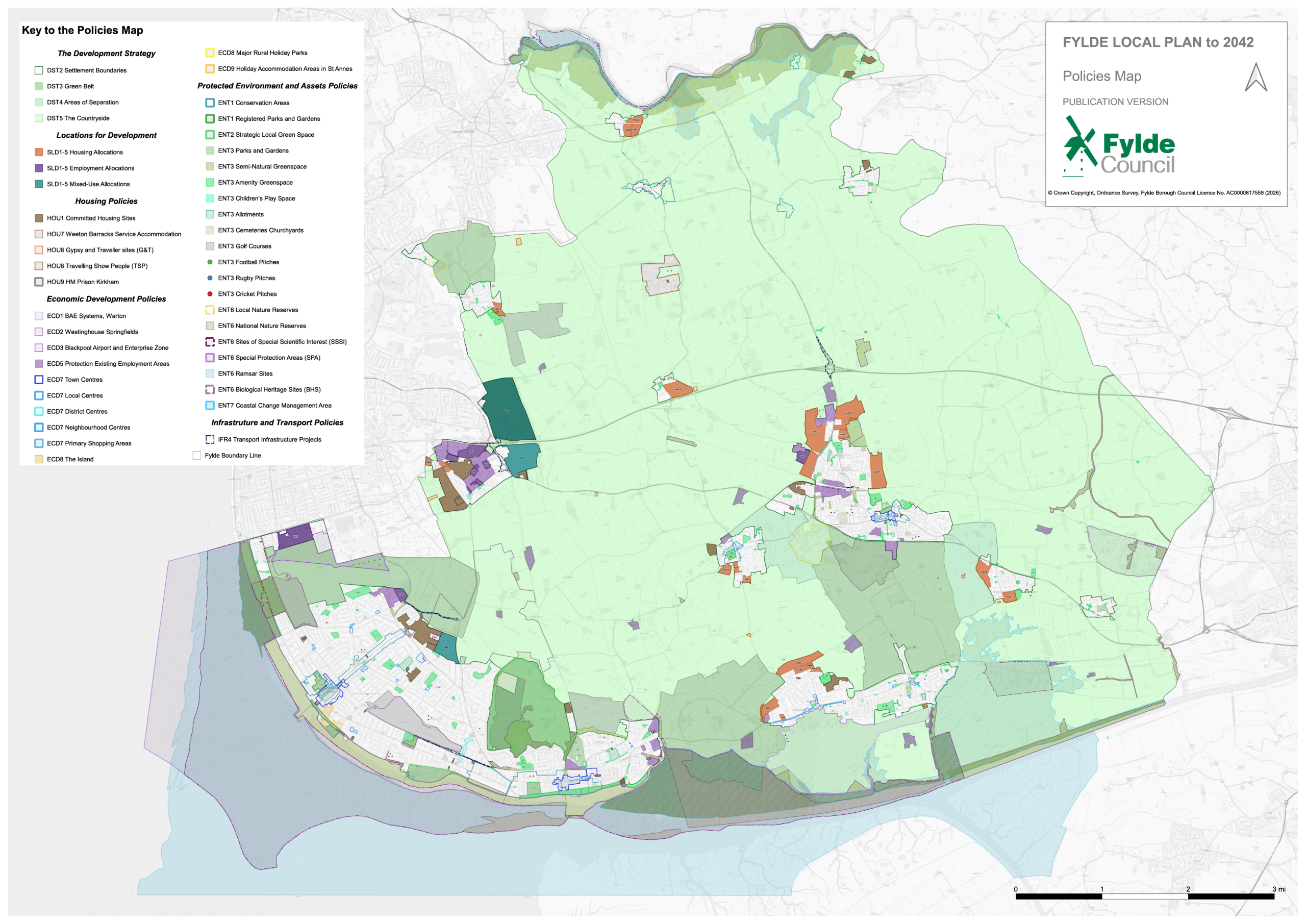
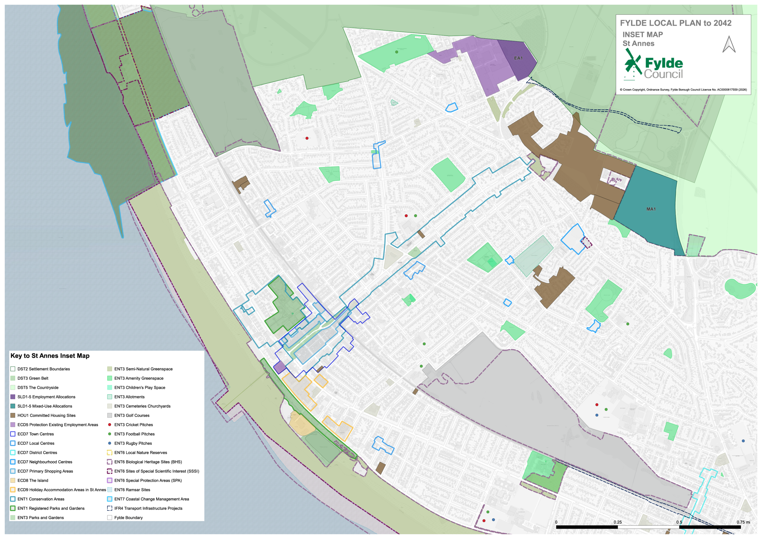
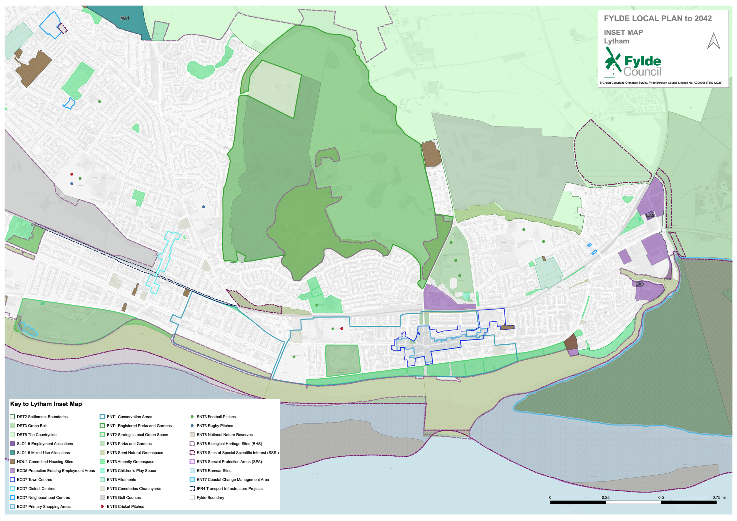
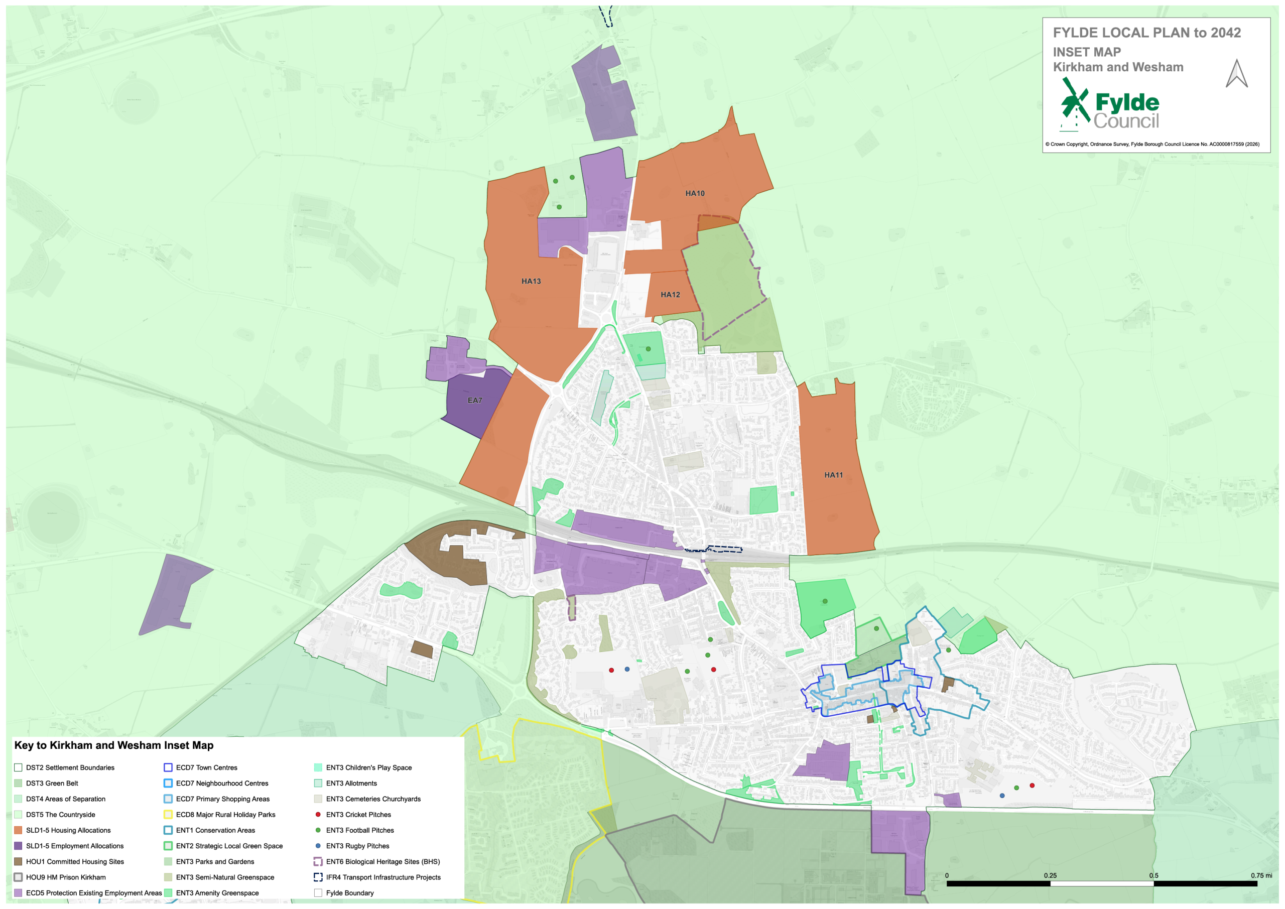
The Policies Map to accompany the Publication Version Fylde Local Plan to 2042 is set out below. The geospatial information set out is the same on all maps provided. Please be aware that these are large files and may take time to open.
- Main Policies Map (Low Res | High Res)
- Inset Map St Annes
- Inset Map Lytham
- Inset Map Kirkham and Wesham